Sand Springs Topo Map Montana
To zoom in, hover over the map of Sand Springs
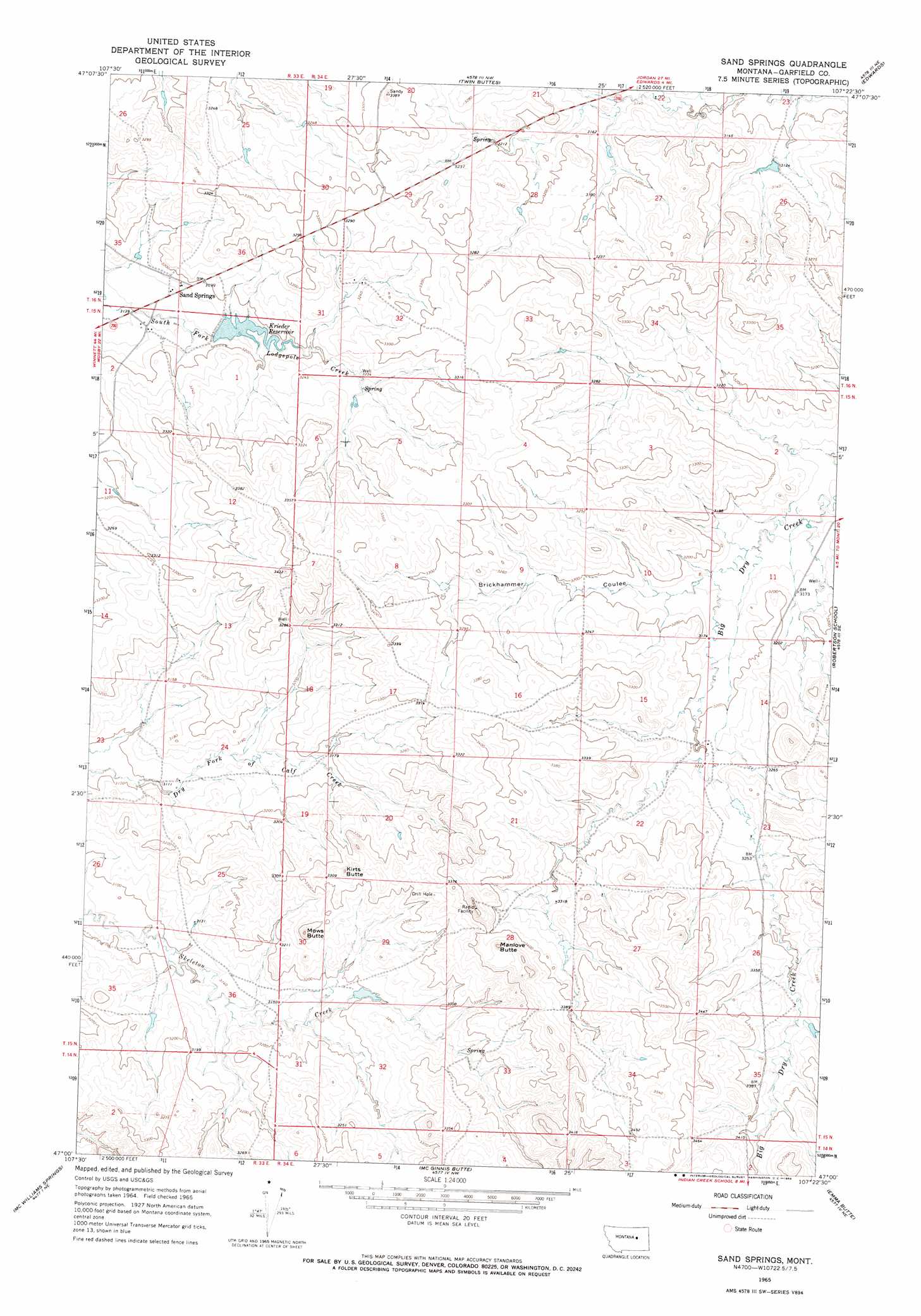
USGS Topo Quad 47107a4 - 1:24,000 scale
| Topo Map Name: | Sand Springs |
| USGS Topo Quad ID: | 47107a4 |
| Print Size: | ca. 21 1/4" wide x 27" high |
| Southeast Coordinates: | 47° N latitude / 107.375° W longitude |
| Map Center Coordinates: | 47.0625° N latitude / 107.4375° W longitude |
| U.S. State: | MT |
| Filename: | o47107a4.jpg |
| Download Map JPG Image: | Sand Springs topo map 1:24,000 scale |
| Map Type: | Topographic |
| Topo Series: | 7.5´ |
| Map Scale: | 1:24,000 |
| Source of Map Images: | United States Geological Survey (USGS) |
| Alternate Map Versions: |
Sand Springs MT 1965, updated 1968 Download PDF Buy paper map Sand Springs MT 2011 Download PDF Buy paper map Sand Springs MT 2014 Download PDF Buy paper map |
1:24,000 Topo Quads surrounding Sand Springs
Benzien |
Hay Coulee |
Steve Forks Sw |
Steve Forks |
Smoky Butte Creek |
Searl Coulee |
Coffin Butte |
Twin Buttes |
Edwards |
Big Dry School |
Froehlich Butte |
Cox Butte |
Sand Springs |
Robertson School |
Van Dusen Spring |
Dutton Ranch |
Mcwilliams Springs |
Mcginnis Butte |
Emma Butte |
School Butte |
Kincheloe Ranch |
Regnal Coulee |
Mcginnis Butte Sw |
Mcginnis Butte Se |
Hole-In-The-Rock |
> Back to 47107a1 at 1:100,000 scale
> Back to 47106a1 at 1:250,000 scale
> Back to U.S. Topo Maps home
Sand Springs topo map: Gazetteer
Sand Springs: Dams
71 Ranch Number 3 Dam elevation 979m 3211′Blue Shoes Dam elevation 975m 3198′
Charagus Dam elevation 966m 3169′
Snowbelt Reservoir Dam elevation 988m 3241′
Sand Springs: Populated Places
Sand Springs elevation 973m 3192′Sand Springs: Post Offices
Sand Springs Post Office elevation 966m 3169′Snowbelt Post Office (historical) elevation 971m 3185′
Sand Springs: Reservoirs
Krieder Reservoir elevation 967m 3172′Sand Springs: Summits
Kirts Butte elevation 1022m 3353′Manlove Butte elevation 1058m 3471′
Mows Butte elevation 1018m 3339′
Sand Springs: Valleys
Brickhammer Coulee elevation 963m 3159′Sand Springs: Wells
15N33E13ADDA01 Well elevation 1002m 3287′15N34E16DADA01 Well elevation 1011m 3316′
Sand Springs digital topo map on disk
Buy this Sand Springs topo map showing relief, roads, GPS coordinates and other geographical features, as a high-resolution digital map file on DVD:
Eastern Montana & Western North Dakota
Buy digital topo maps: Eastern Montana & Western North Dakota