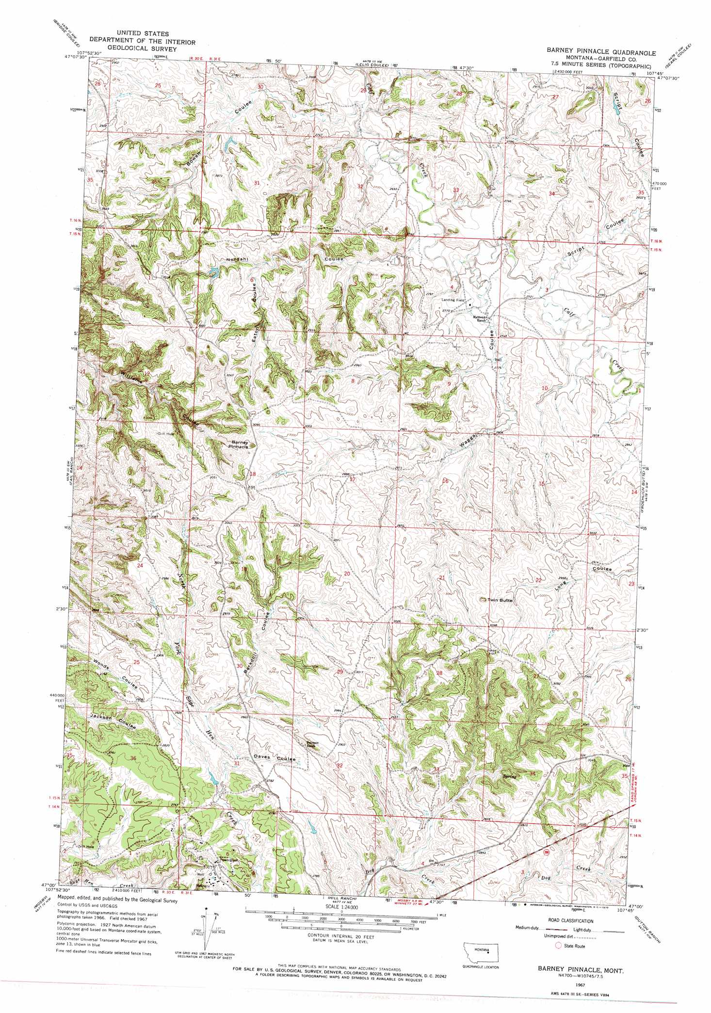
Barney Pinnacle Topo Map Montana
To zoom in, hover over the map of Barney Pinnacle
USGS Topo Quad 47107a7 - 1:24,000 scale
| Topo Map Name: | Barney Pinnacle |
| USGS Topo Quad ID: | 47107a7 |
| Print Size: | ca. 21 1/4" wide x 27" high |
| Southeast Coordinates: | 47° N latitude / 107.75° W longitude |
| Map Center Coordinates: | 47.0625° N latitude / 107.8125° W longitude |
| U.S. State: | MT |
| Filename: | o47107a7.jpg |
| Download Map JPG Image: | Barney Pinnacle topo map 1:24,000 scale |
| Map Type: | Topographic |
| Topo Series: | 7.5´ |
| Map Scale: | 1:24,000 |
| Source of Map Images: | United States Geological Survey (USGS) |
| Alternate Map Versions: |
Barney Pinnacle MT 1967, updated 1970 Download PDF Buy paper map Barney Pinnacle MT 2011 Download PDF Buy paper map Barney Pinnacle MT 2014 Download PDF Buy paper map |
1:24,000 Topo Quads surrounding Barney Pinnacle
Kirkendal Flat |
Nelson Coulee |
Seventynine Coulee |
Benzien |
Hay Coulee |
Tin Can Hill |
Bridge Coulee |
Lelig Coulee |
Searl Coulee |
Coffin Butte |
Cat Creek |
Fail Ranch |
Barney Pinnacle |
Froehlich Butte |
Cox Butte |
Breed Spring |
Mosby |
Hill Ranch |
Dutton Ranch |
Mcwilliams Springs |
Mud Spring |
Maxwell Ranch |
Mosby Se |
Kincheloe Ranch |
Regnal Coulee |
> Back to 47107a1 at 1:100,000 scale
> Back to 47106a1 at 1:250,000 scale
> Back to U.S. Topo Maps home
Barney Pinnacle topo map: Gazetteer
Barney Pinnacle: Airports
Matovich Airport elevation 839m 2752′Barney Pinnacle: Summits
Barney Pinnacle elevation 948m 3110′Twin Butte elevation 940m 3083′
Barney Pinnacle: Valleys
Barkdoll Coulee elevation 838m 2749′Bowen Coulee elevation 801m 2627′
Daves Coulee elevation 822m 2696′
Eaton Coulee elevation 865m 2837′
Nordahl Coulee elevation 823m 2700′
Script Coulee elevation 831m 2726′
Wagga Coulee elevation 839m 2752′
Barney Pinnacle digital topo map on disk
Buy this Barney Pinnacle topo map showing relief, roads, GPS coordinates and other geographical features, as a high-resolution digital map file on DVD:
Eastern Montana & Western North Dakota
Buy digital topo maps: Eastern Montana & Western North Dakota