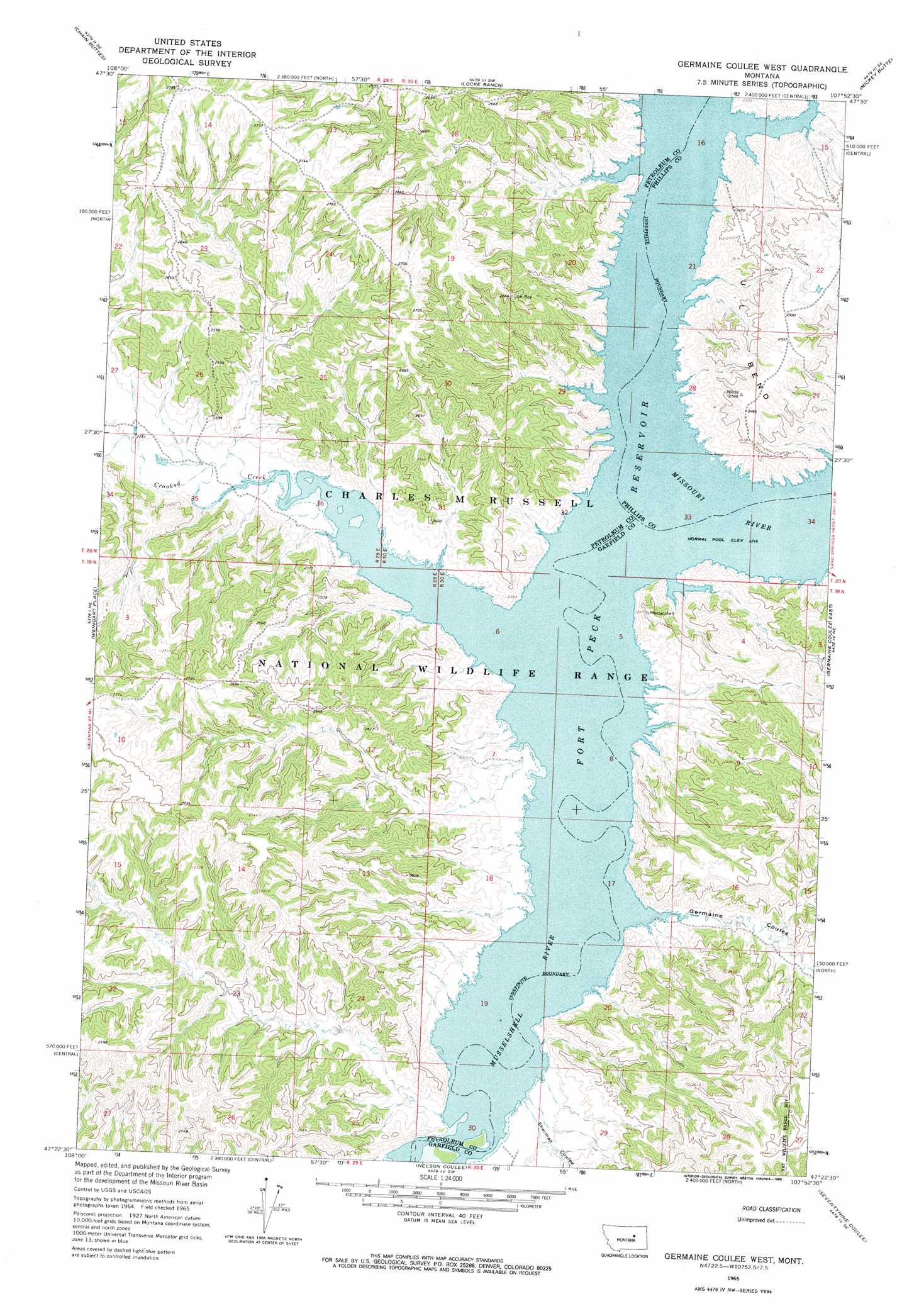
Germaine Coulee West Topo Map Montana
To zoom in, hover over the map of Germaine Coulee West
USGS Topo Quad 47107d8 - 1:24,000 scale
| Topo Map Name: | Germaine Coulee West |
| USGS Topo Quad ID: | 47107d8 |
| Print Size: | ca. 21 1/4" wide x 27" high |
| Southeast Coordinates: | 47.375° N latitude / 107.875° W longitude |
| Map Center Coordinates: | 47.4375° N latitude / 107.9375° W longitude |
| U.S. State: | MT |
| Filename: | o47107d8.jpg |
| Download Map JPG Image: | Germaine Coulee West topo map 1:24,000 scale |
| Map Type: | Topographic |
| Topo Series: | 7.5´ |
| Map Scale: | 1:24,000 |
| Source of Map Images: | United States Geological Survey (USGS) |
| Alternate Map Versions: |
Germaine Coulee West MT 1965, updated 1969 Download PDF Buy paper map Germaine Coulee West MT 1965, updated 1969 Download PDF Buy paper map Germaine Coulee West MT 1965, updated 1969 Download PDF Buy paper map Germaine Coulee West MT 2011 Download PDF Buy paper map Germaine Coulee West MT 2014 Download PDF Buy paper map |
1:24,000 Topo Quads surrounding Germaine Coulee West
Lake Reservoir |
Karsten Coulee |
Pea Ridge |
Indian Lake |
Herman Point |
Dry Coulee |
Chain Buttes |
Locke Ranch |
Mickey Butte |
Lost Creek |
Weingart Place Nw |
Weingart Place |
Germaine Coulee West |
Germaine Coulee East |
Cap Rock Butte |
Davis Spring |
Kirkendal Flat |
Nelson Coulee |
Seventynine Coulee |
Benzien |
Cat Creek Nw |
Tin Can Hill |
Bridge Coulee |
Lelig Coulee |
Searl Coulee |
> Back to 47107a1 at 1:100,000 scale
> Back to 47106a1 at 1:250,000 scale
> Back to U.S. Topo Maps home
Germaine Coulee West topo map: Gazetteer
Germaine Coulee West: Bends
U L Bend elevation 732m 2401′Germaine Coulee West: Parks
Crooked Creek Recreation Area elevation 730m 2395′Germaine Coulee West: Populated Places
Muscleshell City (historical) elevation 685m 2247′Smithson (historical) elevation 685m 2247′
Germaine Coulee West: Post Offices
Kismet Post Office (historical) elevation 685m 2247′Vincent Post Office (historical) elevation 694m 2276′
Germaine Coulee West: Streams
Jim Wells Creek elevation 685m 2247′Sacagawea River elevation 685m 2247′
Germaine Coulee West: Valleys
Germaine Coulee elevation 685m 2247′Sherman Coulee elevation 687m 2253′
Germaine Coulee West digital topo map on disk
Buy this Germaine Coulee West topo map showing relief, roads, GPS coordinates and other geographical features, as a high-resolution digital map file on DVD:
Eastern Montana & Western North Dakota
Buy digital topo maps: Eastern Montana & Western North Dakota