Trumbo Ranch Topo Map Montana
To zoom in, hover over the map of Trumbo Ranch
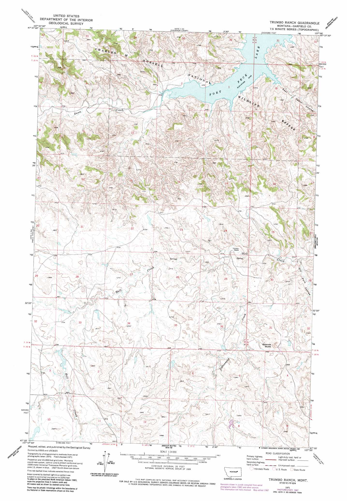
USGS Topo Quad 47107e1 - 1:24,000 scale
| Topo Map Name: | Trumbo Ranch |
| USGS Topo Quad ID: | 47107e1 |
| Print Size: | ca. 21 1/4" wide x 27" high |
| Southeast Coordinates: | 47.5° N latitude / 107° W longitude |
| Map Center Coordinates: | 47.5625° N latitude / 107.0625° W longitude |
| U.S. State: | MT |
| Filename: | o47107e1.jpg |
| Download Map JPG Image: | Trumbo Ranch topo map 1:24,000 scale |
| Map Type: | Topographic |
| Topo Series: | 7.5´ |
| Map Scale: | 1:24,000 |
| Source of Map Images: | United States Geological Survey (USGS) |
| Alternate Map Versions: |
Trumbo Ranch MT 1971, updated 1974 Download PDF Buy paper map Trumbo Ranch MT 1971, updated 1987 Download PDF Buy paper map Trumbo Ranch MT 2011 Download PDF Buy paper map Trumbo Ranch MT 2014 Download PDF Buy paper map |
1:24,000 Topo Quads surrounding Trumbo Ranch
Smith Coulee |
Gibson Coulee |
Murray Hill |
Brown Pass |
Middle Eighth Coulee |
Wolfe Coulee |
Wagon Coulee |
Harper Camp |
Peterson Point |
Little Buffalo Hill |
Chalk Butte |
Hell Hollow |
Trumbo Ranch |
Maloney Hill |
Buffalo Hill |
Brusett |
Moonlight Creek |
Biscuit Butte |
Jordan Nw |
Jordan Ne |
Steve Forks |
Smoky Butte Creek |
Smoky Butte |
Jordan |
Jordan Se |
> Back to 47107e1 at 1:100,000 scale
> Back to 47106a1 at 1:250,000 scale
> Back to U.S. Topo Maps home
Trumbo Ranch topo map: Gazetteer
Trumbo Ranch: Dams
Archie Number 1 Dam elevation 830m 2723′Engdahl Number 7 Dam elevation 839m 2752′
Engdall Reservoir Number 1 Dam elevation 840m 2755′
Engdall Reservoir Number 2 Dam elevation 867m 2844′
Trumbo Ranch: Streams
Cottonwood Creek elevation 788m 2585′Snow Creek elevation 685m 2247′
Trumbo Ranch: Summits
Brownie Butte elevation 876m 2874′Trumbo Ranch: Valleys
Dry Fork Coulee elevation 759m 2490′East Cabin Coulee elevation 685m 2247′
Trumbo Ranch digital topo map on disk
Buy this Trumbo Ranch topo map showing relief, roads, GPS coordinates and other geographical features, as a high-resolution digital map file on DVD:
Eastern Montana & Western North Dakota
Buy digital topo maps: Eastern Montana & Western North Dakota