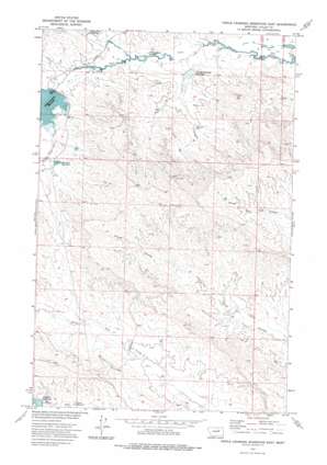
Triple Crossing Res. East Topo Map Montana
To zoom in, hover over the map of Triple Crossing Res. East
USGS Topo Quad 47107h1 - 1:24,000 scale
| Topo Map Name: | Triple Crossing Res. East |
| USGS Topo Quad ID: | 47107h1 |
| Print Size: | ca. 21 1/4" wide x 27" high |
| Southeast Coordinates: | 47.875° N latitude / 107° W longitude |
| Map Center Coordinates: | 47.9375° N latitude / 107.0625° W longitude |
| U.S. State: | MT |
| Filename: | o47107h1.jpg |
| Download Map JPG Image: | Triple Crossing Res. East topo map 1:24,000 scale |
| Map Type: | Topographic |
| Topo Series: | 7.5´ |
| Map Scale: | 1:24,000 |
| Source of Map Images: | United States Geological Survey (USGS) |
| Alternate Map Versions: |
Triple Crossing Reservoir East MT 1973, updated 1976 Download PDF Buy paper map Triple Crossing Reservoir East MT 2011 Download PDF Buy paper map Triple Crossing Reservoir East MT 2014 Download PDF Buy paper map |
1:24,000 Topo Quads surrounding Triple Crossing Res. East
> Back to 47107e1 at 1:100,000 scale
> Back to 47106a1 at 1:250,000 scale
> Back to U.S. Topo Maps home
Triple Crossing Res. East topo map: Gazetteer
Triple Crossing Res. East: Dams
Bat Reservoir Dam elevation 720m 2362′Camp Dam elevation 748m 2454′
Corral Junction Dam elevation 726m 2381′
Corral Junction Extension Dam elevation 728m 2388′
Dividend Dam elevation 751m 2463′
Double Crossing Dam elevation 719m 2358′
Goodwall Reservoir Dam elevation 720m 2362′
Gravel Hill Dam elevation 745m 2444′
Halfpint Reservoir Dam elevation 756m 2480′
Hard Pan Dam elevation 732m 2401′
North Fork Plug Dam elevation 710m 2329′
Teal Reservoir Dam elevation 711m 2332′
Triple Crossing Dam elevation 736m 2414′
Triple Crossing Water Spreaders Dam elevation 718m 2355′
Twin Forks Dam elevation 730m 2395′
Whitetail Reservoir Dam elevation 745m 2444′
Triple Crossing Res. East: Reservoirs
Camp Reservoir elevation 751m 2463′Double Crossing Reservoir elevation 720m 2362′
Halfpint Reservoir elevation 754m 2473′
Triple Crossing Reservoir elevation 734m 2408′
Twin Forks Reservoir elevation 730m 2395′
Whitetail Reservoir elevation 745m 2444′
Willow Bunch Reservoir elevation 721m 2365′
Triple Crossing Res. East: Streams
Middle Fork Lone Tree Creek elevation 734m 2408′South Fork Lone Tree Creek elevation 735m 2411′
Triple Crossing Res. East digital topo map on disk
Buy this Triple Crossing Res. East topo map showing relief, roads, GPS coordinates and other geographical features, as a high-resolution digital map file on DVD:
Eastern Montana & Western North Dakota
Buy digital topo maps: Eastern Montana & Western North Dakota


