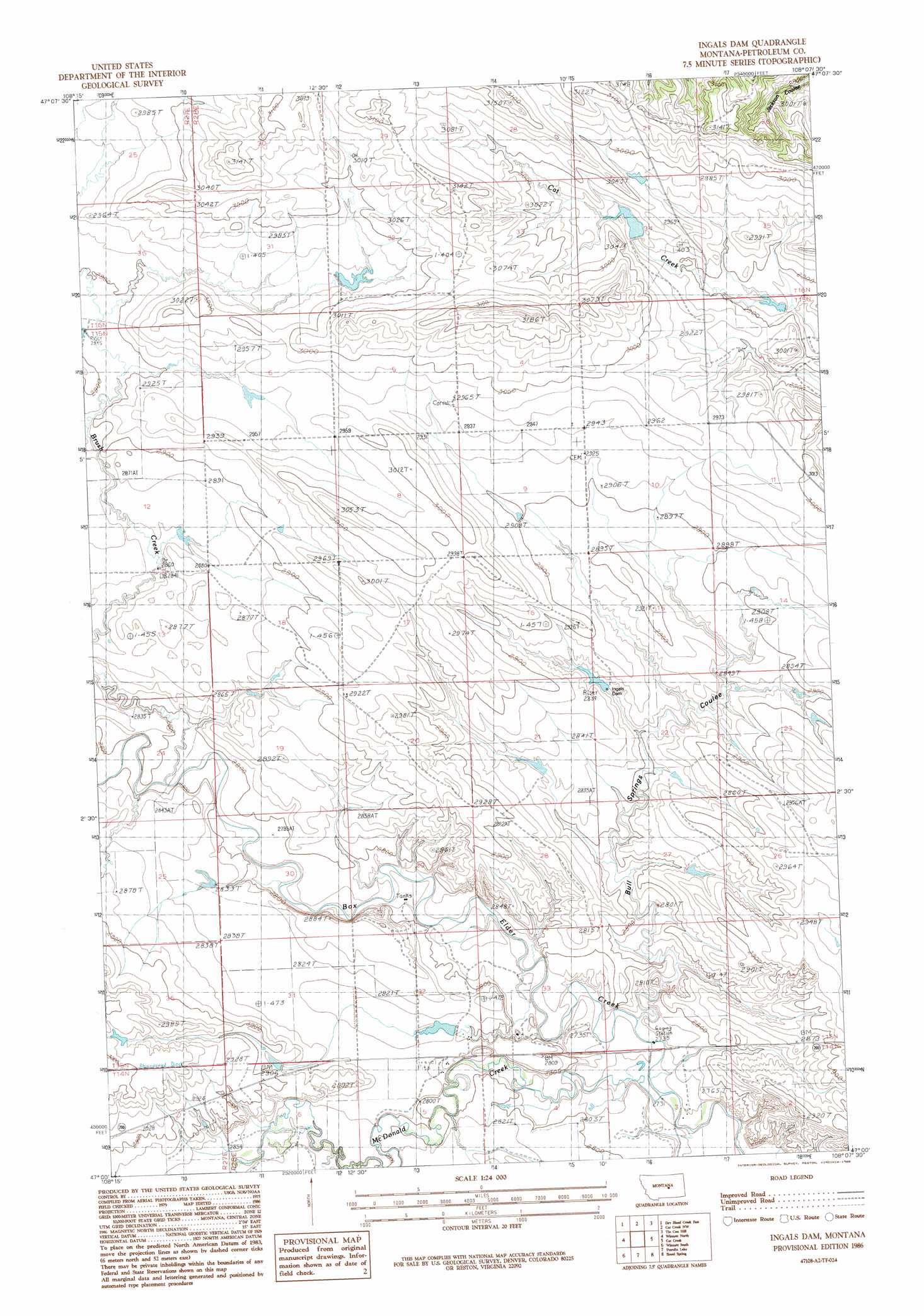
Ingals Dam Topo Map Montana
To zoom in, hover over the map of Ingals Dam
USGS Topo Quad 47108a2 - 1:24,000 scale
| Topo Map Name: | Ingals Dam |
| USGS Topo Quad ID: | 47108a2 |
| Print Size: | ca. 21 1/4" wide x 27" high |
| Southeast Coordinates: | 47° N latitude / 108.125° W longitude |
| Map Center Coordinates: | 47.0625° N latitude / 108.1875° W longitude |
| U.S. State: | MT |
| Filename: | o47108a2.jpg |
| Download Map JPG Image: | Ingals Dam topo map 1:24,000 scale |
| Map Type: | Topographic |
| Topo Series: | 7.5´ |
| Map Scale: | 1:24,000 |
| Source of Map Images: | United States Geological Survey (USGS) |
| Alternate Map Versions: |
Ingals Dam MT 1986, updated 1986 Download PDF Buy paper map Ingals Dam MT 2011 Download PDF Buy paper map Ingals Dam MT 2014 Download PDF Buy paper map |
1:24,000 Topo Quads surrounding Ingals Dam
Valentine |
Brown Spring |
Davis Spring |
Kirkendal Flat |
Nelson Coulee |
Dry Blood Creek West |
Dry Blood Creek East |
Cat Creek Nw |
Tin Can Hill |
Bridge Coulee |
Little Bear Lake |
Winnett North |
Ingals Dam |
Cat Creek |
Fail Ranch |
Yellow Water Res. |
Winnett South |
Petrolia Lake |
Breed Spring |
Mosby |
Flatwillow |
Crowley Dam |
Kelley |
Mud Spring |
Maxwell Ranch |
> Back to 47108a1 at 1:100,000 scale
> Back to 47108a1 at 1:250,000 scale
> Back to U.S. Topo Maps home
Ingals Dam topo map: Gazetteer
Ingals Dam: Dams
Ingals Dam elevation 862m 2828′Manuel Number 1 Dam elevation 885m 2903′
Manuel Number 2 Dam elevation 914m 2998′
Sandman Number 1 Dam elevation 859m 2818′
Ingals Dam: Populated Places
Hoyle (historical) elevation 842m 2762′Shay (historical) elevation 883m 2896′
Ingals Dam: Post Offices
Hoyle Post Office (historical) elevation 842m 2762′Ingals Dam: Streams
Brush Creek elevation 848m 2782′McDonald Creek elevation 842m 2762′
Ingals Dam: Valleys
Bull Springs Coulee elevation 842m 2762′Ingals Dam digital topo map on disk
Buy this Ingals Dam topo map showing relief, roads, GPS coordinates and other geographical features, as a high-resolution digital map file on DVD: