Tin Can Hill Topo Map Montana
To zoom in, hover over the map of Tin Can Hill
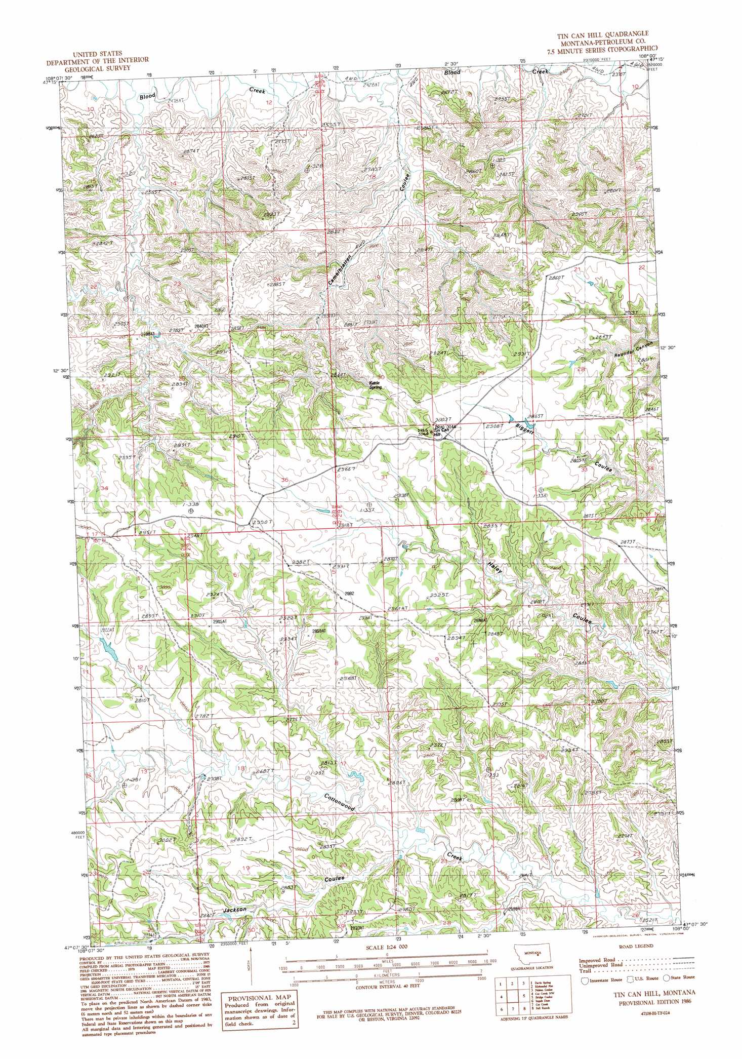
USGS Topo Quad 47108b1 - 1:24,000 scale
| Topo Map Name: | Tin Can Hill |
| USGS Topo Quad ID: | 47108b1 |
| Print Size: | ca. 21 1/4" wide x 27" high |
| Southeast Coordinates: | 47.125° N latitude / 108° W longitude |
| Map Center Coordinates: | 47.1875° N latitude / 108.0625° W longitude |
| U.S. State: | MT |
| Filename: | o47108b1.jpg |
| Download Map JPG Image: | Tin Can Hill topo map 1:24,000 scale |
| Map Type: | Topographic |
| Topo Series: | 7.5´ |
| Map Scale: | 1:24,000 |
| Source of Map Images: | United States Geological Survey (USGS) |
| Alternate Map Versions: |
Tin Can Hill MT 1986, updated 1986 Download PDF Buy paper map Tin Can Hill MT 2011 Download PDF Buy paper map Tin Can Hill MT 2014 Download PDF Buy paper map |
1:24,000 Topo Quads surrounding Tin Can Hill
Dovetail Butte |
Weingart Place Nw |
Weingart Place |
Germaine Coulee West |
Germaine Coulee East |
Brown Spring |
Davis Spring |
Kirkendal Flat |
Nelson Coulee |
Seventynine Coulee |
Dry Blood Creek East |
Cat Creek Nw |
Tin Can Hill |
Bridge Coulee |
Lelig Coulee |
Winnett North |
Ingals Dam |
Cat Creek |
Fail Ranch |
Barney Pinnacle |
Winnett South |
Petrolia Lake |
Breed Spring |
Mosby |
Hill Ranch |
> Back to 47108a1 at 1:100,000 scale
> Back to 47108a1 at 1:250,000 scale
> Back to U.S. Topo Maps home
Tin Can Hill topo map: Gazetteer
Tin Can Hill: Dams
Deep Coulee Dam elevation 806m 2644′Tin Can Hill: Springs
Kettle Spring elevation 872m 2860′Tin Can Hill: Summits
Tin Can Hill elevation 927m 3041′Tin Can Hill: Valleys
Camelbratten Coulee elevation 752m 2467′Jackson Coulee elevation 803m 2634′
Tin Can Hill: Wells
16N29E26BBDA01 Well elevation 838m 2749′17N28E11CA__01 Well elevation 764m 2506′
Tin Can Hill digital topo map on disk
Buy this Tin Can Hill topo map showing relief, roads, GPS coordinates and other geographical features, as a high-resolution digital map file on DVD: