Weingart Place Topo Map Montana
To zoom in, hover over the map of Weingart Place
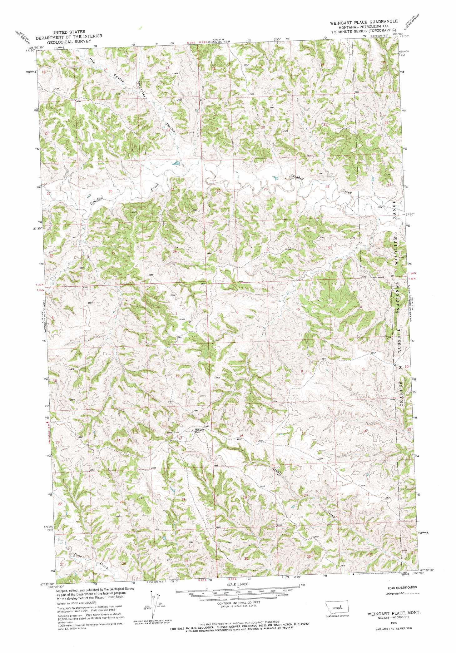
USGS Topo Quad 47108d1 - 1:24,000 scale
| Topo Map Name: | Weingart Place |
| USGS Topo Quad ID: | 47108d1 |
| Print Size: | ca. 21 1/4" wide x 27" high |
| Southeast Coordinates: | 47.375° N latitude / 108° W longitude |
| Map Center Coordinates: | 47.4375° N latitude / 108.0625° W longitude |
| U.S. State: | MT |
| Filename: | o47108d1.jpg |
| Download Map JPG Image: | Weingart Place topo map 1:24,000 scale |
| Map Type: | Topographic |
| Topo Series: | 7.5´ |
| Map Scale: | 1:24,000 |
| Source of Map Images: | United States Geological Survey (USGS) |
| Alternate Map Versions: |
Weingart Place MT 1965, updated 1969 Download PDF Buy paper map Weingart Place MT 2011 Download PDF Buy paper map Weingart Place MT 2014 Download PDF Buy paper map |
1:24,000 Topo Quads surrounding Weingart Place
Blizzard Reservoir |
Lake Reservoir |
Karsten Coulee |
Pea Ridge |
Indian Lake |
Hanson Flat |
Dry Coulee |
Chain Buttes |
Locke Ranch |
Mickey Butte |
Dovetail Butte |
Weingart Place Nw |
Weingart Place |
Germaine Coulee West |
Germaine Coulee East |
Brown Spring |
Davis Spring |
Kirkendal Flat |
Nelson Coulee |
Seventynine Coulee |
Dry Blood Creek East |
Cat Creek Nw |
Tin Can Hill |
Bridge Coulee |
Lelig Coulee |
> Back to 47108a1 at 1:100,000 scale
> Back to 47108a1 at 1:250,000 scale
> Back to U.S. Topo Maps home
Weingart Place topo map: Gazetteer
Weingart Place: Valleys
Carpenter Coulee elevation 714m 2342′Hay Coulee elevation 731m 2398′
Weingart Place: Wells
20N29E28CBDC01 Well elevation 708m 2322′Weingart Place digital topo map on disk
Buy this Weingart Place topo map showing relief, roads, GPS coordinates and other geographical features, as a high-resolution digital map file on DVD: