Lake Reservoir Topo Map Montana
To zoom in, hover over the map of Lake Reservoir
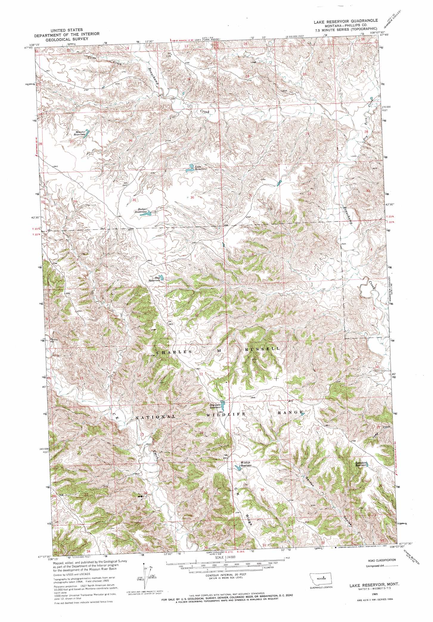
USGS Topo Quad 47108f2 - 1:24,000 scale
| Topo Map Name: | Lake Reservoir |
| USGS Topo Quad ID: | 47108f2 |
| Print Size: | ca. 21 1/4" wide x 27" high |
| Southeast Coordinates: | 47.625° N latitude / 108.125° W longitude |
| Map Center Coordinates: | 47.6875° N latitude / 108.1875° W longitude |
| U.S. State: | MT |
| Filename: | o47108f2.jpg |
| Download Map JPG Image: | Lake Reservoir topo map 1:24,000 scale |
| Map Type: | Topographic |
| Topo Series: | 7.5´ |
| Map Scale: | 1:24,000 |
| Source of Map Images: | United States Geological Survey (USGS) |
| Alternate Map Versions: |
Lake Reservoir MT 1965, updated 1969 Download PDF Buy paper map Lake Reservoir MT 2011 Download PDF Buy paper map Lake Reservoir MT 2014 Download PDF Buy paper map |
1:24,000 Topo Quads surrounding Lake Reservoir
Bear Mountain |
Coburn Butte |
Veseth Reservoir |
Holzhey Reservoir |
Emond Ranch |
Robinson School |
Bison Bone Reservoir |
Dry Fork Ridge |
Barber Coulee |
Dione Reservoir |
Sagebrush Reservoir |
Blizzard Reservoir |
Lake Reservoir |
Karsten Coulee |
Pea Ridge |
Kepple Bottoms |
Hanson Flat |
Dry Coulee |
Chain Buttes |
Locke Ranch |
Pipes Coulee |
Dovetail Butte |
Weingart Place Nw |
Weingart Place |
Germaine Coulee West |
> Back to 47108e1 at 1:100,000 scale
> Back to 47108a1 at 1:250,000 scale
> Back to U.S. Topo Maps home
Lake Reservoir topo map: Gazetteer
Lake Reservoir: Dams
Lake Reservoir Dam elevation 842m 2762′Lake Reservoir: Reservoirs
Badger Reservoir elevation 856m 2808′Buckskin Reservoir elevation 841m 2759′
Dan Reservoir elevation 850m 2788′
Dry Lake Reservoir elevation 861m 2824′
Lake Reservoir elevation 839m 2752′
Monster Reservoir elevation 846m 2775′
Wildlife Reservoir elevation 842m 2762′
Lake Reservoir: Streams
Cline Creek elevation 800m 2624′Dry Fork Creek elevation 756m 2480′
Lake Reservoir: Wells
22N27E23____01 Well elevation 733m 2404′22N27E23DBCB01 Well elevation 728m 2388′
Lake Reservoir digital topo map on disk
Buy this Lake Reservoir topo map showing relief, roads, GPS coordinates and other geographical features, as a high-resolution digital map file on DVD: