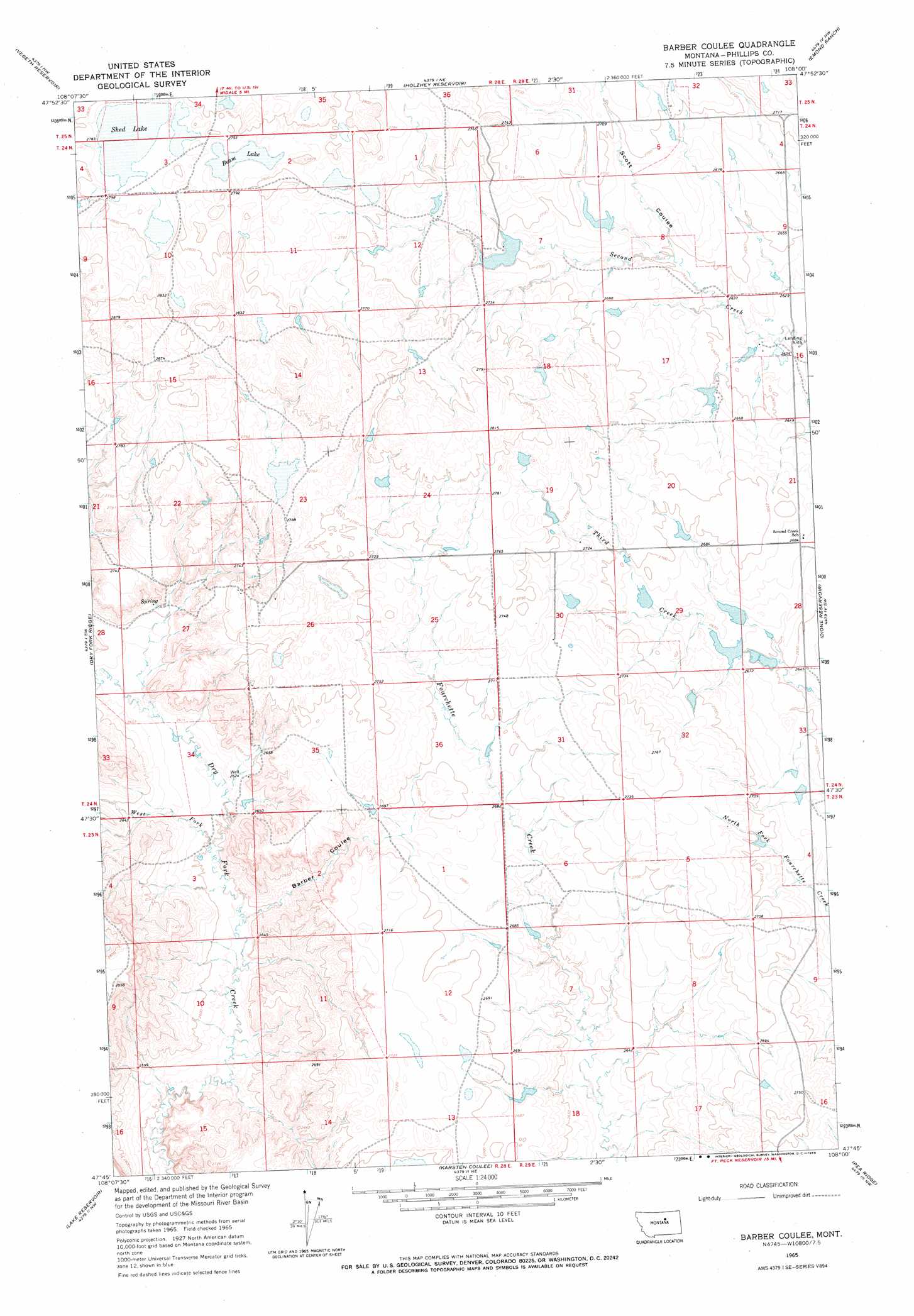
Barber Coulee Topo Map Montana
To zoom in, hover over the map of Barber Coulee
USGS Topo Quad 47108g1 - 1:24,000 scale
| Topo Map Name: | Barber Coulee |
| USGS Topo Quad ID: | 47108g1 |
| Print Size: | ca. 21 1/4" wide x 27" high |
| Southeast Coordinates: | 47.75° N latitude / 108° W longitude |
| Map Center Coordinates: | 47.8125° N latitude / 108.0625° W longitude |
| U.S. State: | MT |
| Filename: | o47108g1.jpg |
| Download Map JPG Image: | Barber Coulee topo map 1:24,000 scale |
| Map Type: | Topographic |
| Topo Series: | 7.5´ |
| Map Scale: | 1:24,000 |
| Source of Map Images: | United States Geological Survey (USGS) |
| Alternate Map Versions: |
Barber Coulee MT 1965, updated 1969 Download PDF Buy paper map Barber Coulee MT 2011 Download PDF Buy paper map Barber Coulee MT 2014 Download PDF Buy paper map |
1:24,000 Topo Quads surrounding Barber Coulee
Ester Lake |
Phillips |
Seymour Reservoir |
Button Butte |
Mitchell Corner |
Coburn Butte |
Veseth Reservoir |
Holzhey Reservoir |
Emond Ranch |
Whitcomb Lake |
Bison Bone Reservoir |
Dry Fork Ridge |
Barber Coulee |
Dione Reservoir |
Stratton Reservoir |
Blizzard Reservoir |
Lake Reservoir |
Karsten Coulee |
Pea Ridge |
Indian Lake |
Hanson Flat |
Dry Coulee |
Chain Buttes |
Locke Ranch |
Mickey Butte |
> Back to 47108e1 at 1:100,000 scale
> Back to 47108a1 at 1:250,000 scale
> Back to U.S. Topo Maps home
Barber Coulee topo map: Gazetteer
Barber Coulee: Dams
Lazy JD Number 12 Dam elevation 815m 2673′None Dam elevation 821m 2693′
R Pankratz Number 1 Dam elevation 816m 2677′
Roth Number 1 Dam elevation 819m 2687′
Roth Number 2 Dam elevation 813m 2667′
Second Telegraph Dam elevation 823m 2700′
William Knight Number 1 Dam elevation 839m 2752′
William Knight Number 2 Dam elevation 847m 2778′
Barber Coulee: Lakes
Beam Lake elevation 848m 2782′Shed Lake elevation 851m 2791′
Barber Coulee: Streams
West Fork Dry Fork Creek elevation 792m 2598′Barber Coulee: Valleys
Barber Coulee elevation 792m 2598′Scott Coulee elevation 809m 2654′
Barber Coulee: Wells
24N28E12AA__01 Well elevation 833m 2732′24N28E12DAB_01 Well elevation 823m 2700′
24N28E27AA__01 Well elevation 838m 2749′
24N29E07BD__01 Well elevation 821m 2693′
24N29E16BC__01 Well elevation 805m 2641′
24N29E30BD__01 Well elevation 838m 2749′
Barber Coulee digital topo map on disk
Buy this Barber Coulee topo map showing relief, roads, GPS coordinates and other geographical features, as a high-resolution digital map file on DVD: