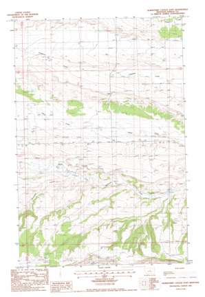
Horsethief Coulee E. Topo Map Montana
To zoom in, hover over the map of Horsethief Coulee E.
USGS Topo Quad 47109a1 - 1:24,000 scale
| Topo Map Name: | Horsethief Coulee E. |
| USGS Topo Quad ID: | 47109a1 |
| Print Size: | ca. 21 1/4" wide x 27" high |
| Southeast Coordinates: | 47° N latitude / 109° W longitude |
| Map Center Coordinates: | 47.0625° N latitude / 109.0625° W longitude |
| U.S. State: | MT |
| Filename: | o47109a1.jpg |
| Download Map JPG Image: | Horsethief Coulee E. topo map 1:24,000 scale |
| Map Type: | Topographic |
| Topo Series: | 7.5´ |
| Map Scale: | 1:24,000 |
| Source of Map Images: | United States Geological Survey (USGS) |
| Alternate Map Versions: |
Horsethief Coulee East MT 1985, updated 1986 Download PDF Buy paper map Horsethief Coulee East MT 2011 Download PDF Buy paper map Horsethief Coulee East MT 2014 Download PDF Buy paper map |
1:24,000 Topo Quads surrounding Horsethief Coulee E.
> Back to 47109a1 at 1:100,000 scale
> Back to 47108a1 at 1:250,000 scale
> Back to U.S. Topo Maps home
Horsethief Coulee E. topo map: Gazetteer
Horsethief Coulee E.: Airports
Holland Ranch Airport elevation 1236m 4055′Horsethief Coulee E.: Dams
Ayers Colony Number 1 Dam elevation 1150m 3772′Horsethief Coulee E.: Parks
Fort Maginnis Historical Marker elevation 1233m 4045′Horsethief Coulee E.: Populated Places
Novary (historical) elevation 1153m 3782′Horsethief Coulee E.: Post Offices
Novary Post Office (historical) elevation 1153m 3782′Horsethief Coulee E.: Valleys
Horsethief Coulee elevation 1191m 3907′Horsethief Coulee E.: Wells
15N18E23ABAA01 Well elevation 1211m 3973′15N21E15BCC_01 Well elevation 1227m 4025′
15N21E21BCAC01 Well elevation 1174m 3851′
16N21E31ADC_01 Well elevation 1233m 4045′
Horsethief Coulee E. digital topo map on disk
Buy this Horsethief Coulee E. topo map showing relief, roads, GPS coordinates and other geographical features, as a high-resolution digital map file on DVD:


