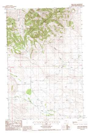
Lewis Peak Topo Map Montana
To zoom in, hover over the map of Lewis Peak
USGS Topo Quad 47109b1 - 1:24,000 scale
| Topo Map Name: | Lewis Peak |
| USGS Topo Quad ID: | 47109b1 |
| Print Size: | ca. 21 1/4" wide x 27" high |
| Southeast Coordinates: | 47.125° N latitude / 109° W longitude |
| Map Center Coordinates: | 47.1875° N latitude / 109.0625° W longitude |
| U.S. State: | MT |
| Filename: | o47109b1.jpg |
| Download Map JPG Image: | Lewis Peak topo map 1:24,000 scale |
| Map Type: | Topographic |
| Topo Series: | 7.5´ |
| Map Scale: | 1:24,000 |
| Source of Map Images: | United States Geological Survey (USGS) |
| Alternate Map Versions: |
Lewis Peak MT 1985, updated 1986 Download PDF Buy paper map Lewis Peak MT 2011 Download PDF Buy paper map Lewis Peak MT 2014 Download PDF Buy paper map |
1:24,000 Topo Quads surrounding Lewis Peak
> Back to 47109a1 at 1:100,000 scale
> Back to 47108a1 at 1:250,000 scale
> Back to U.S. Topo Maps home
Lewis Peak topo map: Gazetteer
Lewis Peak: Gaps
Ross Pass elevation 1463m 4799′Lewis Peak: Mines
Brickyard Creek Mine elevation 1556m 5104′Ross Pass Number 1 Mine elevation 1660m 5446′
Ross Pass Number 2 Mine elevation 1657m 5436′
Ross Pass Number 3 Mine elevation 1647m 5403′
Two Lady Number 16 Mine elevation 1624m 5328′
Two Lady Number 4 Mine elevation 1615m 5298′
Two Lady Number 5 Mine elevation 1615m 5298′
Two Lady Number 7 Mine elevation 1712m 5616′
Lewis Peak: Post Offices
Alpine Post Office (historical) elevation 1148m 3766′Fort Maginnis Post Office (historical) elevation 1214m 3982′
Lewis Peak: Streams
Collar Gulch Creek elevation 1283m 4209′Maiden Creek elevation 1157m 3795′
Lewis Peak: Summits
Lewis Peak elevation 1707m 5600′Lookout Peak elevation 1619m 5311′
Lewis Peak: Valleys
Log Gulch elevation 1266m 4153′Lone Tree Gulch elevation 1242m 4074′
Lewis Peak digital topo map on disk
Buy this Lewis Peak topo map showing relief, roads, GPS coordinates and other geographical features, as a high-resolution digital map file on DVD:


