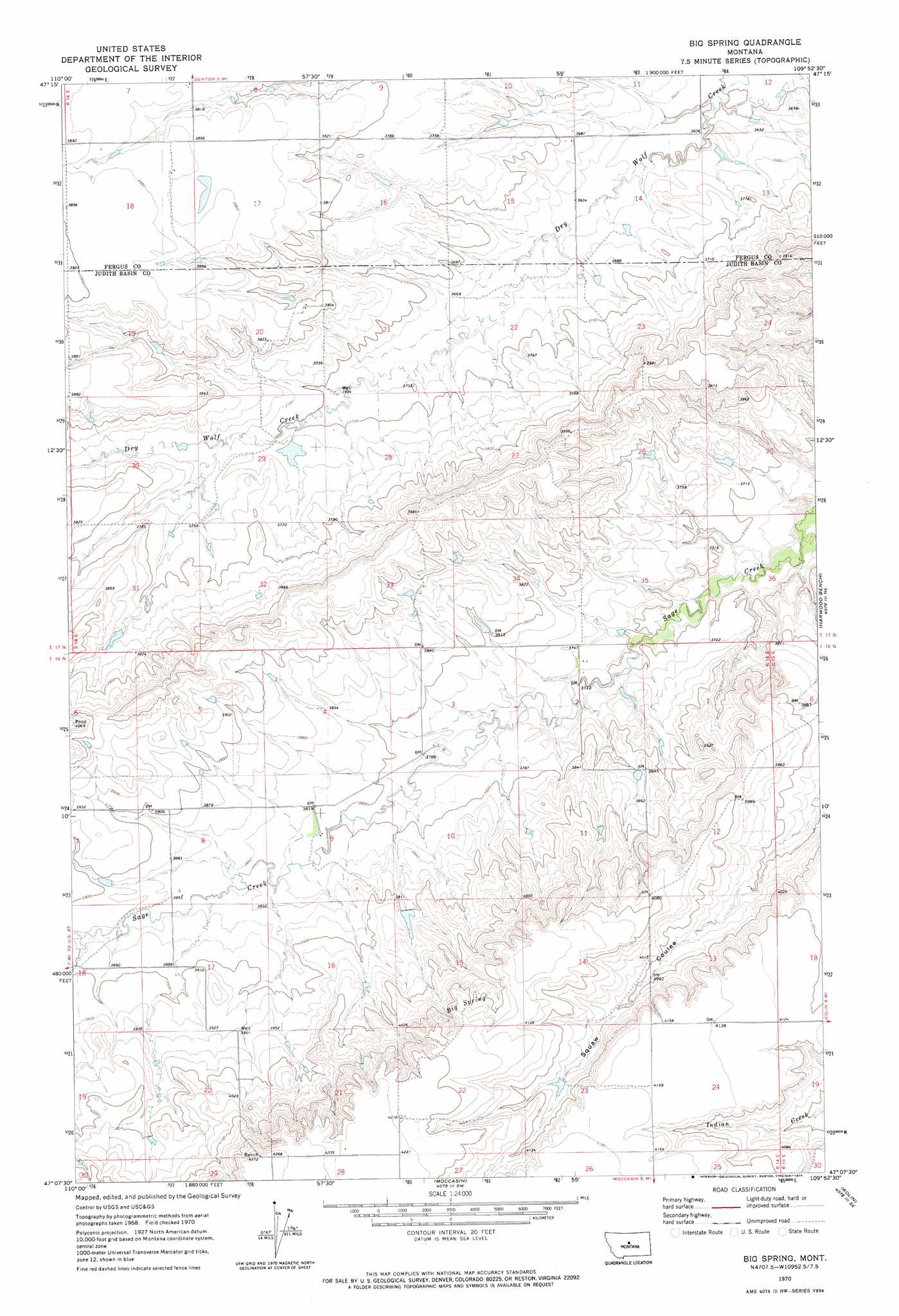
Big Spring Topo Map Montana
To zoom in, hover over the map of Big Spring
USGS Topo Quad 47109b8 - 1:24,000 scale
| Topo Map Name: | Big Spring |
| USGS Topo Quad ID: | 47109b8 |
| Print Size: | ca. 21 1/4" wide x 27" high |
| Southeast Coordinates: | 47.125° N latitude / 109.875° W longitude |
| Map Center Coordinates: | 47.1875° N latitude / 109.9375° W longitude |
| U.S. State: | MT |
| Filename: | o47109b8.jpg |
| Download Map JPG Image: | Big Spring topo map 1:24,000 scale |
| Map Type: | Topographic |
| Topo Series: | 7.5´ |
| Map Scale: | 1:24,000 |
| Source of Map Images: | United States Geological Survey (USGS) |
| Alternate Map Versions: |
Big Spring MT 1970, updated 1974 Download PDF Buy paper map Big Spring MT 2011 Download PDF Buy paper map Big Spring MT 2014 Download PDF Buy paper map |
1:24,000 Topo Quads surrounding Big Spring
Pownal |
Strouf Island |
Possum Run Creek |
Soda Spring Coulee |
Wild Bill Flat West |
Arrow Creek |
Coffee Creek |
Denton |
Hoosac |
Toney Bench |
Stanford |
Stanford Ne |
Big Spring |
Harwood Bench |
Danvers |
Windham |
Benchland |
Moccasin |
Kolin |
Ross Fork |
Red Hill |
Utica |
Ackley Lake |
Sipple |
Moore |
> Back to 47109a1 at 1:100,000 scale
> Back to 47108a1 at 1:250,000 scale
> Back to U.S. Topo Maps home
Big Spring topo map: Gazetteer
Big Spring: Dams
Coffee Cake Dam elevation 1137m 3730′Big Spring: Springs
Big Spring elevation 1250m 4101′Big Spring: Streams
Willow Creek elevation 1181m 3874′Big Spring: Wells
16N14E03CDB_01 Well elevation 1148m 3766′16N14E08CDC_01 Well elevation 1174m 3851′
16N14E09BDD_01 Well elevation 1160m 3805′
16N14E20AAB_01 Well elevation 1203m 3946′
17N14E07DB__01 Well elevation 1180m 3871′
17N14E15AAAA01 Well elevation 1108m 3635′
17N14E20ADB_01 Well elevation 1160m 3805′
17N14E28DAAD01 Well elevation 1166m 3825′
17N14E32BC__01 Well elevation 1158m 3799′
17N14E33DBBC01 Well elevation 1180m 3871′
Big Spring digital topo map on disk
Buy this Big Spring topo map showing relief, roads, GPS coordinates and other geographical features, as a high-resolution digital map file on DVD: