Hilger Topo Map Montana
To zoom in, hover over the map of Hilger
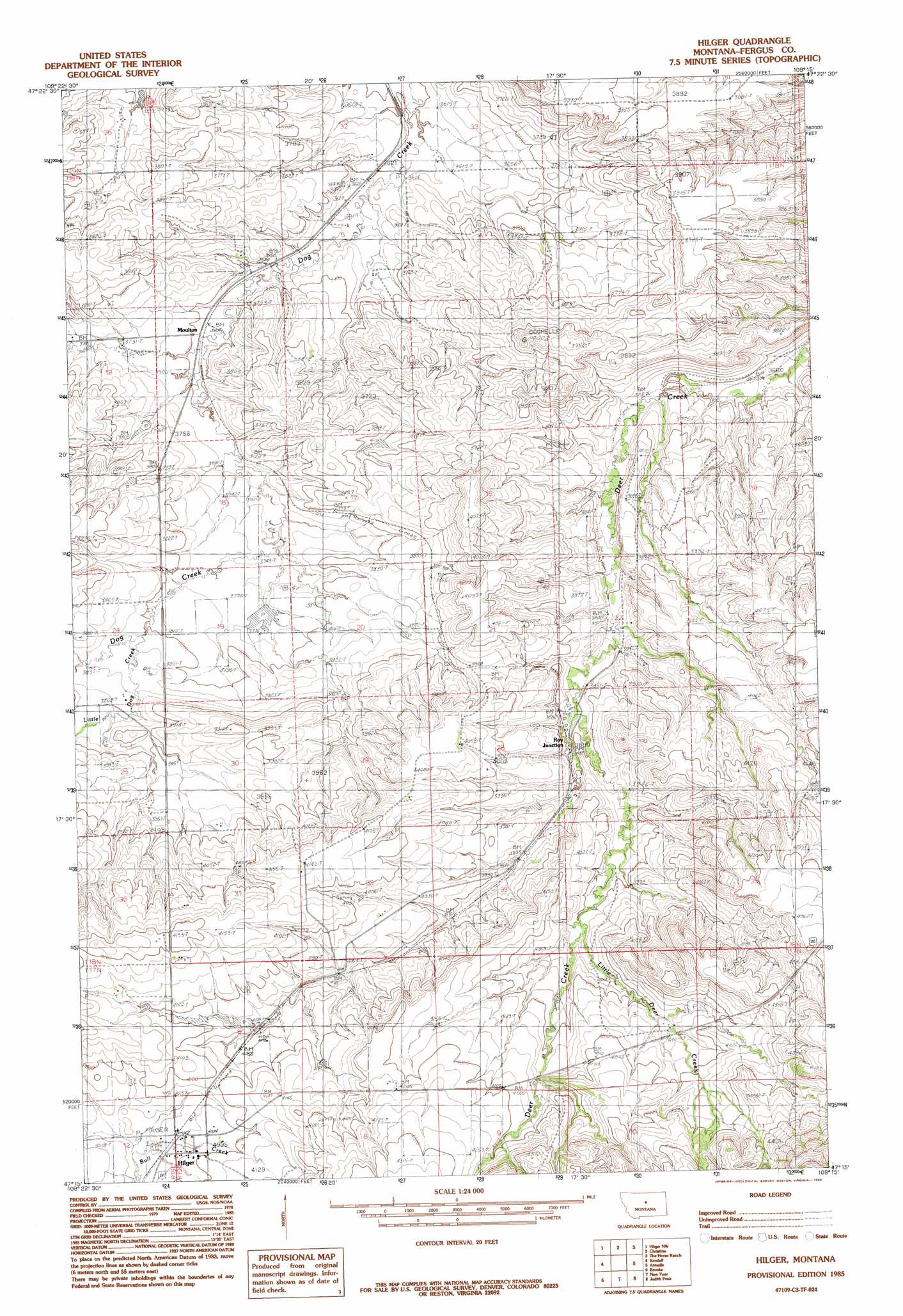
USGS Topo Quad 47109c3 - 1:24,000 scale
| Topo Map Name: | Hilger |
| USGS Topo Quad ID: | 47109c3 |
| Print Size: | ca. 21 1/4" wide x 27" high |
| Southeast Coordinates: | 47.25° N latitude / 109.25° W longitude |
| Map Center Coordinates: | 47.3125° N latitude / 109.3125° W longitude |
| U.S. State: | MT |
| Filename: | o47109c3.jpg |
| Download Map JPG Image: | Hilger topo map 1:24,000 scale |
| Map Type: | Topographic |
| Topo Series: | 7.5´ |
| Map Scale: | 1:24,000 |
| Source of Map Images: | United States Geological Survey (USGS) |
| Alternate Map Versions: |
Hilger MT 1985, updated 1985 Download PDF Buy paper map Hilger MT 2011 Download PDF Buy paper map Hilger MT 2014 Download PDF Buy paper map |
1:24,000 Topo Quads surrounding Hilger
Anderson Bridge |
Winifred West |
Winifred East |
Gerhard Corner |
Bakers Spring |
Wild Bill Flat East |
Hilger Nw |
Christina |
The Horse Ranch |
Fergus Ne |
Seventytwo Hills |
Kendall |
Hilger |
Armells |
Fergus |
Spring Creek Junction |
Brooks |
New Year |
Judith Peak |
Lewis Peak |
Glengarry |
Lewistown |
Pike Creek |
Horsethief Coulee W. |
Horsethief Coulee E. |
> Back to 47109a1 at 1:100,000 scale
> Back to 47108a1 at 1:250,000 scale
> Back to U.S. Topo Maps home
Hilger topo map: Gazetteer
Hilger: Dams
Van Haur Dam elevation 1157m 3795′Hilger: Populated Places
Hilger elevation 1240m 4068′Moulton elevation 1128m 3700′
Hilger: Post Offices
Hilger Post Office elevation 1240m 4068′Moulton Post Office (historical) elevation 1128m 3700′
Hilger: Streams
Little Deer Creek elevation 1225m 4019′Little Dog Creek elevation 1159m 3802′
Hilger: Wells
17N18E01ABAC01 Well elevation 1265m 4150′17N19E07BBC_01 Well elevation 1245m 4084′
17N19E07BC__01 Well elevation 1245m 4084′
17N19E07BC__02 Well elevation 1245m 4084′
18N18E12ACA_01 Well elevation 1143m 3750′
18N18E24DCD_01 Well elevation 1192m 3910′
18N19E08ABB_01 Well elevation 1155m 3789′
18N19E08BCD_01 Well elevation 1172m 3845′
18N19E18DA__01 Well elevation 1154m 3786′
18N19E19BBB_01 Well elevation 1160m 3805′
18N19E28BCA_01 Well elevation 1221m 4005′
18N19E31CCC_01 Well elevation 1253m 4110′
18N19E31CCCD01 Well elevation 1271m 4169′
18N19E33AAA_01 Well elevation 1254m 4114′
Hilger digital topo map on disk
Buy this Hilger topo map showing relief, roads, GPS coordinates and other geographical features, as a high-resolution digital map file on DVD: