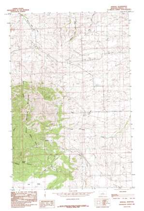
Kendall Topo Map Montana
To zoom in, hover over the map of Kendall
USGS Topo Quad 47109c4 - 1:24,000 scale
| Topo Map Name: | Kendall |
| USGS Topo Quad ID: | 47109c4 |
| Print Size: | ca. 21 1/4" wide x 27" high |
| Southeast Coordinates: | 47.25° N latitude / 109.375° W longitude |
| Map Center Coordinates: | 47.3125° N latitude / 109.4375° W longitude |
| U.S. State: | MT |
| Filename: | o47109c4.jpg |
| Download Map JPG Image: | Kendall topo map 1:24,000 scale |
| Map Type: | Topographic |
| Topo Series: | 7.5´ |
| Map Scale: | 1:24,000 |
| Source of Map Images: | United States Geological Survey (USGS) |
| Alternate Map Versions: |
Kendall MT 1985, updated 1985 Download PDF Buy paper map Kendall MT 2011 Download PDF Buy paper map Kendall MT 2014 Download PDF Buy paper map |
1:24,000 Topo Quads surrounding Kendall
> Back to 47109a1 at 1:100,000 scale
> Back to 47108a1 at 1:250,000 scale
> Back to U.S. Topo Maps home
Kendall topo map: Gazetteer
Kendall: Flats
The Park elevation 1433m 4701′Kendall: Mines
Abbey Adit Mine elevation 1492m 4895′Abbey Shaft elevation 1470m 4822′
Dog Creek Number 1 Mine elevation 1537m 5042′
Golden Discovery Mine elevation 1539m 5049′
Iron Gulch Mine elevation 1529m 5016′
Jack Lund Mine elevation 1366m 4481′
JT Canyon Shaft elevation 1544m 5065′
Kendall Venture Mine elevation 1404m 4606′
Mason Canyon Number 1 Mine elevation 1631m 5351′
Plum Creek Number 1 Mine elevation 1460m 4790′
Kendall: Populated Places
Kendall (historical) elevation 1407m 4616′Kendall: Post Offices
Kendall (historical) elevation 1407m 4616′Kendall: Ranges
North Moccasin Mountains elevation 1641m 5383′Kendall: Springs
Sennett Spring elevation 1320m 4330′Kendall: Valleys
JT Canyon elevation 1329m 4360′Mason Canyon elevation 1351m 4432′
Kendall: Wells
17N18E06AAD_01 Well elevation 1371m 4498′18N18E05BBA_01 Well elevation 1170m 3838′
18N18E06DCD_01 Well elevation 1182m 3877′
18N18E15BDA_01 Well elevation 1205m 3953′
Kendall digital topo map on disk
Buy this Kendall topo map showing relief, roads, GPS coordinates and other geographical features, as a high-resolution digital map file on DVD:


