Hilger Nw Topo Map Montana
To zoom in, hover over the map of Hilger Nw
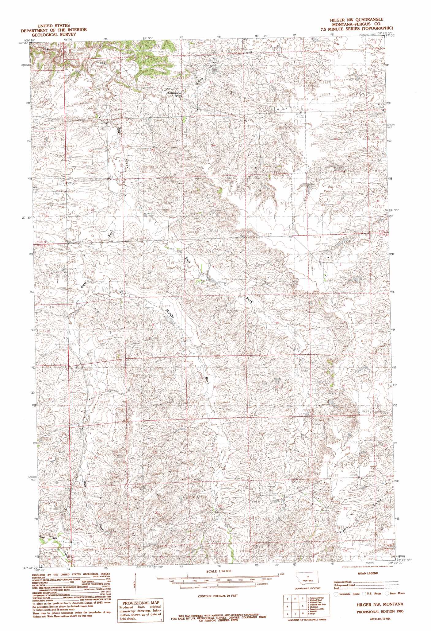
USGS Topo Quad 47109d4 - 1:24,000 scale
| Topo Map Name: | Hilger Nw |
| USGS Topo Quad ID: | 47109d4 |
| Print Size: | ca. 21 1/4" wide x 27" high |
| Southeast Coordinates: | 47.375° N latitude / 109.375° W longitude |
| Map Center Coordinates: | 47.4375° N latitude / 109.4375° W longitude |
| U.S. State: | MT |
| Filename: | o47109d4.jpg |
| Download Map JPG Image: | Hilger Nw topo map 1:24,000 scale |
| Map Type: | Topographic |
| Topo Series: | 7.5´ |
| Map Scale: | 1:24,000 |
| Source of Map Images: | United States Geological Survey (USGS) |
| Alternate Map Versions: |
Hilger NW MT 1985, updated 1985 Download PDF Buy paper map Hilger NW MT 2011 Download PDF Buy paper map Hilger NW MT 2014 Download PDF Buy paper map |
1:24,000 Topo Quads surrounding Hilger Nw
P N Ranch |
Council Island |
Gallatin Rapids |
Taffy Ridge |
Woodhawk Hill |
Wolf Creek Falls |
Anderson Bridge |
Winifred West |
Winifred East |
Gerhard Corner |
Wild Bill Flat West |
Wild Bill Flat East |
Hilger Nw |
Christina |
The Horse Ranch |
Toney Bench |
Seventytwo Hills |
Kendall |
Hilger |
Armells |
Danvers |
Spring Creek Junction |
Brooks |
New Year |
Judith Peak |
> Back to 47109a1 at 1:100,000 scale
> Back to 47108a1 at 1:250,000 scale
> Back to U.S. Topo Maps home
Hilger Nw topo map: Gazetteer
Hilger Nw: Dams
Wicker Basket Number 2 Dam elevation 1112m 3648′Hilger Nw: Populated Places
Cone Butte (historical) elevation 1117m 3664′Salt Creek (historical) elevation 1029m 3375′
Hilger Nw: Springs
Cottonwood Spring elevation 1071m 3513′Hilger Nw: Streams
East Fork Salt Creek elevation 1007m 3303′Middle Fork Salt Creek elevation 1031m 3382′
West Fork Salt Creek elevation 1007m 3303′
Hilger Nw: Wells
20N18E24CCAB01 Well elevation 1061m 3480′20N18E34CDCC01 Well elevation 1118m 3667′
Hilger Nw digital topo map on disk
Buy this Hilger Nw topo map showing relief, roads, GPS coordinates and other geographical features, as a high-resolution digital map file on DVD: