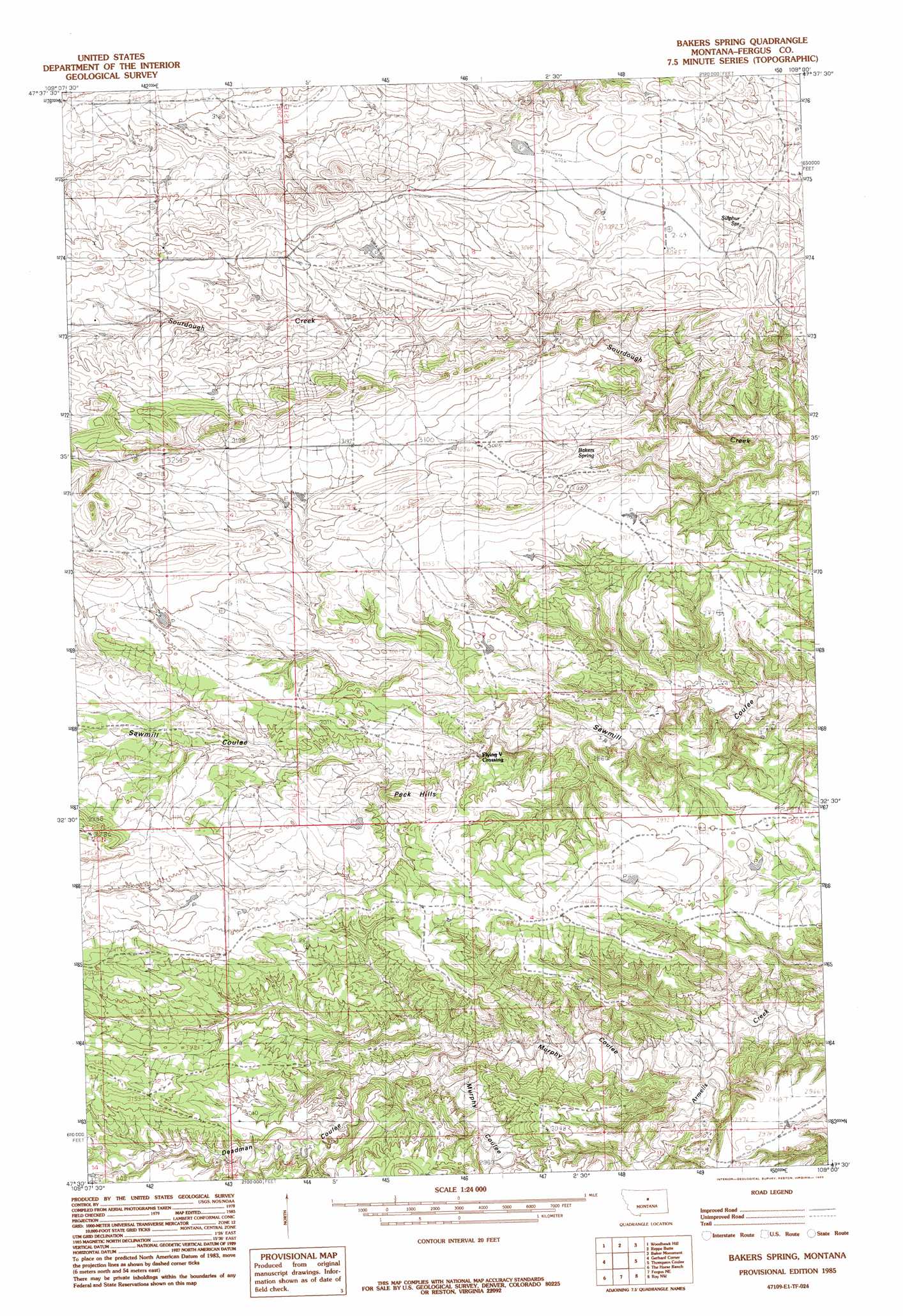
Bakers Spring Topo Map Montana
To zoom in, hover over the map of Bakers Spring
USGS Topo Quad 47109e1 - 1:24,000 scale
| Topo Map Name: | Bakers Spring |
| USGS Topo Quad ID: | 47109e1 |
| Print Size: | ca. 21 1/4" wide x 27" high |
| Southeast Coordinates: | 47.5° N latitude / 109° W longitude |
| Map Center Coordinates: | 47.5625° N latitude / 109.0625° W longitude |
| U.S. State: | MT |
| Filename: | o47109e1.jpg |
| Download Map JPG Image: | Bakers Spring topo map 1:24,000 scale |
| Map Type: | Topographic |
| Topo Series: | 7.5´ |
| Map Scale: | 1:24,000 |
| Source of Map Images: | United States Geological Survey (USGS) |
| Alternate Map Versions: |
Bakers Spring MT 1985, updated 1985 Download PDF Buy paper map Bakers Spring MT 2011 Download PDF Buy paper map Bakers Spring MT 2014 Download PDF Buy paper map |
1:24,000 Topo Quads surrounding Bakers Spring
Leroy |
Bird Rapids |
Sturgeon Island |
Cow Island |
Shetland Divide |
Taffy Ridge |
Woodhawk Hill |
Reppe Butte |
Baker Monument |
Grand Island |
Winifred East |
Gerhard Corner |
Bakers Spring |
Thompson Coulee |
Mitchell Crossing |
Christina |
The Horse Ranch |
Fergus Ne |
Roy Nw |
Griffee Coulee |
Hilger |
Armells |
Fergus |
Roy |
Bohemian Corners |
> Back to 47109e1 at 1:100,000 scale
> Back to 47108a1 at 1:250,000 scale
> Back to U.S. Topo Maps home
Bakers Spring topo map: Gazetteer
Bakers Spring: Dams
Elephant Dam elevation 910m 2985′Poor Sport Dam elevation 883m 2896′
Bakers Spring: Springs
Bakers Spring elevation 916m 3005′Sulphur Spring elevation 924m 3031′
Bakers Spring: Streams
Murphy Coulee elevation 833m 2732′Bakers Spring: Summits
Peck Hills elevation 951m 3120′Bakers Spring: Valleys
Burnt Timber Coulee elevation 906m 2972′Deadman Coulee elevation 854m 2801′
Bakers Spring: Wells
20N21E06BADC01 Well elevation 915m 3001′Bakers Spring digital topo map on disk
Buy this Bakers Spring topo map showing relief, roads, GPS coordinates and other geographical features, as a high-resolution digital map file on DVD: