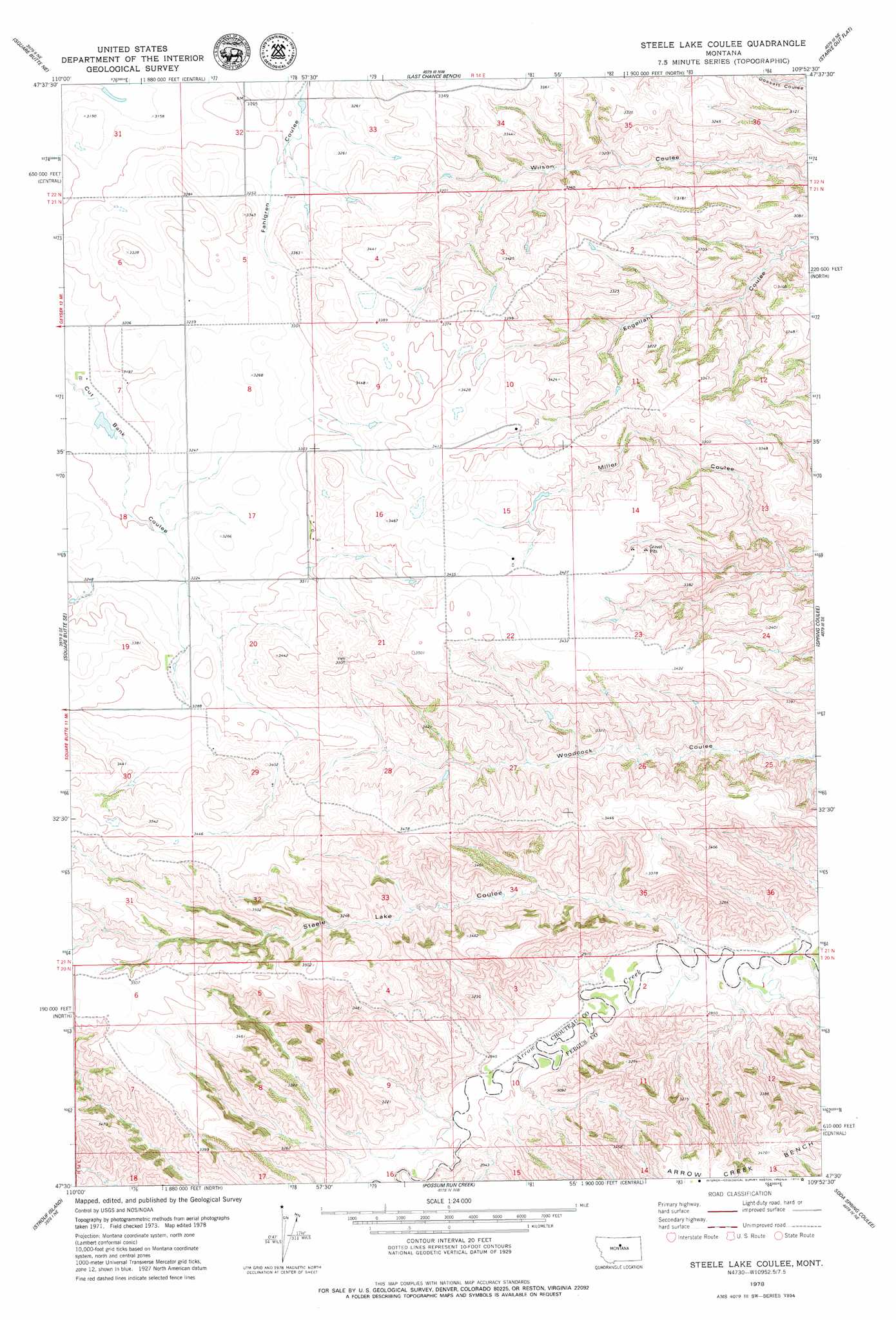
Steele Lake Coulee Topo Map Montana
To zoom in, hover over the map of Steele Lake Coulee
USGS Topo Quad 47109e8 - 1:24,000 scale
| Topo Map Name: | Steele Lake Coulee |
| USGS Topo Quad ID: | 47109e8 |
| Print Size: | ca. 21 1/4" wide x 27" high |
| Southeast Coordinates: | 47.5° N latitude / 109.875° W longitude |
| Map Center Coordinates: | 47.5625° N latitude / 109.9375° W longitude |
| U.S. State: | MT |
| Filename: | o47109e8.jpg |
| Download Map JPG Image: | Steele Lake Coulee topo map 1:24,000 scale |
| Map Type: | Topographic |
| Topo Series: | 7.5´ |
| Map Scale: | 1:24,000 |
| Source of Map Images: | United States Geological Survey (USGS) |
| Alternate Map Versions: |
Steele Lake Coulee MT 1978, updated 1979 Download PDF Buy paper map Steele Lake Coulee MT 2011 Download PDF Buy paper map Steele Lake Coulee MT 2014 Download PDF Buy paper map |
1:24,000 Topo Quads surrounding Steele Lake Coulee
Eagle Buttes Sw |
Eagle Buttes |
Dark Butte |
Iliad |
Pigtail Coulee |
Dammel Reservoir |
Square Butte Ne |
Last Chance Bench |
Starve Out Flat |
P N Ranch |
Square Butte |
Square Butte Se |
Steele Lake Coulee |
Spring Coulee |
Wolf Creek Falls |
Pownal |
Strouf Island |
Possum Run Creek |
Soda Spring Coulee |
Wild Bill Flat West |
Arrow Creek |
Coffee Creek |
Denton |
Hoosac |
Toney Bench |
> Back to 47109e1 at 1:100,000 scale
> Back to 47108a1 at 1:250,000 scale
> Back to U.S. Topo Maps home
Steele Lake Coulee topo map: Gazetteer
Steele Lake Coulee: Dams
Fuddy Duddy Dam elevation 971m 3185′Steele Lake Coulee: Valleys
Steele Lake Coulee elevation 842m 2762′Steele Lake Coulee: Wells
21N14E07BCDA01 Well elevation 974m 3195′Steele Lake Coulee digital topo map on disk
Buy this Steele Lake Coulee topo map showing relief, roads, GPS coordinates and other geographical features, as a high-resolution digital map file on DVD: