Woodhawk Hill Topo Map Montana
To zoom in, hover over the map of Woodhawk Hill
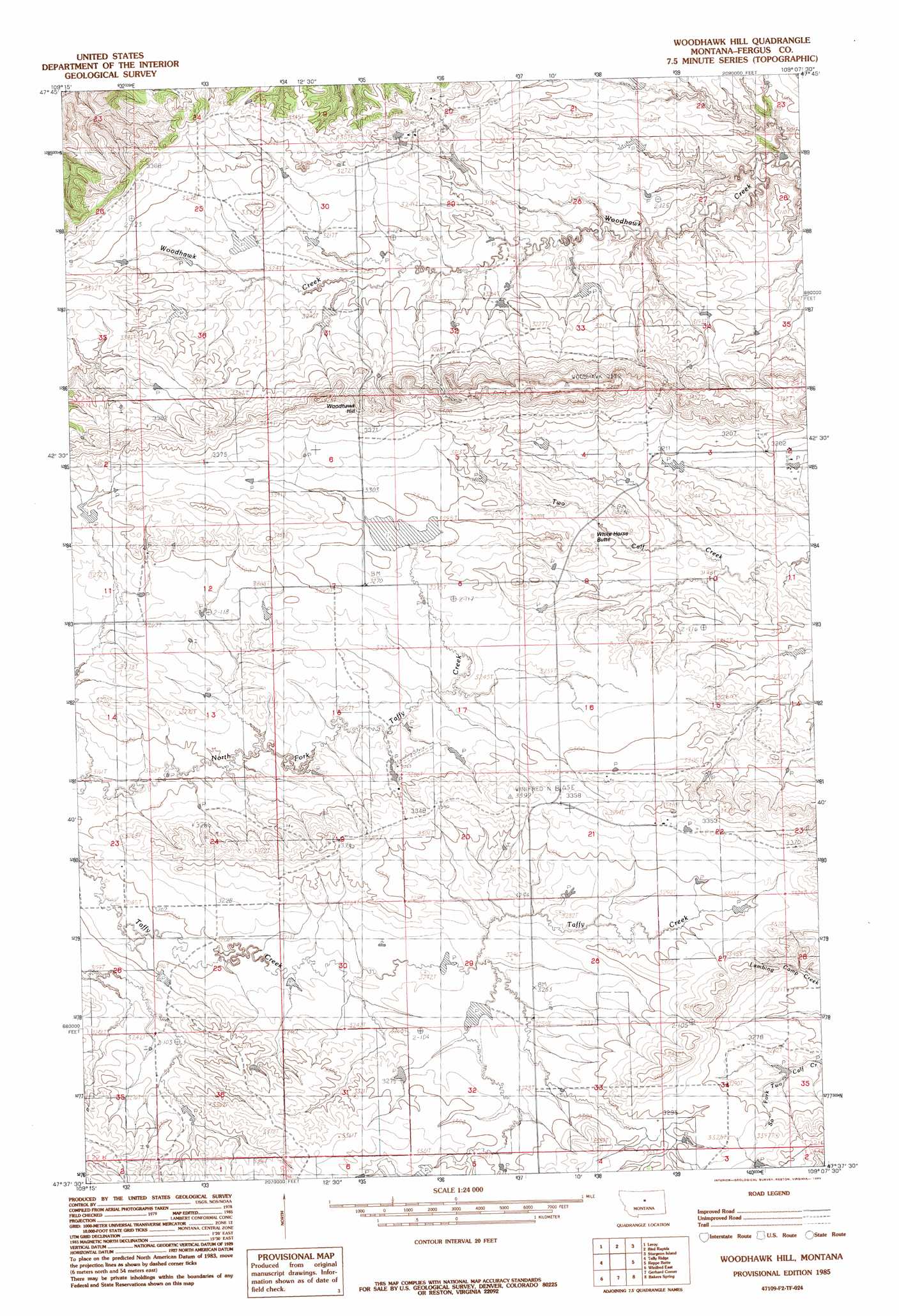
USGS Topo Quad 47109f2 - 1:24,000 scale
| Topo Map Name: | Woodhawk Hill |
| USGS Topo Quad ID: | 47109f2 |
| Print Size: | ca. 21 1/4" wide x 27" high |
| Southeast Coordinates: | 47.625° N latitude / 109.125° W longitude |
| Map Center Coordinates: | 47.6875° N latitude / 109.1875° W longitude |
| U.S. State: | MT |
| Filename: | o47109f2.jpg |
| Download Map JPG Image: | Woodhawk Hill topo map 1:24,000 scale |
| Map Type: | Topographic |
| Topo Series: | 7.5´ |
| Map Scale: | 1:24,000 |
| Source of Map Images: | United States Geological Survey (USGS) |
| Alternate Map Versions: |
Woodhawk Hill MT 1985, updated 1985 Download PDF Buy paper map Woodhawk Hill MT 2011 Download PDF Buy paper map Woodhawk Hill MT 2014 Download PDF Buy paper map |
1:24,000 Topo Quads surrounding Woodhawk Hill
Saddle Rock |
Nolan Reservoir |
Sandpiper Reservoir |
Butch Reservoir |
John Coulee |
Ragland Bench |
Leroy |
Bird Rapids |
Sturgeon Island |
Cow Island |
Gallatin Rapids |
Taffy Ridge |
Woodhawk Hill |
Reppe Butte |
Baker Monument |
Winifred West |
Winifred East |
Gerhard Corner |
Bakers Spring |
Thompson Coulee |
Hilger Nw |
Christina |
The Horse Ranch |
Fergus Ne |
Roy Nw |
> Back to 47109e1 at 1:100,000 scale
> Back to 47108a1 at 1:250,000 scale
> Back to U.S. Topo Maps home
Woodhawk Hill topo map: Gazetteer
Woodhawk Hill: Dams
Ford Irrigation Dam elevation 1003m 3290′Kermits Dam elevation 995m 3264′
Othar Number 2 Dam elevation 994m 3261′
Woodhawk Hill: Populated Places
Woodhawk (historical) elevation 1022m 3353′Woodhawk Hill: Springs
Hart Spring elevation 976m 3202′Woodhawk Hill: Summits
White Horse Butte elevation 992m 3254′Woodhawk Hill elevation 1074m 3523′
Woodhawk Hill: Wells
21N21E19BCAC01 Well elevation 1030m 3379′22N20E22BBBB01 Well elevation 1027m 3369′
22N20E22CABD01 Well elevation 1029m 3375′
Woodhawk Hill digital topo map on disk
Buy this Woodhawk Hill topo map showing relief, roads, GPS coordinates and other geographical features, as a high-resolution digital map file on DVD: