Bird Rapids Topo Map Montana
To zoom in, hover over the map of Bird Rapids
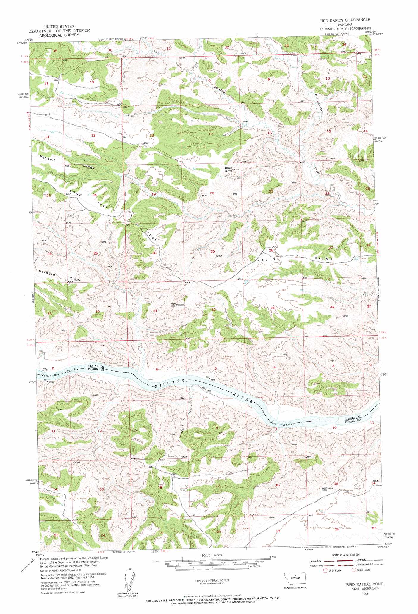
USGS Topo Quad 47109g2 - 1:24,000 scale
| Topo Map Name: | Bird Rapids |
| USGS Topo Quad ID: | 47109g2 |
| Print Size: | ca. 21 1/4" wide x 27" high |
| Southeast Coordinates: | 47.75° N latitude / 109.125° W longitude |
| Map Center Coordinates: | 47.8125° N latitude / 109.1875° W longitude |
| U.S. State: | MT |
| Filename: | o47109g2.jpg |
| Download Map JPG Image: | Bird Rapids topo map 1:24,000 scale |
| Map Type: | Topographic |
| Topo Series: | 7.5´ |
| Map Scale: | 1:24,000 |
| Source of Map Images: | United States Geological Survey (USGS) |
| Alternate Map Versions: |
Bird Rapids MT 1954, updated 1956 Download PDF Buy paper map Bird Rapids MT 2011 Download PDF Buy paper map Bird Rapids MT 2014 Download PDF Buy paper map |
1:24,000 Topo Quads surrounding Bird Rapids
Blue Stone Peak |
Williamson Butte |
Runyan Bench |
Rattlesnake |
Lake Seventeen West |
Saddle Rock |
Nolan Reservoir |
Sandpiper Reservoir |
Butch Reservoir |
John Coulee |
Ragland Bench |
Leroy |
Bird Rapids |
Sturgeon Island |
Cow Island |
Gallatin Rapids |
Taffy Ridge |
Woodhawk Hill |
Reppe Butte |
Baker Monument |
Winifred West |
Winifred East |
Gerhard Corner |
Bakers Spring |
Thompson Coulee |
> Back to 47109e1 at 1:100,000 scale
> Back to 47108a1 at 1:250,000 scale
> Back to U.S. Topo Maps home
Bird Rapids topo map: Gazetteer
Bird Rapids: Dams
Tarzan Dam elevation 995m 3264′Bird Rapids: Rapids
Bird Rapids elevation 709m 2326′Castle Bluffs Rapids elevation 712m 2335′
Magpie Rapids elevation 711m 2332′
Bird Rapids: Ridges
Lone Tree Ridge elevation 979m 3211′Pendell Ridge elevation 988m 3241′
Bird Rapids: Streams
North Fork Lion Coulee elevation 866m 2841′Bird Rapids: Summits
Black Butte elevation 967m 3172′Bird Rapids: Valleys
Lion Coulee elevation 803m 2634′Bird Rapids digital topo map on disk
Buy this Bird Rapids topo map showing relief, roads, GPS coordinates and other geographical features, as a high-resolution digital map file on DVD: