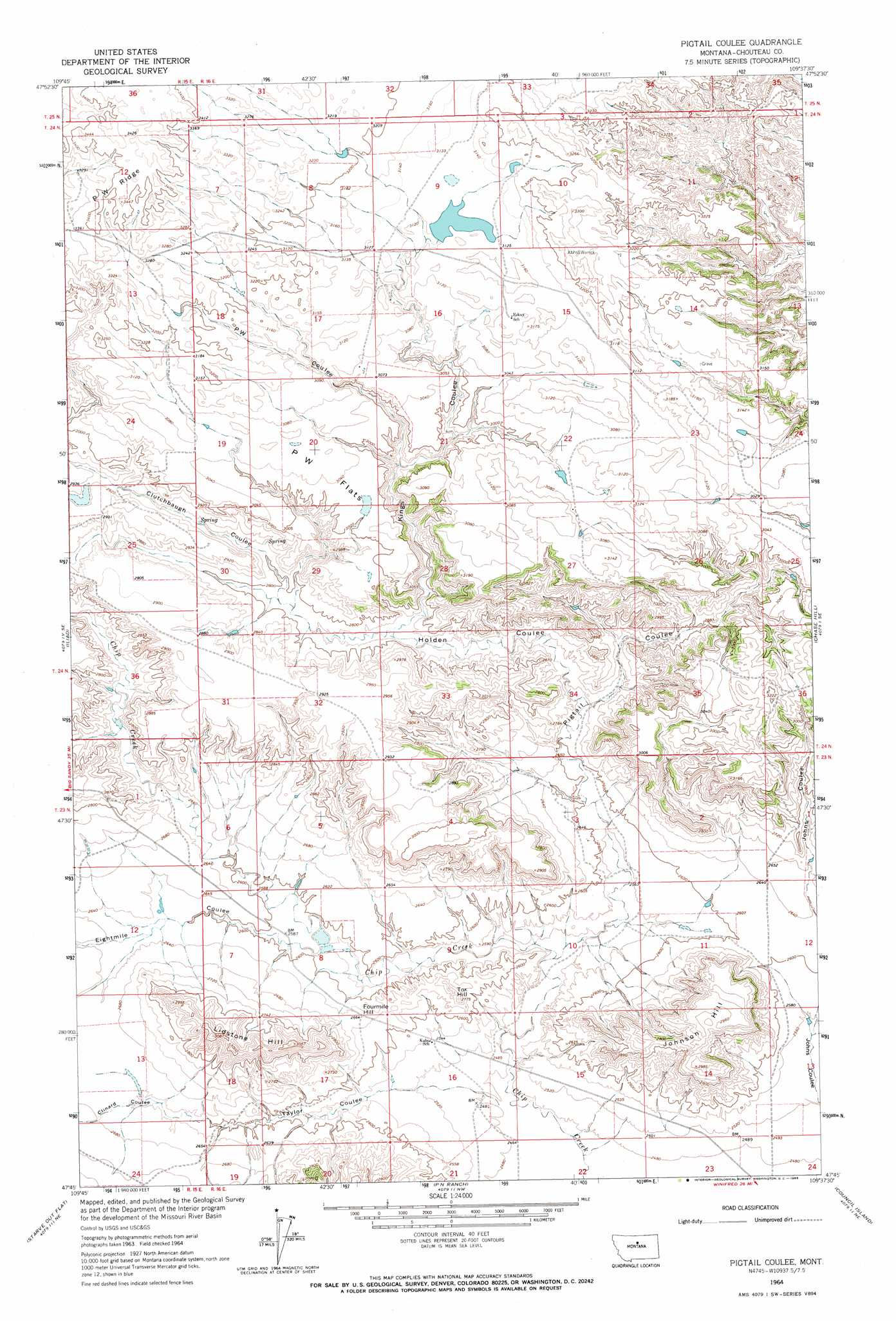
Pigtail Coulee Topo Map Montana
To zoom in, hover over the map of Pigtail Coulee
USGS Topo Quad 47109g6 - 1:24,000 scale
| Topo Map Name: | Pigtail Coulee |
| USGS Topo Quad ID: | 47109g6 |
| Print Size: | ca. 21 1/4" wide x 27" high |
| Southeast Coordinates: | 47.75° N latitude / 109.625° W longitude |
| Map Center Coordinates: | 47.8125° N latitude / 109.6875° W longitude |
| U.S. State: | MT |
| Filename: | o47109g6.jpg |
| Download Map JPG Image: | Pigtail Coulee topo map 1:24,000 scale |
| Map Type: | Topographic |
| Topo Series: | 7.5´ |
| Map Scale: | 1:24,000 |
| Source of Map Images: | United States Geological Survey (USGS) |
| Alternate Map Versions: |
Pigtail Coulee MT 1964, updated 1966 Download PDF Buy paper map Pigtail Coulee MT 2011 Download PDF Buy paper map Pigtail Coulee MT 2014 Download PDF Buy paper map |
1:24,000 Topo Quads surrounding Pigtail Coulee
Studhorse Butte |
Ryan Butte |
Tiger Butte |
Warrick |
Blue Stone Peak |
Eagleton Nw |
Seifort Reservoir |
Eskay Nw |
Eskay Ne |
Saddle Rock |
Dark Butte |
Iliad |
Pigtail Coulee |
Chase Hill |
Ragland Bench |
Last Chance Bench |
Starve Out Flat |
P N Ranch |
Council Island |
Gallatin Rapids |
Steele Lake Coulee |
Spring Coulee |
Wolf Creek Falls |
Anderson Bridge |
Winifred West |
> Back to 47109e1 at 1:100,000 scale
> Back to 47108a1 at 1:250,000 scale
> Back to U.S. Topo Maps home
Pigtail Coulee topo map: Gazetteer
Pigtail Coulee: Dams
Chip Dipper Dam elevation 780m 2559′Delilah Dam elevation 953m 3126′
Pigtail Coulee: Flats
P W Flats elevation 930m 3051′Pigtail Coulee: Populated Places
Eskay (historical) elevation 938m 3077′Pigtail Coulee: Post Offices
Eskay Post Office (historical) elevation 938m 3077′Pigtail Coulee: Ridges
P W Ridge elevation 1047m 3435′Pigtail Coulee: Summits
Fourmile Hill elevation 806m 2644′Johnson Hill elevation 903m 2962′
Lidstone Hill elevation 907m 2975′
Tox Hill elevation 841m 2759′
Pigtail Coulee: Valleys
Clinard Coulee elevation 805m 2641′Clutchbaugh Coulee elevation 853m 2798′
Eightmile Coulee elevation 782m 2565′
Holden Coulee elevation 805m 2641′
Johns Coulee elevation 785m 2575′
Kings Coulee elevation 843m 2765′
Pigtail Coulee elevation 768m 2519′
PW Coulee elevation 887m 2910′
Taylor Coulee elevation 757m 2483′
Pigtail Coulee digital topo map on disk
Buy this Pigtail Coulee topo map showing relief, roads, GPS coordinates and other geographical features, as a high-resolution digital map file on DVD: