Butch Reservoir Topo Map Montana
To zoom in, hover over the map of Butch Reservoir
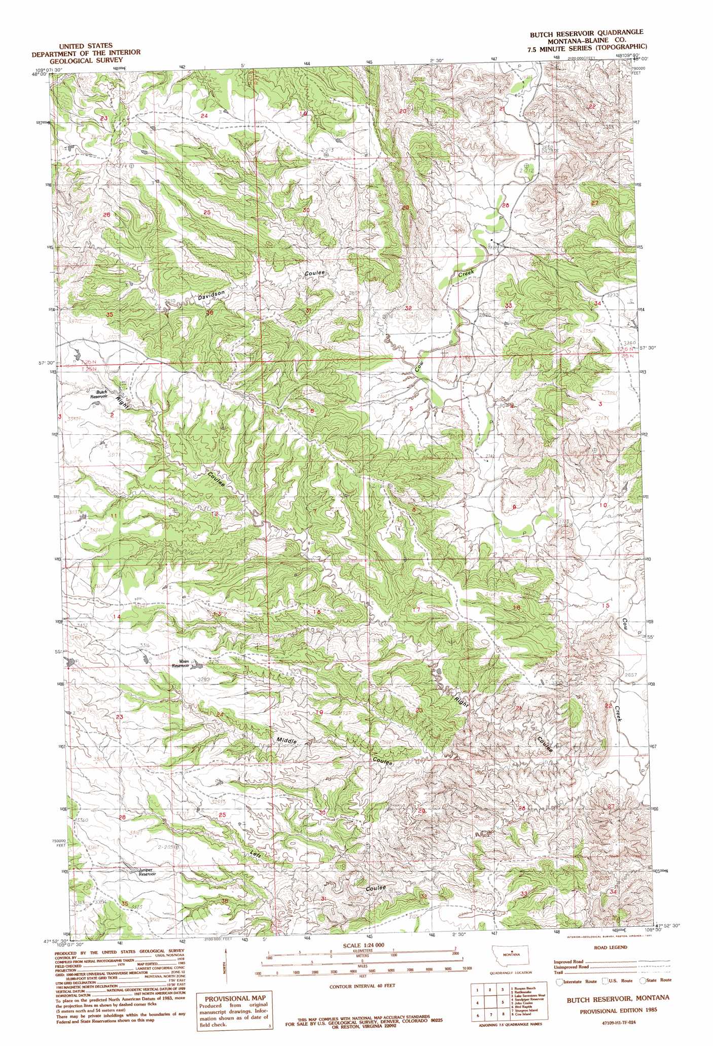
USGS Topo Quad 47109h1 - 1:24,000 scale
| Topo Map Name: | Butch Reservoir |
| USGS Topo Quad ID: | 47109h1 |
| Print Size: | ca. 21 1/4" wide x 27" high |
| Southeast Coordinates: | 47.875° N latitude / 109° W longitude |
| Map Center Coordinates: | 47.9375° N latitude / 109.0625° W longitude |
| U.S. State: | MT |
| Filename: | o47109h1.jpg |
| Download Map JPG Image: | Butch Reservoir topo map 1:24,000 scale |
| Map Type: | Topographic |
| Topo Series: | 7.5´ |
| Map Scale: | 1:24,000 |
| Source of Map Images: | United States Geological Survey (USGS) |
| Alternate Map Versions: |
Butch Reservoir MT 1985, updated 1985 Download PDF Buy paper map Butch Reservoir MT 2011 Download PDF Buy paper map Butch Reservoir MT 2014 Download PDF Buy paper map |
1:24,000 Topo Quads surrounding Butch Reservoir
Corrigan Mountain |
Scotty Butte |
Suction Butte |
Putnam Lake |
Lake Seventeen Ne |
Williamson Butte |
Runyan Bench |
Rattlesnake |
Lake Seventeen West |
Lake Seventeen East |
Nolan Reservoir |
Sandpiper Reservoir |
Butch Reservoir |
John Coulee |
Crazyman Coulee |
Leroy |
Bird Rapids |
Sturgeon Island |
Cow Island |
Shetland Divide |
Taffy Ridge |
Woodhawk Hill |
Reppe Butte |
Baker Monument |
Grand Island |
> Back to 47109e1 at 1:100,000 scale
> Back to 47108a1 at 1:250,000 scale
> Back to U.S. Topo Maps home
Butch Reservoir topo map: Gazetteer
Butch Reservoir: Reservoirs
Butch Reservoir elevation 1000m 3280′Juniper Reservoir elevation 994m 3261′
Wren Reservoir elevation 988m 3241′
Butch Reservoir: Streams
Suction Creek elevation 875m 2870′Butch Reservoir: Valleys
Davidson Coulee elevation 853m 2798′Left Coulee elevation 799m 2621′
Middle Coulee elevation 847m 2778′
Right Coulee elevation 891m 2923′
Butch Reservoir: Wells
26N20E36ADCC01 Well elevation 946m 3103′Butch Reservoir digital topo map on disk
Buy this Butch Reservoir topo map showing relief, roads, GPS coordinates and other geographical features, as a high-resolution digital map file on DVD: