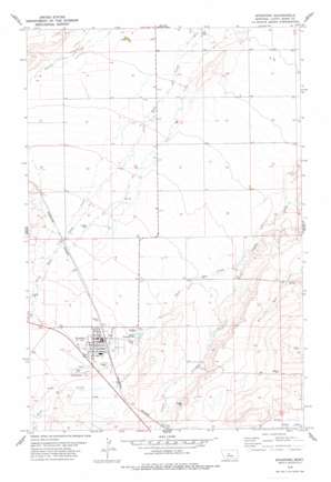
Stanford Topo Map Montana
To zoom in, hover over the map of Stanford
USGS Topo Quad 47110b2 - 1:24,000 scale
| Topo Map Name: | Stanford |
| USGS Topo Quad ID: | 47110b2 |
| Print Size: | ca. 21 1/4" wide x 27" high |
| Southeast Coordinates: | 47.125° N latitude / 110.125° W longitude |
| Map Center Coordinates: | 47.1875° N latitude / 110.1875° W longitude |
| U.S. State: | MT |
| Filename: | o47110b2.jpg |
| Download Map JPG Image: | Stanford topo map 1:24,000 scale |
| Map Type: | Topographic |
| Topo Series: | 7.5´ |
| Map Scale: | 1:24,000 |
| Source of Map Images: | United States Geological Survey (USGS) |
| Alternate Map Versions: |
Stanford MT 1978, updated 1979 Download PDF Buy paper map Stanford MT 2011 Download PDF Buy paper map Stanford MT 2014 Download PDF Buy paper map |
1:24,000 Topo Quads surrounding Stanford
> Back to 47110a1 at 1:100,000 scale
> Back to 47110a1 at 1:250,000 scale
> Back to U.S. Topo Maps home
Stanford topo map: Gazetteer
Stanford: Airports
Stanford Airport elevation 1317m 4320′Stanford: Parks
Stanford City Park elevation 1305m 4281′Stanford: Populated Places
Cotton Trailer Court elevation 1305m 4281′Edith Nelson Trailer Court elevation 1302m 4271′
Hall Trailer Court elevation 1303m 4274′
J and M Trailer Court elevation 1313m 4307′
Stanford elevation 1305m 4281′
Stanford: Post Offices
Stanford Post Office elevation 1304m 4278′Stanford: Springs
16N12E02DD__01 Spring elevation 1254m 4114′16N12E04BB__01 Spring elevation 1275m 4183′
16N12E10CD__01 Spring elevation 1293m 4242′
16N12E17BB__01 Spring elevation 1316m 4317′
16N12E24DA__01 Spring elevation 1316m 4317′
16N12E24DA__02 Spring elevation 1316m 4317′
17N12E18AA__01 Spring elevation 1224m 4015′
17N12E28CD__01 Spring elevation 1254m 4114′
17N12E32BC__01 Spring elevation 1274m 4179′
17N12E32DD__03 Spring elevation 1275m 4183′
17N12E33AB__01 Spring elevation 1259m 4130′
17N12E33BA__01 Spring elevation 1256m 4120′
Stanford: Streams
Skull Creek elevation 1245m 4084′Stanford: Wells
16N12E02DD__02 Well elevation 1261m 4137′16N12E03BC__01 Well elevation 1277m 4189′
16N12E03CC__01 Well elevation 1283m 4209′
16N12E03CC__02 Well elevation 1283m 4209′
16N12E03CC__03 Well elevation 1283m 4209′
16N12E05BA__01 Well elevation 1287m 4222′
16N12E07DA__01 Well elevation 1312m 4304′
16N12E07DA__02 Well elevation 1312m 4304′
16N12E07DDB_02 Well elevation 1314m 4311′
16N12E08AB__01 Well elevation 1301m 4268′
16N12E08AD__01 Well elevation 1302m 4271′
16N12E08CDDD01 Well elevation 1309m 4294′
16N12E08CDDD02 Well elevation 1310m 4297′
16N12E08DACD01 Well elevation 1304m 4278′
16N12E08DC__01 Well elevation 1310m 4297′
16N12E09CD__01 Well elevation 1299m 4261′
16N12E09DC__01 Well elevation 1301m 4268′
16N12E10DCCC01 Well elevation 1298m 4258′
16N12E11AAAD01 Well elevation 1256m 4120′
16N12E12BB__01 Well elevation 1260m 4133′
16N12E12BB__02 Well elevation 1260m 4133′
16N12E13AC__01 Well elevation 1317m 4320′
16N12E13CD__01 Well elevation 1308m 4291′
16N12E14CCCC01 Well elevation 1286m 4219′
16N12E14DD__01 Well elevation 1318m 4324′
16N12E15AB__01 Well elevation 1302m 4271′
16N12E15BB__01 Well elevation 1296m 4251′
16N12E16AA__01 Well elevation 1295m 4248′
16N12E16ACBD01 Well elevation 1300m 4265′
16N12E16BB__01 Well elevation 1307m 4288′
16N12E16BB__02 Well elevation 1307m 4288′
16N12E16BB__03 Well elevation 1307m 4288′
16N12E16BB__04 Well elevation 1307m 4288′
16N12E16BBBC01 Well elevation 1305m 4281′
16N12E16BBCB01 Well elevation 1306m 4284′
16N12E16BD__01 Well elevation 1305m 4281′
16N12E16BD__02 Well elevation 1305m 4281′
16N12E16CC__01 Well elevation 1302m 4271′
16N12E16CC__02 Well elevation 1302m 4271′
16N12E16DCAD01 Well elevation 1294m 4245′
16N12E17AA__01 Well elevation 1310m 4297′
16N12E17DA__01 Well elevation 1315m 4314′
16N12E17DA__02 Well elevation 1315m 4314′
16N12E17DA__03 Well elevation 1315m 4314′
16N12E17DAAA01 Well elevation 1311m 4301′
16N12E17DAAA02 Well elevation 1311m 4301′
16N12E17DDAB01 Well elevation 1315m 4314′
16N12E21AABB01 Well elevation 1296m 4251′
16N12E21CB__01 Well elevation 1310m 4297′
16N12E22CA__01 Well elevation 1310m 4297′
16N12E24BB__01 Well elevation 1309m 4294′
16N12E24DD__01 Well elevation 1293m 4242′
16N12E29AA__01 Well elevation 1329m 4360′
17N12E14CD__01 Well elevation 1223m 4012′
17N12E14CD__02 Well elevation 1223m 4012′
17N12E15BA__01 Well elevation 1213m 3979′
17N12E15BA__02 Well elevation 1216m 3989′
17N12E15BA__03 Well elevation 1216m 3989′
17N12E17BB__01 Well elevation 1224m 4015′
17N12E17DC__01 Well elevation 1233m 4045′
17N12E17DC__02 Well elevation 1233m 4045′
17N12E18AA__02 Well elevation 1224m 4015′
17N12E21AD__01 Well elevation 1235m 4051′
17N12E21CD__01 Well elevation 1244m 4081′
17N12E21DA__01 Well elevation 1236m 4055′
17N12E22B___01 Well elevation 1231m 4038′
17N12E22BB__01 Well elevation 1229m 4032′
17N12E23DC__01 Well elevation 1232m 4041′
17N12E24BB__01 Well elevation 1221m 4005′
17N12E24BB__02 Well elevation 1221m 4005′
17N12E24BB__03 Well elevation 1221m 4005′
17N12E27____01 Well elevation 1248m 4094′
17N12E27B___01 Well elevation 1246m 4087′
17N12E27BC__01 Well elevation 1248m 4094′
17N12E28BA__01 Well elevation 1247m 4091′
17N12E28DA__01 Well elevation 1254m 4114′
17N12E28DA__02 Well elevation 1254m 4114′
17N12E29CDDA01 Well elevation 1262m 4140′
17N12E30DD__01 Well elevation 1267m 4156′
17N12E31DC__01 Well elevation 1292m 4238′
17N12E32AB__01 Well elevation 1266m 4153′
17N12E32BB__01 Well elevation 1270m 4166′
17N12E32DB__01 Well elevation 1274m 4179′
17N12E32DD__01 Well elevation 1275m 4183′
17N12E32DD__02 Well elevation 1275m 4183′
17N12E33CB__01 Well elevation 1269m 4163′
Stanford digital topo map on disk
Buy this Stanford topo map showing relief, roads, GPS coordinates and other geographical features, as a high-resolution digital map file on DVD:


