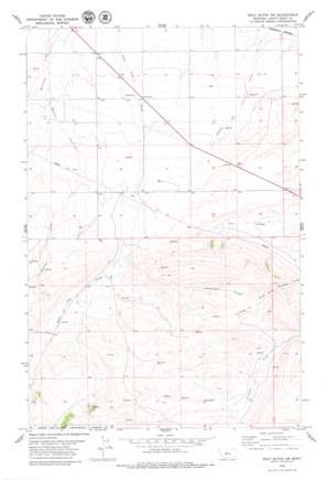
Wolf Butte Nw Topo Map Montana
To zoom in, hover over the map of Wolf Butte Nw
USGS Topo Quad 47110b4 - 1:24,000 scale
| Topo Map Name: | Wolf Butte Nw |
| USGS Topo Quad ID: | 47110b4 |
| Print Size: | ca. 21 1/4" wide x 27" high |
| Southeast Coordinates: | 47.125° N latitude / 110.375° W longitude |
| Map Center Coordinates: | 47.1875° N latitude / 110.4375° W longitude |
| U.S. State: | MT |
| Filename: | o47110b4.jpg |
| Download Map JPG Image: | Wolf Butte Nw topo map 1:24,000 scale |
| Map Type: | Topographic |
| Topo Series: | 7.5´ |
| Map Scale: | 1:24,000 |
| Source of Map Images: | United States Geological Survey (USGS) |
| Alternate Map Versions: |
Wolf Butte NW MT 1995, updated 1997 Download PDF Buy paper map Wolf Butte NW MT 2011 Download PDF Buy paper map Wolf Butte NW MT 2014 Download PDF Buy paper map |
| FStopo: | US Forest Service topo Wolf Butte NW is available: Download FStopo PDF Download FStopo TIF |
1:24,000 Topo Quads surrounding Wolf Butte Nw
> Back to 47110a1 at 1:100,000 scale
> Back to 47110a1 at 1:250,000 scale
> Back to U.S. Topo Maps home
Wolf Butte Nw topo map: Gazetteer
Wolf Butte Nw: Parks
Mining Plays Second Fiddle Historical Marker elevation 1323m 4340′Wolf Butte Nw: Post Offices
Grafton Post Office (historical) elevation 1284m 4212′Wolf Butte Nw: Springs
16N10E03DA__01 Spring elevation 1544m 5065′16N10E04CD__01 Spring elevation 1422m 4665′
16N10E05BC__01 Spring elevation 1428m 4685′
16N10E05DC__01 Spring elevation 1514m 4967′
16N10E08AD__01 Spring elevation 1440m 4724′
16N10E08DA__01 Spring elevation 1454m 4770′
16N10E09AD__01 Spring elevation 1459m 4786′
16N10E09BC__01 Spring elevation 1436m 4711′
16N10E09DA__01 Spring elevation 1488m 4881′
16N10E10BC__01 Spring elevation 1457m 4780′
16N10E11BA__01 Spring elevation 1483m 4865′
16N10E12CB__01 Spring elevation 1408m 4619′
16N10E12DB__01 Spring elevation 1406m 4612′
16N10E13BC__01 Spring elevation 1437m 4714′
16N10E13CB__01 Spring elevation 1432m 4698′
16N10E14BA__02 Spring elevation 1475m 4839′
16N10E17AD__01 Spring elevation 1486m 4875′
16N10E17AD__02 Spring elevation 1486m 4875′
16N10E21AD__01 Spring elevation 1543m 5062′
16N10E21DA__01 Spring elevation 1558m 5111′
16N10E21DC__01 Spring elevation 1598m 5242′
16N10E22BC__01 Spring elevation 1519m 4983′
16N10E23DD__01 Spring elevation 1440m 4724′
16N10E24BC__01 Spring elevation 1437m 4714′
16N10E24DB__01 Spring elevation 1444m 4737′
16N11E06BC__01 Spring elevation 1388m 4553′
16N11E18BA__01 Spring elevation 1382m 4534′
16N11E18BC__01 Spring elevation 1397m 4583′
16N11E18BC__02 Spring elevation 1397m 4583′
16N11E18CC__01 Spring elevation 1464m 4803′
17N10E08CC__02 Spring elevation 1281m 4202′
17N10E12DC__01 Spring elevation 1275m 4183′
17N10E19AD__01 Spring elevation 1315m 4314′
17N10E19AD__02 Spring elevation 1315m 4314′
17N10E19DA__01 Spring elevation 1323m 4340′
17N10E20AC__01 Spring elevation 1329m 4360′
17N10E23AA__01 Spring elevation 1323m 4340′
17N10E24BA__01 Spring elevation 1320m 4330′
17N10E29AC__02 Spring elevation 1348m 4422′
17N10E31DB__01 Spring elevation 1406m 4612′
17N11E07CD__01 Spring elevation 1274m 4179′
17N11E19CC__01 Spring elevation 1335m 4379′
Wolf Butte Nw: Streams
Alkali Creek elevation 1390m 4560′Shannon Creek elevation 1303m 4274′
Wolf Butte Nw: Valleys
Rattlesnake Coulee elevation 1390m 4560′Wolf Butte Coulee elevation 1408m 4619′
Wolf Butte Nw: Wells
16N10E05AA__01 Well elevation 1413m 4635′16N10E05AABA01 Well elevation 1408m 4619′
16N10E05BC__02 Well elevation 1428m 4685′
16N10E08CDAA01 Well elevation 1451m 4760′
16N10E14BA__01 Well elevation 1475m 4839′
16N10E17CB__01 Well elevation 1487m 4878′
16N10E18DA__01 Well elevation 1476m 4842′
17N10E08CC__01 Well elevation 1281m 4202′
17N10E09DC__01 Well elevation 1296m 4251′
17N10E09DC__02 Well elevation 1296m 4251′
17N10E10DC__01 Well elevation 1296m 4251′
17N10E13BA__01 Well elevation 1289m 4229′
17N10E14AB__01 Well elevation 1295m 4248′
17N10E14AB__02 Well elevation 1295m 4248′
17N10E14AB__03 Well elevation 1295m 4248′
17N10E15BB__01 Well elevation 1302m 4271′
17N10E16BB__01 Well elevation 1301m 4268′
17N10E16BB__02 Well elevation 1301m 4268′
17N10E16DDDD01 Well elevation 1324m 4343′
17N10E17AB__01 Well elevation 1294m 4245′
17N10E17AB__02 Well elevation 1294m 4245′
17N10E17ABAC01 Well elevation 1299m 4261′
17N10E17BB__01 Well elevation 1287m 4222′
17N10E18DC__01 Well elevation 1314m 4311′
17N10E20BD__01 Well elevation 1324m 4343′
17N10E20BD__02 Well elevation 1324m 4343′
17N10E20BDCC01 Well elevation 1326m 4350′
17N10E21AD__01 Well elevation 1331m 4366′
17N10E22BD__01 Well elevation 1333m 4373′
17N10E22CB__01 Well elevation 1337m 4386′
17N10E23DD__01 Well elevation 1342m 4402′
17N10E24AB__01 Well elevation 1313m 4307′
17N10E24AB__02 Well elevation 1313m 4307′
17N10E24AB__03 Well elevation 1313m 4307′
17N10E26ADDB01 Well elevation 1378m 4520′
17N10E26BB__01 Well elevation 1348m 4422′
17N10E27DD__01 Well elevation 1369m 4491′
17N10E28DC__01 Well elevation 1363m 4471′
17N10E29AC__01 Well elevation 1348m 4422′
17N10E29BD__01 Well elevation 1353m 4438′
17N10E29CC__01 Well elevation 1385m 4543′
17N10E32BBAB01 Well elevation 1386m 4547′
17N10E32DD__01 Well elevation 1396m 4580′
17N10E33AA__01 Well elevation 1364m 4475′
17N10E33AA__02 Well elevation 1364m 4475′
17N10E33CABB01 Well elevation 1386m 4547′
17N10E34BBBB01 Well elevation 1370m 4494′
17N10E35AB__01 Well elevation 1388m 4553′
17N10E35BA__01 Well elevation 1380m 4527′
17N10E36CB__01 Well elevation 1370m 4494′
18N10E02BD__01 Well elevation 1409m 4622′
Wolf Butte Nw digital topo map on disk
Buy this Wolf Butte Nw topo map showing relief, roads, GPS coordinates and other geographical features, as a high-resolution digital map file on DVD:


