Coffee Creek Topo Map Montana
To zoom in, hover over the map of Coffee Creek
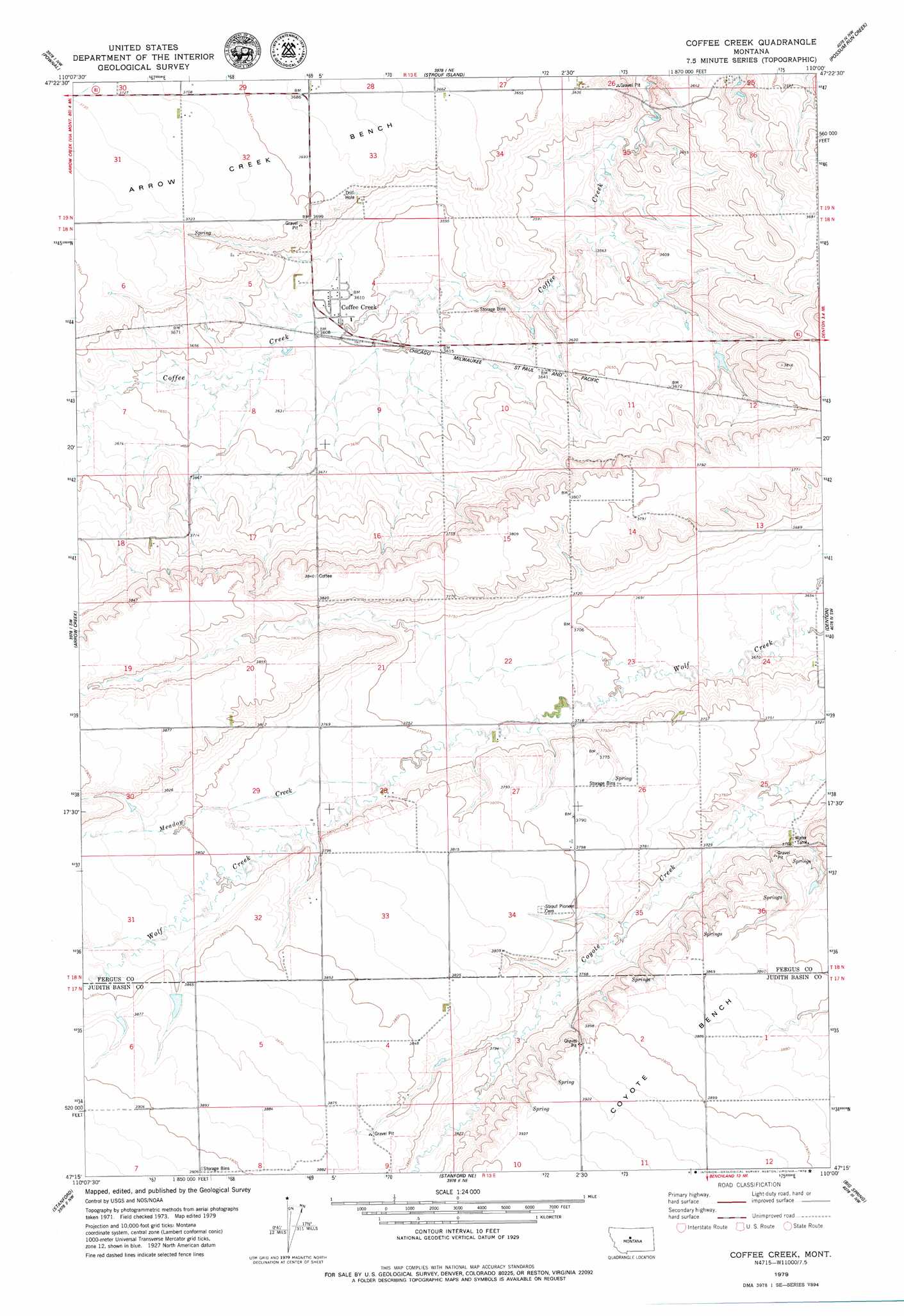
USGS Topo Quad 47110c1 - 1:24,000 scale
| Topo Map Name: | Coffee Creek |
| USGS Topo Quad ID: | 47110c1 |
| Print Size: | ca. 21 1/4" wide x 27" high |
| Southeast Coordinates: | 47.25° N latitude / 110° W longitude |
| Map Center Coordinates: | 47.3125° N latitude / 110.0625° W longitude |
| U.S. State: | MT |
| Filename: | o47110c1.jpg |
| Download Map JPG Image: | Coffee Creek topo map 1:24,000 scale |
| Map Type: | Topographic |
| Topo Series: | 7.5´ |
| Map Scale: | 1:24,000 |
| Source of Map Images: | United States Geological Survey (USGS) |
| Alternate Map Versions: |
Coffee Creek MT 1979, updated 1979 Download PDF Buy paper map Coffee Creek MT 2011 Download PDF Buy paper map Coffee Creek MT 2014 Download PDF Buy paper map |
1:24,000 Topo Quads surrounding Coffee Creek
Geraldine |
Square Butte |
Square Butte Se |
Steele Lake Coulee |
Spring Coulee |
Jiggs Flat |
Pownal |
Strouf Island |
Possum Run Creek |
Soda Spring Coulee |
Leiberg Coulee |
Arrow Creek |
Coffee Creek |
Denton |
Hoosac |
Merino |
Stanford |
Stanford Ne |
Big Spring |
Harwood Bench |
Cayuse Basin |
Windham |
Benchland |
Moccasin |
Kolin |
> Back to 47110a1 at 1:100,000 scale
> Back to 47110a1 at 1:250,000 scale
> Back to U.S. Topo Maps home
Coffee Creek topo map: Gazetteer
Coffee Creek: Dams
Missouri Wolf Dam elevation 1179m 3868′Coffee Creek: Populated Places
Coffee Creek elevation 1100m 3608′Coffee Creek: Post Offices
Coffee Creek Post Office elevation 1100m 3608′Coffee Creek: Springs
18N13E05BAD_01 Spring elevation 1129m 3704′18N13E36AAA_01 Spring elevation 1147m 3763′
Coffee Creek: Streams
Meadow Creek elevation 1147m 3763′Coffee Creek: Wells
17N13E06AA__01 Well elevation 1181m 3874′18N13E05BDA_01 Well elevation 1133m 3717′
Coffee Creek digital topo map on disk
Buy this Coffee Creek topo map showing relief, roads, GPS coordinates and other geographical features, as a high-resolution digital map file on DVD: