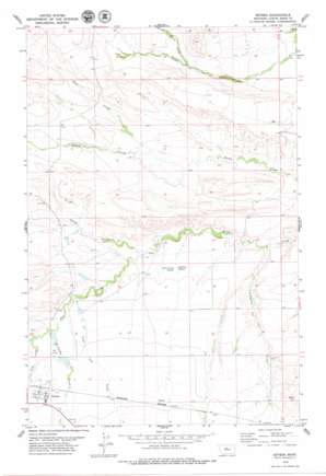
Geyser Topo Map Montana
To zoom in, hover over the map of Geyser
USGS Topo Quad 47110c4 - 1:24,000 scale
| Topo Map Name: | Geyser |
| USGS Topo Quad ID: | 47110c4 |
| Print Size: | ca. 21 1/4" wide x 27" high |
| Southeast Coordinates: | 47.25° N latitude / 110.375° W longitude |
| Map Center Coordinates: | 47.3125° N latitude / 110.4375° W longitude |
| U.S. State: | MT |
| Filename: | o47110c4.jpg |
| Download Map JPG Image: | Geyser topo map 1:24,000 scale |
| Map Type: | Topographic |
| Topo Series: | 7.5´ |
| Map Scale: | 1:24,000 |
| Source of Map Images: | United States Geological Survey (USGS) |
| Alternate Map Versions: |
Geyser MT 1979, updated 1979 Download PDF Buy paper map Geyser MT 2011 Download PDF Buy paper map Geyser MT 2014 Download PDF Buy paper map |
1:24,000 Topo Quads surrounding Geyser
> Back to 47110a1 at 1:100,000 scale
> Back to 47110a1 at 1:250,000 scale
> Back to U.S. Topo Maps home
Geyser topo map: Gazetteer
Geyser: Dams
Dordrecht Dam elevation 1248m 4094′Doukhobors Dam elevation 1237m 4058′
Draco Dam elevation 1244m 4081′
Dramamine Dam elevation 1230m 4035′
Geyser: Populated Places
Geyser elevation 1276m 4186′Geyser: Post Offices
Geyser Post Office elevation 1276m 4186′Geyser: Springs
17N10E01AB__01 Spring elevation 1245m 4084′17N10E01AB__02 Spring elevation 1245m 4084′
17N10E01BA__01 Spring elevation 1250m 4101′
17N10E02BD__01 Spring elevation 1251m 4104′
17N10E03AC__01 Spring elevation 1262m 4140′
17N10E03CD__01 Spring elevation 1272m 4173′
17N10E03DC__01 Spring elevation 1272m 4173′
17N10E04DD__01 Spring elevation 1275m 4183′
17N10E08BA__01 Spring elevation 1265m 4150′
17N10E09AB__01 Spring elevation 1280m 4199′
17N10E12BA__01 Spring elevation 1271m 4169′
18N10E01BD__02 Spring elevation 1270m 4166′
18N10E01BD__03 Spring elevation 1270m 4166′
18N10E01DD__02 Spring elevation 1257m 4124′
18N10E05BB__01 Spring elevation 1302m 4271′
18N10E06AC__01 Spring elevation 1316m 4317′
18N10E07DD__02 Spring elevation 1275m 4183′
18N10E18AD__01 Spring elevation 1268m 4160′
18N10E22CD__01 Spring elevation 1210m 3969′
18N10E22DA__01 Spring elevation 1201m 3940′
18N10E23DA__01 Spring elevation 1192m 3910′
18N10E24CB__01 Spring elevation 1183m 3881′
18N10E25BA__01 Spring elevation 1203m 3946′
18N10E28AD__01 Spring elevation 1221m 4005′
18N10E34CC__01 Spring elevation 1255m 4117′
18N10E35DD__01 Spring elevation 1254m 4114′
19N10E32CB__01 Spring elevation 1322m 4337′
19N10E32CD__01 Spring elevation 1302m 4271′
19N10E33BD__01 Spring elevation 1304m 4278′
19N11E31BD__01 Spring elevation 1181m 3874′
Arrow Creek Spring elevation 1214m 3982′
Big Flat Spring elevation 1214m 3982′
Geyser: Streams
Dipping Vat Creek elevation 1163m 3815′Hay Creek elevation 1195m 3920′
Lone Tree Creek elevation 1219m 3999′
Martin Creek elevation 1254m 4114′
McCarthy Creek elevation 1232m 4041′
Rose Creek elevation 1212m 3976′
Geyser: Valleys
Crow Coulee elevation 1239m 4064′Geyser: Wells
17N10E01DD__01 Well elevation 1257m 4124′17N10E02CC__01 Well elevation 1271m 4169′
17N10E03BA__01 Well elevation 1257m 4124′
17N10E04DC__01 Well elevation 1275m 4183′
17N10E05BC__01 Well elevation 1261m 4137′
17N10E05CCD_01 Well elevation 1269m 4163′
17N10E05CD__01 Well elevation 1262m 4140′
17N10E05CD__02 Well elevation 1262m 4140′
17N10E05CD__03 Well elevation 1262m 4140′
17N10E05DCDB01 Well elevation 1272m 4173′
17N10E05DD__01 Well elevation 1270m 4166′
17N10E06AC__01 Well elevation 1250m 4101′
17N10E06AC__02 Well elevation 1250m 4101′
17N10E06DD__01 Well elevation 1275m 4183′
17N10E31DA__01 Well elevation 1293m 4242′
18N10E01BC__01 Well elevation 1275m 4183′
18N10E01BD__01 Well elevation 1270m 4166′
18N10E01DD__01 Well elevation 1255m 4117′
18N10E02BD__02 Well elevation 1293m 4242′
18N10E13CA__01 Well elevation 1199m 3933′
18N10E13CA__02 Well elevation 1199m 3933′
18N10E29CDDC01 Well elevation 1227m 4025′
18N10E32B___01 Well elevation 1228m 4028′
18N10E32B___02 Well elevation 1228m 4028′
18N10E32CC__01 Well elevation 1243m 4078′
18N10E32CCCA01 Well elevation 1243m 4078′
18N10E32D___01 Well elevation 1249m 4097′
18N10E35CD__01 Well elevation 1249m 4097′
18N10E35CDCD01 Well elevation 1249m 4097′
18N11E30CC__01 Well elevation 1231m 4038′
18N11E31CB__01 Well elevation 1254m 4114′
18N11E31CB__02 Well elevation 1254m 4114′
19N10E35AD__01 Well elevation 1244m 4081′
Geyser digital topo map on disk
Buy this Geyser topo map showing relief, roads, GPS coordinates and other geographical features, as a high-resolution digital map file on DVD:


