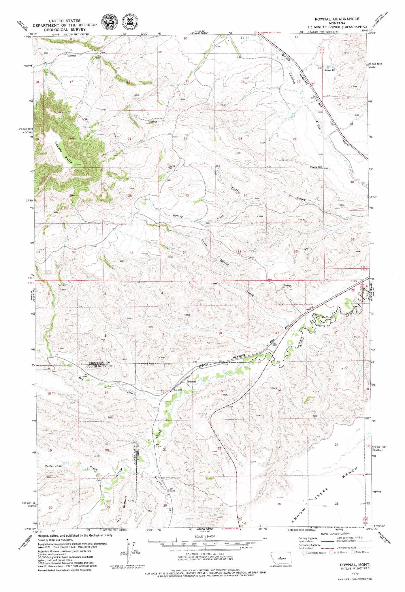
Pownal Topo Map Montana
To zoom in, hover over the map of Pownal
USGS Topo Quad 47110d2 - 1:24,000 scale
| Topo Map Name: | Pownal |
| USGS Topo Quad ID: | 47110d2 |
| Print Size: | ca. 21 1/4" wide x 27" high |
| Southeast Coordinates: | 47.375° N latitude / 110.125° W longitude |
| Map Center Coordinates: | 47.4375° N latitude / 110.1875° W longitude |
| U.S. State: | MT |
| Filename: | o47110d2.jpg |
| Download Map JPG Image: | Pownal topo map 1:24,000 scale |
| Map Type: | Topographic |
| Topo Series: | 7.5´ |
| Map Scale: | 1:24,000 |
| Source of Map Images: | United States Geological Survey (USGS) |
| Alternate Map Versions: |
Pownal MT 1979, updated 1979 Download PDF Buy paper map Pownal MT 2011 Download PDF Buy paper map Pownal MT 2014 Download PDF Buy paper map |
1:24,000 Topo Quads surrounding Pownal
Montague |
Geraldine Ne |
Dammel Reservoir |
Square Butte Ne |
Last Chance Bench |
Lepleys Creek |
Geraldine |
Square Butte |
Square Butte Se |
Steele Lake Coulee |
Palisade Butte |
Jiggs Flat |
Pownal |
Strouf Island |
Possum Run Creek |
Geyser |
Leiberg Coulee |
Arrow Creek |
Coffee Creek |
Denton |
Wolf Butte Nw |
Merino |
Stanford |
Stanford Ne |
Big Spring |
> Back to 47110a1 at 1:100,000 scale
> Back to 47110a1 at 1:250,000 scale
> Back to U.S. Topo Maps home
Pownal topo map: Gazetteer
Pownal: Populated Places
Pownal elevation 958m 3143′Pownal: Streams
Cottonwood Creek elevation 973m 3192′Davis Creek elevation 984m 3228′
Little Battle Creek elevation 927m 3041′
Spring Creek elevation 1038m 3405′
Surprise Creek elevation 961m 3152′
Pownal: Summits
Square Butte elevation 1747m 5731′Pownal: Valleys
Ole Coulee elevation 951m 3120′Pownal: Wells
19N12E14DBA_01 Well elevation 960m 3149′19N12E28DCD_01 Well elevation 1000m 3280′
20N12E10CCCA01 Well elevation 994m 3261′
20N12E13BCDB01 Well elevation 955m 3133′
20N12E14BBD_01 Well elevation 960m 3149′
20N12E24CCC_01 Well elevation 937m 3074′
20N12E24DDD_01 Well elevation 938m 3077′
20N13E18CDCB01 Well elevation 1002m 3287′
Pownal digital topo map on disk
Buy this Pownal topo map showing relief, roads, GPS coordinates and other geographical features, as a high-resolution digital map file on DVD: