Shonkin Topo Map Montana
To zoom in, hover over the map of Shonkin
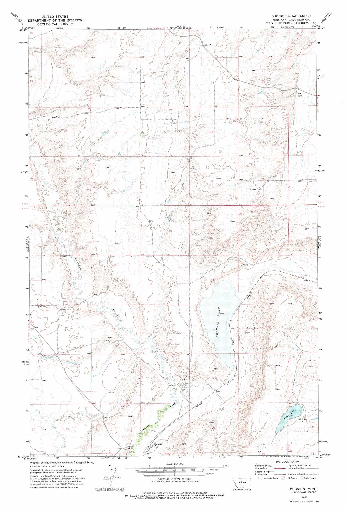
USGS Topo Quad 47110f5 - 1:24,000 scale
| Topo Map Name: | Shonkin |
| USGS Topo Quad ID: | 47110f5 |
| Print Size: | ca. 21 1/4" wide x 27" high |
| Southeast Coordinates: | 47.625° N latitude / 110.5° W longitude |
| Map Center Coordinates: | 47.6875° N latitude / 110.5625° W longitude |
| U.S. State: | MT |
| Filename: | o47110f5.jpg |
| Download Map JPG Image: | Shonkin topo map 1:24,000 scale |
| Map Type: | Topographic |
| Topo Series: | 7.5´ |
| Map Scale: | 1:24,000 |
| Source of Map Images: | United States Geological Survey (USGS) |
| Alternate Map Versions: |
Shonkin MT 1972, updated 1976 Download PDF Buy paper map Shonkin MT 2011 Download PDF Buy paper map Shonkin MT 2014 Download PDF Buy paper map |
1:24,000 Topo Quads surrounding Shonkin
Carter Ne |
Fort Benton Nw |
Loma West |
Loma East |
Stranahan |
Tunis |
Fort Benton |
O'Hanlon Coulee |
Rocky Lake |
Stranahan Se |
Rice Reservoir |
Shonkin Nw |
Shonkin |
Montague |
Geraldine Ne |
Highwood |
Big Sag |
Carter Mountain |
Lepleys Creek |
Geraldine |
Belt Ne |
Highwood Baldy |
Arrow Peak |
Palisade Butte |
Jiggs Flat |
> Back to 47110e1 at 1:100,000 scale
> Back to 47110a1 at 1:250,000 scale
> Back to U.S. Topo Maps home
Shonkin topo map: Gazetteer
Shonkin: Lakes
Sand Lake elevation 1095m 3592′Shonkin Lake elevation 961m 3152′
Shonkin: Populated Places
Patterson (historical) elevation 948m 3110′Shonkin elevation 968m 3175′
Shonkin: Post Offices
Shonkin Post Office (historical) elevation 968m 3175′Shonkin digital topo map on disk
Buy this Shonkin topo map showing relief, roads, GPS coordinates and other geographical features, as a high-resolution digital map file on DVD: