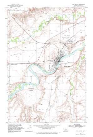
Fort Benton Topo Map Montana
To zoom in, hover over the map of Fort Benton
USGS Topo Quad 47110g6 - 1:24,000 scale
| Topo Map Name: | Fort Benton |
| USGS Topo Quad ID: | 47110g6 |
| Print Size: | ca. 21 1/4" wide x 27" high |
| Southeast Coordinates: | 47.75° N latitude / 110.625° W longitude |
| Map Center Coordinates: | 47.8125° N latitude / 110.6875° W longitude |
| U.S. State: | MT |
| Filename: | o47110g6.jpg |
| Download Map JPG Image: | Fort Benton topo map 1:24,000 scale |
| Map Type: | Topographic |
| Topo Series: | 7.5´ |
| Map Scale: | 1:24,000 |
| Source of Map Images: | United States Geological Survey (USGS) |
| Alternate Map Versions: |
Fort Benton MT 1954, updated 1956 Download PDF Buy paper map Fort Benton MT 1954, updated 1977 Download PDF Buy paper map Fort Benton MT 2011 Download PDF Buy paper map Fort Benton MT 2014 Download PDF Buy paper map |
1:24,000 Topo Quads surrounding Fort Benton
> Back to 47110e1 at 1:100,000 scale
> Back to 47110a1 at 1:250,000 scale
> Back to U.S. Topo Maps home
Fort Benton topo map: Gazetteer
Fort Benton: Airports
Fort Benton Airport elevation 877m 2877′Fort Benton: Basins
Cottonwood Bottom elevation 813m 2667′Fort Benton: Bridges
Chouteau County Memorial Bridge elevation 798m 2618′Fort Benton Bridge elevation 798m 2618′
Fort Benton: Dams
Fort Benton Sewage Lagoon Dam elevation 800m 2624′Hankins Number 1 Dam elevation 909m 2982′
Fort Benton: Islands
Roosevelt Island elevation 801m 2627′Fort Benton: Parks
Fort Benton Historical Marker elevation 883m 2896′Lewis and Clark State Memorial elevation 886m 2906′
Shep Memorial elevation 881m 2890′
Whoop-Up Trail Monument elevation 799m 2621′
World War I Memorial elevation 799m 2621′
Fort Benton: Populated Places
Fort Benton elevation 799m 2621′Kershaw elevation 883m 2896′
Fort Benton: Post Offices
Fort Benton Post Office elevation 799m 2621′Fort Benton: Summits
Chinaman Hill elevation 942m 3090′Fort Benton: Valleys
The Canyon elevation 805m 2641′Fort Benton: Wells
23N08E12CACA01 Well elevation 908m 2979′24N08E26BCCA01 Well elevation 803m 2634′
24N08E26BDBA01 Well elevation 801m 2627′
Fort Benton digital topo map on disk
Buy this Fort Benton topo map showing relief, roads, GPS coordinates and other geographical features, as a high-resolution digital map file on DVD:


