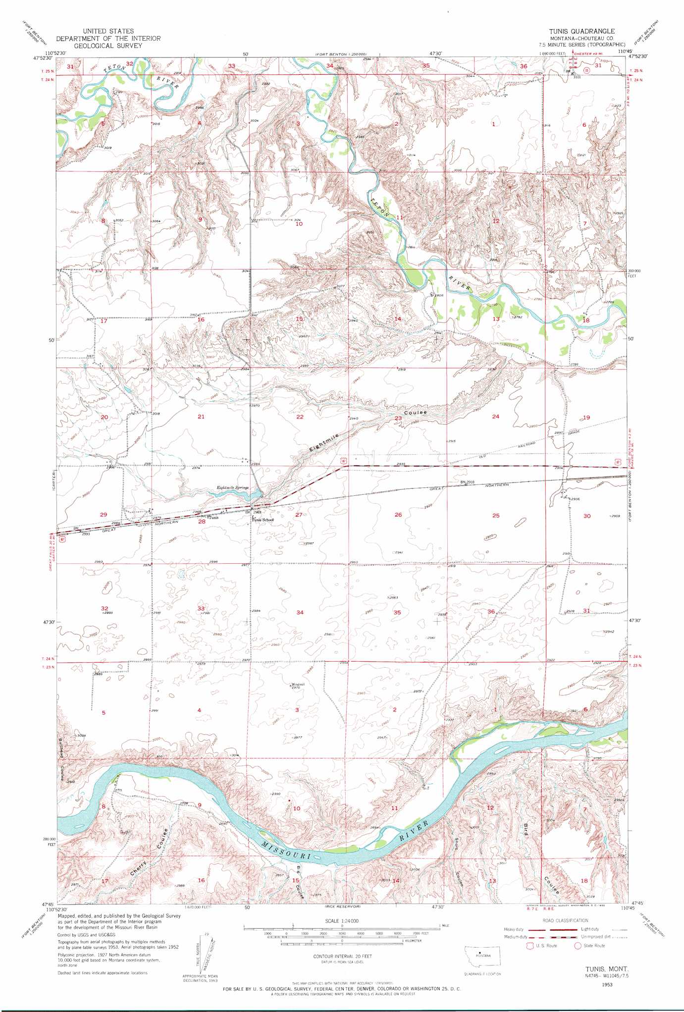
Tunis Topo Map Montana
To zoom in, hover over the map of Tunis
USGS Topo Quad 47110g7 - 1:24,000 scale
| Topo Map Name: | Tunis |
| USGS Topo Quad ID: | 47110g7 |
| Print Size: | ca. 21 1/4" wide x 27" high |
| Southeast Coordinates: | 47.75° N latitude / 110.75° W longitude |
| Map Center Coordinates: | 47.8125° N latitude / 110.8125° W longitude |
| U.S. State: | MT |
| Filename: | o47110g7.jpg |
| Download Map JPG Image: | Tunis topo map 1:24,000 scale |
| Map Type: | Topographic |
| Topo Series: | 7.5´ |
| Map Scale: | 1:24,000 |
| Source of Map Images: | United States Geological Survey (USGS) |
| Alternate Map Versions: |
Tunis MT 1953, updated 1955 Download PDF Buy paper map Tunis MT 2011 Download PDF Buy paper map Tunis MT 2014 Download PDF Buy paper map |
1:24,000 Topo Quads surrounding Tunis
Russell Chapel |
Dorner School |
Goose Bill Butte |
Day School Sw |
Day School |
Dent Bridge Ne |
Apple School |
Carter Ne |
Fort Benton Nw |
Loma West |
Antelope Lake |
Carter |
Tunis |
Fort Benton |
O'Hanlon Coulee |
Floweree |
Lander Crossing |
Rice Reservoir |
Shonkin Nw |
Shonkin |
Morony Dam |
Waltham |
Highwood |
Big Sag |
Carter Mountain |
> Back to 47110e1 at 1:100,000 scale
> Back to 47110a1 at 1:250,000 scale
> Back to U.S. Topo Maps home
Tunis topo map: Gazetteer
Tunis: Dams
Eithtmile Spring Dam elevation 906m 2972′Tunis: Populated Places
Tunis elevation 906m 2972′Tunis: Post Offices
Teton Post Office (historical) elevation 876m 2874′Tunis Post Office (historical) elevation 906m 2972′
Tunis: Reservoirs
Eightmile Springs elevation 892m 2926′Tunis: Valleys
Bird Coulee elevation 815m 2673′Bullhead Coulee elevation 823m 2700′
Cherry Coulee elevation 829m 2719′
Eightmile Coulee elevation 854m 2801′
Long Coulee elevation 814m 2670′
Short Coulee elevation 821m 2693′
Tunis digital topo map on disk
Buy this Tunis topo map showing relief, roads, GPS coordinates and other geographical features, as a high-resolution digital map file on DVD: