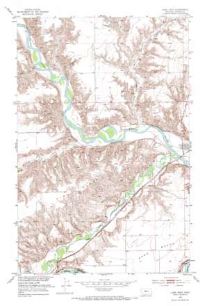
Loma West Topo Map Montana
To zoom in, hover over the map of Loma West
USGS Topo Quad 47110h5 - 1:24,000 scale
| Topo Map Name: | Loma West |
| USGS Topo Quad ID: | 47110h5 |
| Print Size: | ca. 21 1/4" wide x 27" high |
| Southeast Coordinates: | 47.875° N latitude / 110.5° W longitude |
| Map Center Coordinates: | 47.9375° N latitude / 110.5625° W longitude |
| U.S. State: | MT |
| Filename: | o47110h5.jpg |
| Download Map JPG Image: | Loma West topo map 1:24,000 scale |
| Map Type: | Topographic |
| Topo Series: | 7.5´ |
| Map Scale: | 1:24,000 |
| Source of Map Images: | United States Geological Survey (USGS) |
| Alternate Map Versions: |
Loma West MT 1953, updated 1955 Download PDF Buy paper map Loma West MT 1953, updated 1973 Download PDF Buy paper map Loma West MT 2011 Download PDF Buy paper map Loma West MT 2014 Download PDF Buy paper map |
1:24,000 Topo Quads surrounding Loma West
> Back to 47110e1 at 1:100,000 scale
> Back to 47110a1 at 1:250,000 scale
> Back to U.S. Topo Maps home
Loma West topo map: Gazetteer
Loma West: Benches
Rowe Bench elevation 854m 2801′Loma West: Bridges
Loma Bridge elevation 781m 2562′Loma West: Islands
Brule Bar elevation 783m 2568′Loma West: Parks
Marias River Historical Marker elevation 787m 2582′Loma West: Populated Places
Loma elevation 785m 2575′Loma West: Post Offices
Loma Post Office elevation 785m 2575′Teton Post Office (historical) elevation 803m 2634′
Loma West: Ridges
Vimy Ridge elevation 929m 3047′Loma West: Streams
Chip Creek elevation 784m 2572′Teton River elevation 781m 2562′
Loma West: Valleys
Dry Fork Coulee elevation 787m 2582′Dry Fork Coulee elevation 811m 2660′
Fisher Coulee elevation 793m 2601′
Loma West: Wells
25N09E09DBAD01 Well elevation 809m 2654′Loma West digital topo map on disk
Buy this Loma West topo map showing relief, roads, GPS coordinates and other geographical features, as a high-resolution digital map file on DVD:


