Antelope Flat Topo Map Montana
To zoom in, hover over the map of Antelope Flat
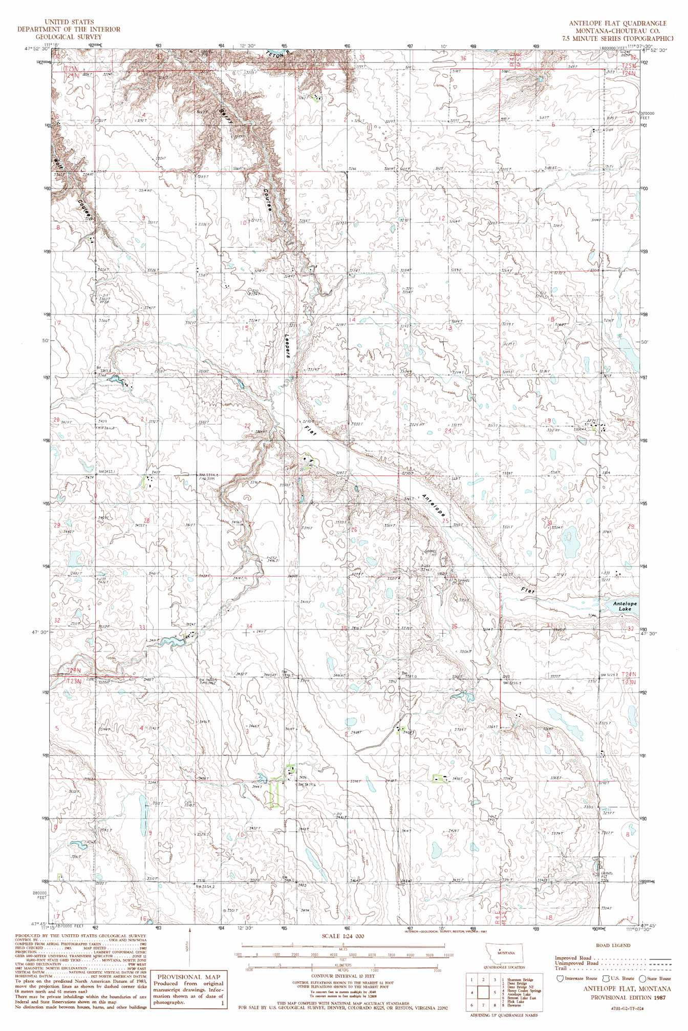
USGS Topo Quad 47111g2 - 1:24,000 scale
| Topo Map Name: | Antelope Flat |
| USGS Topo Quad ID: | 47111g2 |
| Print Size: | ca. 21 1/4" wide x 27" high |
| Southeast Coordinates: | 47.75° N latitude / 111.125° W longitude |
| Map Center Coordinates: | 47.8125° N latitude / 111.1875° W longitude |
| U.S. State: | MT |
| Filename: | o47111g2.jpg |
| Download Map JPG Image: | Antelope Flat topo map 1:24,000 scale |
| Map Type: | Topographic |
| Topo Series: | 7.5´ |
| Map Scale: | 1:24,000 |
| Source of Map Images: | United States Geological Survey (USGS) |
| Alternate Map Versions: |
Antelope Flat MT 1987, updated 1987 Download PDF Buy paper map Antelope Flat MT 2011 Download PDF Buy paper map Antelope Flat MT 2014 Download PDF Buy paper map |
1:24,000 Topo Quads surrounding Antelope Flat
Faris School |
Knees |
Mcbridy Spring |
Russell Chapel |
Dorner School |
Timber Coulee North |
Shannon Bridge |
Dent Bridge |
Dent Bridge Ne |
Apple School |
Timber Coulee South |
Sheep Coulee Springs |
Antelope Flat |
Antelope Lake |
Carter |
Benton Lake West |
Benton Lake East |
Flick Lake |
Floweree |
Lander Crossing |
Manchester |
Northwest Great Falls |
Northeast Great Falls |
Morony Dam |
Waltham |
> Back to 47111e1 at 1:100,000 scale
> Back to 47110a1 at 1:250,000 scale
> Back to U.S. Topo Maps home
Antelope Flat topo map: Gazetteer
Antelope Flat: Dams
Leepin' Antelope Dam elevation 996m 3267′Antelope Flat: Flats
Antelope Flat elevation 995m 3264′Leepers Flat elevation 1002m 3287′
Antelope Flat digital topo map on disk
Buy this Antelope Flat topo map showing relief, roads, GPS coordinates and other geographical features, as a high-resolution digital map file on DVD: