Dutton Topo Map Montana
To zoom in, hover over the map of Dutton
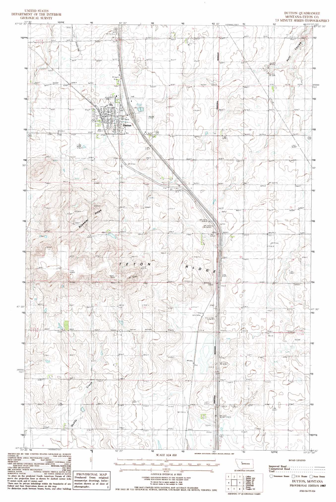
USGS Topo Quad 47111g6 - 1:24,000 scale
| Topo Map Name: | Dutton |
| USGS Topo Quad ID: | 47111g6 |
| Print Size: | ca. 21 1/4" wide x 27" high |
| Southeast Coordinates: | 47.75° N latitude / 111.625° W longitude |
| Map Center Coordinates: | 47.8125° N latitude / 111.6875° W longitude |
| U.S. State: | MT |
| Filename: | o47111g6.jpg |
| Download Map JPG Image: | Dutton topo map 1:24,000 scale |
| Map Type: | Topographic |
| Topo Series: | 7.5´ |
| Map Scale: | 1:24,000 |
| Source of Map Images: | United States Geological Survey (USGS) |
| Alternate Map Versions: |
Dutton MT 1987, updated 1987 Download PDF Buy paper map Dutton MT 2011 Download PDF Buy paper map Dutton MT 2014 Download PDF Buy paper map |
1:24,000 Topo Quads surrounding Dutton
Conrad Sw |
Brady |
Fowler Coulee Sw |
Fowler Coulee Se |
Faris School |
Collins Nw |
Collins |
Dutton Nw |
Dutton Ne |
Timber Coulee North |
T L Gap |
Collins Se |
Dutton |
Dutton Se |
Timber Coulee South |
Cleiv |
Greenfield |
Power |
Vaughn Ne |
Benton Lake West |
Fairfield |
Fort Shaw |
Sun River |
Vaughn |
Manchester |
> Back to 47111e1 at 1:100,000 scale
> Back to 47110a1 at 1:250,000 scale
> Back to U.S. Topo Maps home
Dutton topo map: Gazetteer
Dutton: Airports
Dutton Airport elevation 1124m 3687′Dutton: Crossings
Interchange 313 elevation 1126m 3694′Dutton: Dams
Robbie Dam elevation 1134m 3720′Thav Dam elevation 1153m 3782′
Dutton: Populated Places
Dutton elevation 1136m 3727′Dutton: Post Offices
Dutton Post Office elevation 1130m 3707′Dutton: Ridges
Teton Ridge elevation 1243m 4078′Dutton: Summits
Bosseler Ridge elevation 1223m 4012′Dutton: Wells
23N01W03AAC_01 Well elevation 1172m 3845′Dutton digital topo map on disk
Buy this Dutton topo map showing relief, roads, GPS coordinates and other geographical features, as a high-resolution digital map file on DVD: