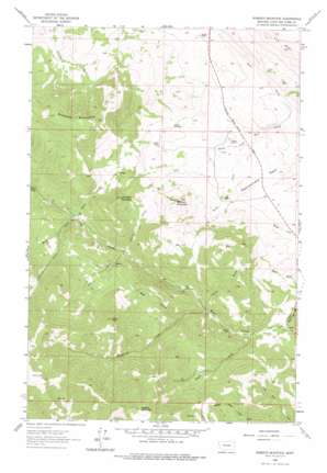
Roberts Mountain Topo Map Montana
To zoom in, hover over the map of Roberts Mountain
USGS Topo Quad 47112a2 - 1:24,000 scale
| Topo Map Name: | Roberts Mountain |
| USGS Topo Quad ID: | 47112a2 |
| Print Size: | ca. 21 1/4" wide x 27" high |
| Southeast Coordinates: | 47° N latitude / 112.125° W longitude |
| Map Center Coordinates: | 47.0625° N latitude / 112.1875° W longitude |
| U.S. State: | MT |
| Filename: | o47112a2.jpg |
| Download Map JPG Image: | Roberts Mountain topo map 1:24,000 scale |
| Map Type: | Topographic |
| Topo Series: | 7.5´ |
| Map Scale: | 1:24,000 |
| Source of Map Images: | United States Geological Survey (USGS) |
| Alternate Map Versions: |
Roberts Mountain MT 1961, updated 1964 Download PDF Buy paper map Roberts Mountain MT 1961, updated 1975 Download PDF Buy paper map Roberts Mountain MT 2011 Download PDF Buy paper map Roberts Mountain MT 2014 Download PDF Buy paper map |
1:24,000 Topo Quads surrounding Roberts Mountain
> Back to 47112a1 at 1:100,000 scale
> Back to 47112a1 at 1:250,000 scale
> Back to U.S. Topo Maps home
Roberts Mountain topo map: Gazetteer
Roberts Mountain: Mines
Rosetta Mine elevation 1191m 3907′Rosetta Mine elevation 1202m 3943′
Roberts Mountain: Ridges
Rattlesnake Reef elevation 1310m 4297′Roberts Mountain: Streams
Carter Creek elevation 1192m 3910′French Creek elevation 1278m 4192′
Gladstone Creek elevation 1207m 3959′
Greenpole Creek elevation 1339m 4393′
Rogers Creek elevation 1171m 3841′
Wells Fork Rock Creek elevation 1232m 4041′
Willis Creek elevation 1272m 4173′
Woods Creek elevation 1316m 4317′
Roberts Mountain: Summits
Butcher Mountain elevation 1635m 5364′Lannigan Mountain elevation 1644m 5393′
Roberts Mountain elevation 1954m 6410′
Rogers Mountain elevation 2111m 6925′
Toms Peak elevation 1829m 6000′
Wolf Creek Hill elevation 1184m 3884′
Roberts Mountain: Valleys
Allen Gulch elevation 1320m 4330′Bear Gulch elevation 1232m 4041′
Denton Gulch elevation 1367m 4484′
Foster Gulch elevation 1221m 4005′
Lannigan Gulch elevation 1279m 4196′
Roberts Mountain digital topo map on disk
Buy this Roberts Mountain topo map showing relief, roads, GPS coordinates and other geographical features, as a high-resolution digital map file on DVD:


