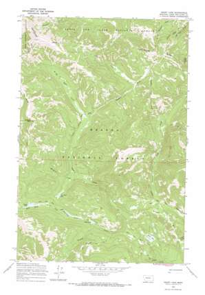
Heart Lake Topo Map Montana
To zoom in, hover over the map of Heart Lake
USGS Topo Quad 47112b6 - 1:24,000 scale
| Topo Map Name: | Heart Lake |
| USGS Topo Quad ID: | 47112b6 |
| Print Size: | ca. 21 1/4" wide x 27" high |
| Southeast Coordinates: | 47.125° N latitude / 112.625° W longitude |
| Map Center Coordinates: | 47.1875° N latitude / 112.6875° W longitude |
| U.S. State: | MT |
| Filename: | o47112b6.jpg |
| Download Map JPG Image: | Heart Lake topo map 1:24,000 scale |
| Map Type: | Topographic |
| Topo Series: | 7.5´ |
| Map Scale: | 1:24,000 |
| Source of Map Images: | United States Geological Survey (USGS) |
| Alternate Map Versions: |
Heart Lake MT 1968, updated 1971 Download PDF Buy paper map Heart Lake MT 2001, updated 2004 Download PDF Buy paper map Heart Lake MT 2011 Download PDF Buy paper map Heart Lake MT 2014 Download PDF Buy paper map |
| FStopo: | US Forest Service topo Heart Lake is available: Download FStopo PDF Download FStopo TIF |
1:24,000 Topo Quads surrounding Heart Lake
> Back to 47112a1 at 1:100,000 scale
> Back to 47112a1 at 1:250,000 scale
> Back to U.S. Topo Maps home
Heart Lake topo map: Gazetteer
Heart Lake: Lakes
Heart Lake elevation 1961m 6433′Parker Lake elevation 1826m 5990′
Two Point Lake elevation 1886m 6187′
Webb Lake elevation 1861m 6105′
Heart Lake: Ridges
Red Ridge elevation 2458m 8064′Heart Lake: Streams
Bighorn Creek elevation 1754m 5754′Crow Creek elevation 1970m 6463′
Lake Fork Bighorn Creek elevation 1896m 6220′
Lookout Creek elevation 1734m 5688′
Maryann Creek elevation 1866m 6122′
Middle Fork Creek elevation 1910m 6266′
Ringeye Creek elevation 1779m 5836′
Heart Lake: Summits
Pyramid Peak elevation 2647m 8684′Heart Lake: Trails
Blacktail Creek Trail elevation 1962m 6437′Landers Fork Trail elevation 1827m 5994′
Main Line Trail elevation 1848m 6062′
Red Mountain Trail elevation 2390m 7841′
Upper Landers Trail elevation 1932m 6338′
Heart Lake digital topo map on disk
Buy this Heart Lake topo map showing relief, roads, GPS coordinates and other geographical features, as a high-resolution digital map file on DVD:


