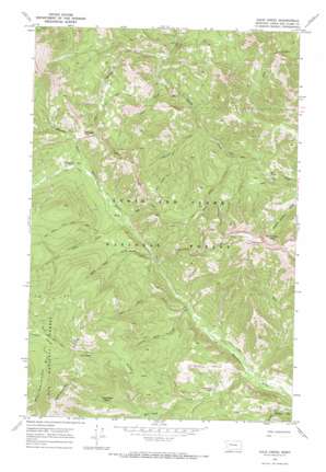
Jakie Creek Topo Map Montana
To zoom in, hover over the map of Jakie Creek
USGS Topo Quad 47112c6 - 1:24,000 scale
| Topo Map Name: | Jakie Creek |
| USGS Topo Quad ID: | 47112c6 |
| Print Size: | ca. 21 1/4" wide x 27" high |
| Southeast Coordinates: | 47.25° N latitude / 112.625° W longitude |
| Map Center Coordinates: | 47.3125° N latitude / 112.6875° W longitude |
| U.S. State: | MT |
| Filename: | o47112c6.jpg |
| Download Map JPG Image: | Jakie Creek topo map 1:24,000 scale |
| Map Type: | Topographic |
| Topo Series: | 7.5´ |
| Map Scale: | 1:24,000 |
| Source of Map Images: | United States Geological Survey (USGS) |
| Alternate Map Versions: |
Jakie Creek MT 1970, updated 1973 Download PDF Buy paper map Jakie Creek MT 1995, updated 1997 Download PDF Buy paper map Jakie Creek MT 2011 Download PDF Buy paper map Jakie Creek MT 2014 Download PDF Buy paper map |
| FStopo: | US Forest Service topo Jakie Creek is available: Download FStopo PDF Download FStopo TIF |
1:24,000 Topo Quads surrounding Jakie Creek
> Back to 47112a1 at 1:100,000 scale
> Back to 47112a1 at 1:250,000 scale
> Back to U.S. Topo Maps home
Jakie Creek topo map: Gazetteer
Jakie Creek: Basins
Bunch Grass Basin elevation 2124m 6968′Carmichael Basin elevation 1931m 6335′
Jakie Creek: Gaps
Elk Pass elevation 1830m 6003′Welcome Pass elevation 1871m 6138′
Jakie Creek: Lakes
Twin Lakes elevation 2058m 6751′Jakie Creek: Streams
Bald Bear Creek elevation 1709m 5606′Jakie Creek elevation 1573m 5160′
Lookout Creek elevation 1707m 5600′
Lost Cabin Creek elevation 1743m 5718′
Lower Twin Creek elevation 1699m 5574′
Moudess Creek elevation 1531m 5022′
Pass Creek elevation 1743m 5718′
Pear Creek elevation 1621m 5318′
Sixmile Creek elevation 1716m 5629′
Star Creek elevation 1705m 5593′
Twin Creek elevation 1670m 5479′
Upper Twin Creek elevation 1699m 5574′
Weasel Creek elevation 1642m 5387′
Welcome Creek elevation 1791m 5875′
Whitetail Creek elevation 1623m 5324′
Jakie Creek: Summits
Grassy Hills elevation 2015m 6610′Jakie Creek: Trails
Elk Pass Trail elevation 2012m 6601′Jakie Creek Trail elevation 1794m 5885′
Smith Creek Trail elevation 1711m 5613′
Steamboat Lookout Pass elevation 2294m 7526′
Weasel Creek Trail elevation 1959m 6427′
Whitetail Creek Trail elevation 1937m 6354′
Jakie Creek digital topo map on disk
Buy this Jakie Creek topo map showing relief, roads, GPS coordinates and other geographical features, as a high-resolution digital map file on DVD:


