Gouchnour Ranch Topo Map Montana
To zoom in, hover over the map of Gouchnour Ranch
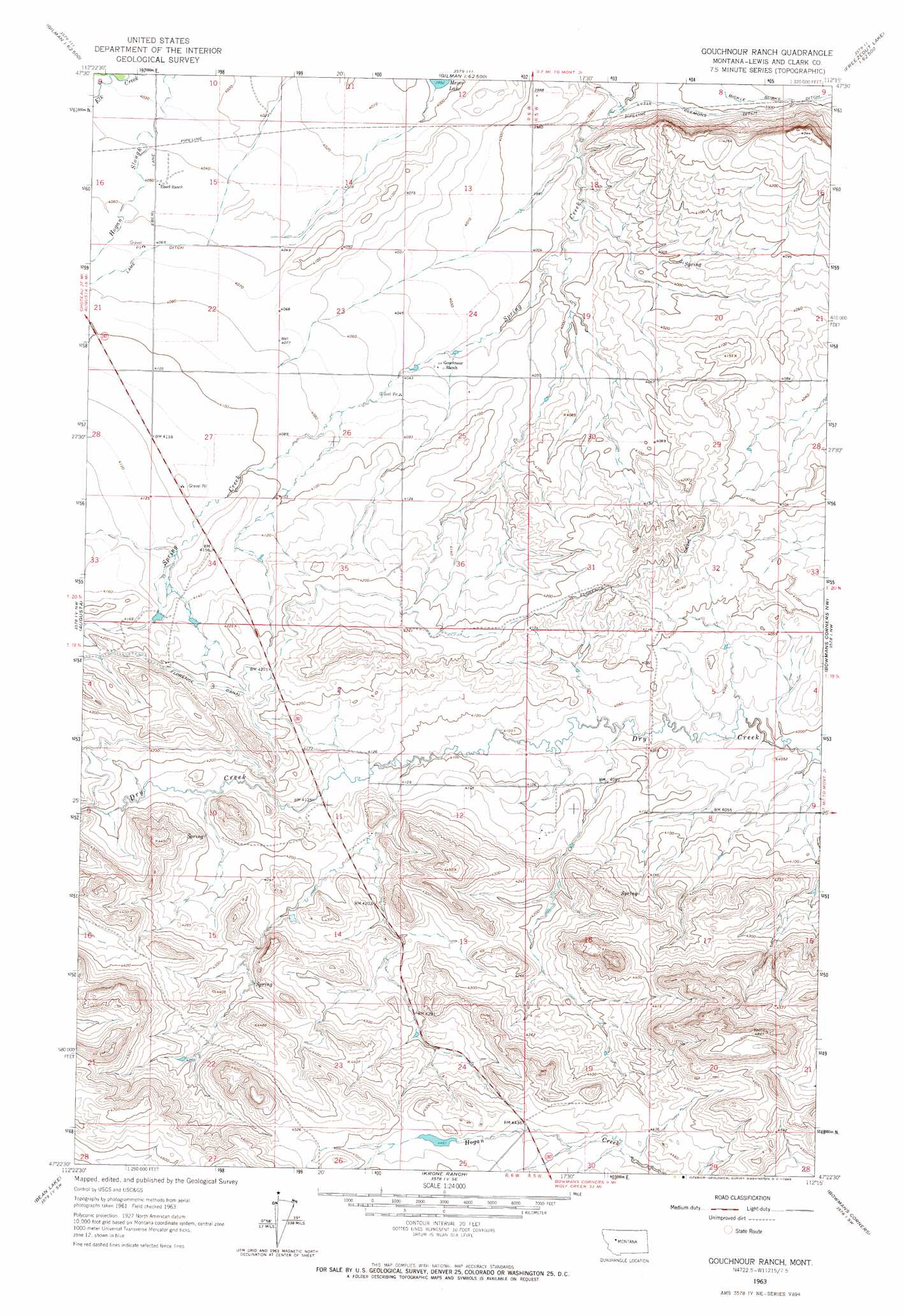
USGS Topo Quad 47112d3 - 1:24,000 scale
| Topo Map Name: | Gouchnour Ranch |
| USGS Topo Quad ID: | 47112d3 |
| Print Size: | ca. 21 1/4" wide x 27" high |
| Southeast Coordinates: | 47.375° N latitude / 112.25° W longitude |
| Map Center Coordinates: | 47.4375° N latitude / 112.3125° W longitude |
| U.S. State: | MT |
| Filename: | o47112d3.jpg |
| Download Map JPG Image: | Gouchnour Ranch topo map 1:24,000 scale |
| Map Type: | Topographic |
| Topo Series: | 7.5´ |
| Map Scale: | 1:24,000 |
| Source of Map Images: | United States Geological Survey (USGS) |
| Alternate Map Versions: |
Gouchnour Ranch MT 1963, updated 1965 Download PDF Buy paper map Gouchnour Ranch MT 2011 Download PDF Buy paper map Gouchnour Ranch MT 2014 Download PDF Buy paper map |
1:24,000 Topo Quads surrounding Gouchnour Ranch
Split Rock Lake |
Pishkun Reservoir |
Nunemaker Hill |
Sevenmile Hill |
Freezeout Lake |
Barr Creek |
Split Rock Junction |
Gilman |
Golden Ridge |
Lowry |
Nilan Reservoir |
Augusta |
Gouchnour Ranch |
Bowmans Corners Nw |
Bowmans Corners Ne |
Steamboat Mountain |
Bean Lake |
Krone Ranch |
Bowmans Corners |
Henry Creek |
Caribou Peak |
Blowout Mountain |
Johnson Mountain |
Comb Rock |
Coburn Mountain |
> Back to 47112a1 at 1:100,000 scale
> Back to 47112a1 at 1:250,000 scale
> Back to U.S. Topo Maps home
Gouchnour Ranch topo map: Gazetteer
Gouchnour Ranch: Canals
Florence Canal elevation 1286m 4219′Lame Ditch elevation 1239m 4064′
Lytle Clemons Ditch elevation 1192m 3910′
Gouchnour Ranch: Dams
Detergent Dam elevation 1361m 4465′Gouchnour Ranch digital topo map on disk
Buy this Gouchnour Ranch topo map showing relief, roads, GPS coordinates and other geographical features, as a high-resolution digital map file on DVD: