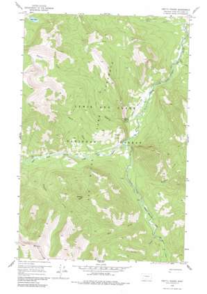
Pretty Prairie Topo Map Montana
To zoom in, hover over the map of Pretty Prairie
USGS Topo Quad 47112e8 - 1:24,000 scale
| Topo Map Name: | Pretty Prairie |
| USGS Topo Quad ID: | 47112e8 |
| Print Size: | ca. 21 1/4" wide x 27" high |
| Southeast Coordinates: | 47.5° N latitude / 112.875° W longitude |
| Map Center Coordinates: | 47.5625° N latitude / 112.9375° W longitude |
| U.S. State: | MT |
| Filename: | o47112e8.jpg |
| Download Map JPG Image: | Pretty Prairie topo map 1:24,000 scale |
| Map Type: | Topographic |
| Topo Series: | 7.5´ |
| Map Scale: | 1:24,000 |
| Source of Map Images: | United States Geological Survey (USGS) |
| Alternate Map Versions: |
Pretty Prairie MT 1958, updated 1960 Download PDF Buy paper map Pretty Prairie MT 1958, updated 1967 Download PDF Buy paper map Pretty Prairie MT 1958, updated 1988 Download PDF Buy paper map Pretty Prairie MT 1995, updated 1997 Download PDF Buy paper map Pretty Prairie MT 2011 Download PDF Buy paper map Pretty Prairie MT 2014 Download PDF Buy paper map |
| FStopo: | US Forest Service topo Pretty Prairie is available: Download FStopo PDF Download FStopo TIF |
1:24,000 Topo Quads surrounding Pretty Prairie
> Back to 47112e1 at 1:100,000 scale
> Back to 47112a1 at 1:250,000 scale
> Back to U.S. Topo Maps home
Pretty Prairie topo map: Gazetteer
Pretty Prairie: Flats
Pretty Prairie elevation 1511m 4957′Pretty Prairie: Lakes
Bear Lake elevation 2094m 6870′Pretty Prairie: Parks
Sun River Game Preserve elevation 1509m 4950′Pretty Prairie: Streams
Bear Creek elevation 1458m 4783′Bighead Creek elevation 1527m 5009′
Burned Creek elevation 1585m 5200′
Deer Creek elevation 1558m 5111′
Goat Creek elevation 1461m 4793′
Nineteen Creek elevation 1554m 5098′
Prairie Creek elevation 1508m 4947′
Straight Creek elevation 1591m 5219′
Wapiti Creek elevation 1540m 5052′
West Fork South Fork Sun River elevation 1521m 4990′
Windfall Creek elevation 1475m 4839′
Pretty Prairie: Summits
Deadman Hill elevation 2236m 7335′Pretty Prairie digital topo map on disk
Buy this Pretty Prairie topo map showing relief, roads, GPS coordinates and other geographical features, as a high-resolution digital map file on DVD:


