Nunemaker Hill Topo Map Montana
To zoom in, hover over the map of Nunemaker Hill
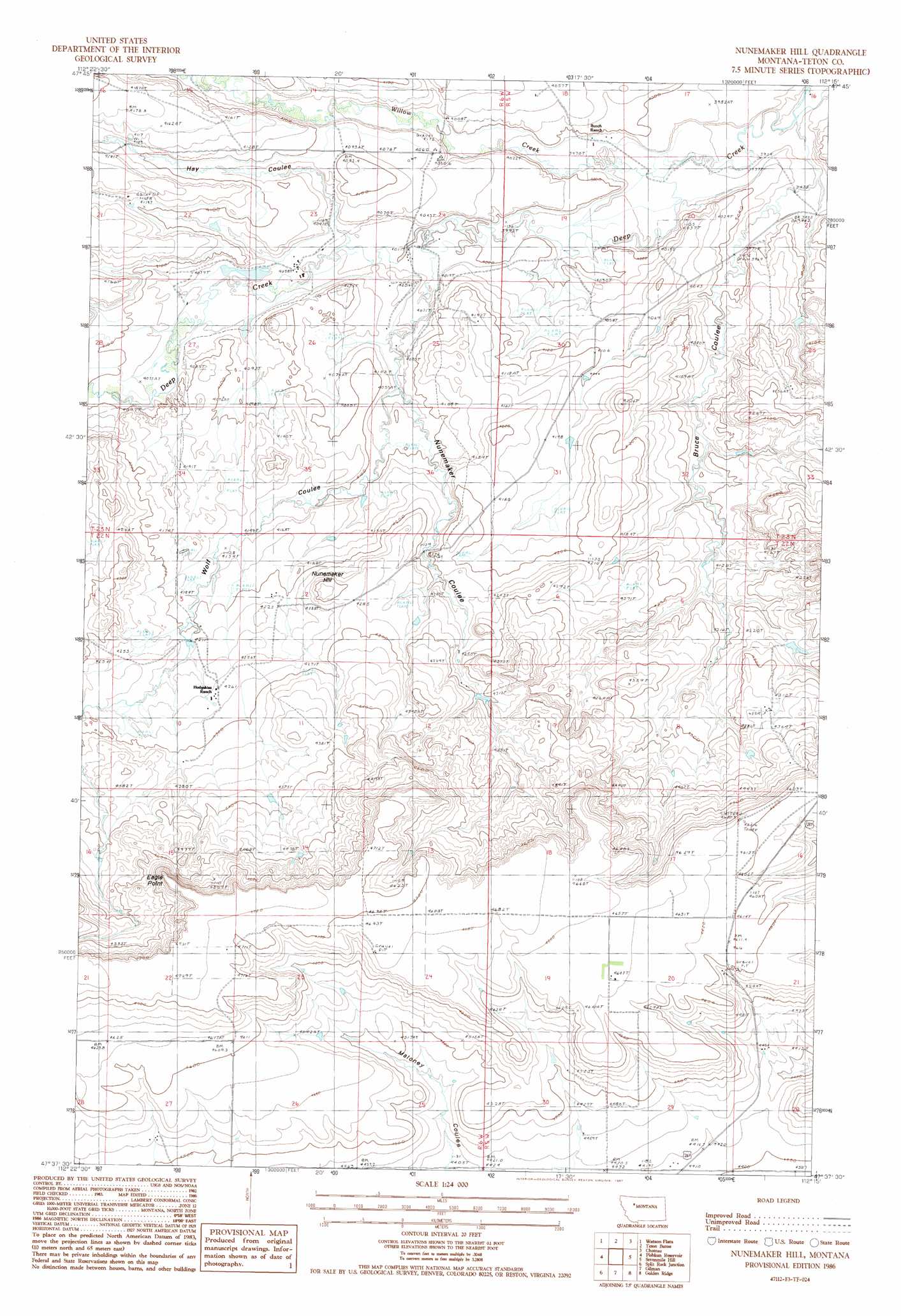
USGS Topo Quad 47112f3 - 1:24,000 scale
| Topo Map Name: | Nunemaker Hill |
| USGS Topo Quad ID: | 47112f3 |
| Print Size: | ca. 21 1/4" wide x 27" high |
| Southeast Coordinates: | 47.625° N latitude / 112.25° W longitude |
| Map Center Coordinates: | 47.6875° N latitude / 112.3125° W longitude |
| U.S. State: | MT |
| Filename: | o47112f3.jpg |
| Download Map JPG Image: | Nunemaker Hill topo map 1:24,000 scale |
| Map Type: | Topographic |
| Topo Series: | 7.5´ |
| Map Scale: | 1:24,000 |
| Source of Map Images: | United States Geological Survey (USGS) |
| Alternate Map Versions: |
Nunemaker Hill MT 1986, updated 1987 Download PDF Buy paper map Nunemaker Hill MT 2011 Download PDF Buy paper map Nunemaker Hill MT 2014 Download PDF Buy paper map |
1:24,000 Topo Quads surrounding Nunemaker Hill
Twin Lakes |
Bynum Reservoir |
Bynum |
Agawam South |
Eyraud Lakes |
Lake Theboe |
Watson Flats |
Teton Buttes |
Choteau |
Choteau Se |
Split Rock Lake |
Pishkun Reservoir |
Nunemaker Hill |
Sevenmile Hill |
Freezeout Lake |
Barr Creek |
Split Rock Junction |
Gilman |
Golden Ridge |
Lowry |
Nilan Reservoir |
Augusta |
Gouchnour Ranch |
Bowmans Corners Nw |
Bowmans Corners Ne |
> Back to 47112e1 at 1:100,000 scale
> Back to 47112a1 at 1:250,000 scale
> Back to U.S. Topo Maps home
Nunemaker Hill topo map: Gazetteer
Nunemaker Hill: Cliffs
Eagle Point elevation 1428m 4685′Nunemaker Hill: Dams
Jonquil Dam elevation 1307m 4288′Nunemaker Hill: Streams
Willow Creek elevation 1203m 3946′Nunemaker Hill: Summits
Nunemaker Hill elevation 1319m 4327′Nunemaker Hill: Valleys
Bruce Coulee elevation 1201m 3940′Hay Coulee elevation 1226m 4022′
Nunemaker Coulee elevation 1235m 4051′
Wolf Coulee elevation 1225m 4019′
Nunemaker Hill digital topo map on disk
Buy this Nunemaker Hill topo map showing relief, roads, GPS coordinates and other geographical features, as a high-resolution digital map file on DVD: