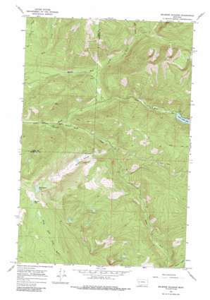
Belmore Sloughs Topo Map Montana
To zoom in, hover over the map of Belmore Sloughs
USGS Topo Quad 47113b7 - 1:24,000 scale
| Topo Map Name: | Belmore Sloughs |
| USGS Topo Quad ID: | 47113b7 |
| Print Size: | ca. 21 1/4" wide x 27" high |
| Southeast Coordinates: | 47.125° N latitude / 113.75° W longitude |
| Map Center Coordinates: | 47.1875° N latitude / 113.8125° W longitude |
| U.S. State: | MT |
| Filename: | o47113b7.jpg |
| Download Map JPG Image: | Belmore Sloughs topo map 1:24,000 scale |
| Map Type: | Topographic |
| Topo Series: | 7.5´ |
| Map Scale: | 1:24,000 |
| Source of Map Images: | United States Geological Survey (USGS) |
| Alternate Map Versions: |
Belmore Sloughs MT 1965, updated 1968 Download PDF Buy paper map Belmore Sloughs MT 1965, updated 1986 Download PDF Buy paper map Belmore Sloughs MT 2011 Download PDF Buy paper map Belmore Sloughs MT 2014 Download PDF Buy paper map |
1:24,000 Topo Quads surrounding Belmore Sloughs
> Back to 47113a1 at 1:100,000 scale
> Back to 47112a1 at 1:250,000 scale
> Back to U.S. Topo Maps home
Belmore Sloughs topo map: Gazetteer
Belmore Sloughs: Dams
Jocko Dam elevation 1453m 4767′Belmore Sloughs: Lakes
Lower Jocko Lake elevation 1453m 4767′Meadow Lake elevation 1911m 6269′
White Horse Lake elevation 1932m 6338′
Belmore Sloughs: Reservoirs
Jocko Lake elevation 1453m 4767′Belmore Sloughs: Streams
Belmore Sloughs elevation 1288m 4225′Deep Creek elevation 1388m 4553′
Falls Creek elevation 1209m 3966′
Middle Fork Jocko River elevation 1225m 4019′
South Fork Jocko River elevation 1208m 3963′
Belmore Sloughs digital topo map on disk
Buy this Belmore Sloughs topo map showing relief, roads, GPS coordinates and other geographical features, as a high-resolution digital map file on DVD:


