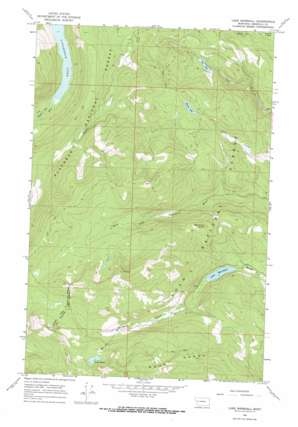
Lake Marshall Topo Map Montana
To zoom in, hover over the map of Lake Marshall
USGS Topo Quad 47113c6 - 1:24,000 scale
| Topo Map Name: | Lake Marshall |
| USGS Topo Quad ID: | 47113c6 |
| Print Size: | ca. 21 1/4" wide x 27" high |
| Southeast Coordinates: | 47.25° N latitude / 113.625° W longitude |
| Map Center Coordinates: | 47.3125° N latitude / 113.6875° W longitude |
| U.S. State: | MT |
| Filename: | o47113c6.jpg |
| Download Map JPG Image: | Lake Marshall topo map 1:24,000 scale |
| Map Type: | Topographic |
| Topo Series: | 7.5´ |
| Map Scale: | 1:24,000 |
| Source of Map Images: | United States Geological Survey (USGS) |
| Alternate Map Versions: |
Lake Marshall MT 1965, updated 1968 Download PDF Buy paper map Lake Marshall MT 1999, updated 2003 Download PDF Buy paper map Lake Marshall MT 2011 Download PDF Buy paper map Lake Marshall MT 2014 Download PDF Buy paper map |
| FStopo: | US Forest Service topo Lake Marshall is available: Download FStopo PDF Download FStopo TIF |
1:24,000 Topo Quads surrounding Lake Marshall
> Back to 47113a1 at 1:100,000 scale
> Back to 47112a1 at 1:250,000 scale
> Back to U.S. Topo Maps home
Lake Marshall topo map: Gazetteer
Lake Marshall: Lakes
Beaver Lake elevation 1746m 5728′Colt Lake elevation 1475m 4839′
Lake Dinah elevation 1973m 6473′
Lake Marshall elevation 1449m 4753′
Lake Marshall: Streams
Herrick Run elevation 1320m 4330′Lake Marshall: Summits
Mount Henry elevation 2163m 7096′Sunset Peak elevation 2177m 7142′
West Fork Point elevation 1903m 6243′
Lake Marshall digital topo map on disk
Buy this Lake Marshall topo map showing relief, roads, GPS coordinates and other geographical features, as a high-resolution digital map file on DVD:


