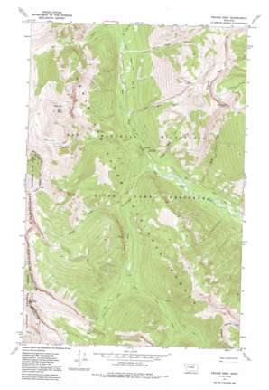
Prairie Reef Topo Map Montana
To zoom in, hover over the map of Prairie Reef
USGS Topo Quad 47113e1 - 1:24,000 scale
| Topo Map Name: | Prairie Reef |
| USGS Topo Quad ID: | 47113e1 |
| Print Size: | ca. 21 1/4" wide x 27" high |
| Southeast Coordinates: | 47.5° N latitude / 113° W longitude |
| Map Center Coordinates: | 47.5625° N latitude / 113.0625° W longitude |
| U.S. State: | MT |
| Filename: | o47113e1.jpg |
| Download Map JPG Image: | Prairie Reef topo map 1:24,000 scale |
| Map Type: | Topographic |
| Topo Series: | 7.5´ |
| Map Scale: | 1:24,000 |
| Source of Map Images: | United States Geological Survey (USGS) |
| Alternate Map Versions: |
Prairie Reef MT 1970, updated 1973 Download PDF Buy paper map Prairie Reef MT 1970, updated 1983 Download PDF Buy paper map Prairie Reef MT 1970, updated 1992 Download PDF Buy paper map Prairie Reef MT 1995, updated 1997 Download PDF Buy paper map Prairie Reef MT 2011 Download PDF Buy paper map Prairie Reef MT 2014 Download PDF Buy paper map |
| FStopo: | US Forest Service topo Prairie Reef is available: Download FStopo PDF Download FStopo TIF |
1:24,000 Topo Quads surrounding Prairie Reef
> Back to 47113e1 at 1:100,000 scale
> Back to 47112a1 at 1:250,000 scale
> Back to U.S. Topo Maps home
Prairie Reef topo map: Gazetteer
Prairie Reef: Lakes
Hermit Lake elevation 2386m 7828′Prairie Reef: Ridges
Prairie Reef elevation 2461m 8074′Prairie Reef: Streams
Ahorn Creek elevation 1618m 5308′Black Bear Creek elevation 1665m 5462′
Blind Fork elevation 1652m 5419′
East Fork Ahorn Creek elevation 1708m 5603′
Indian Creek elevation 1645m 5396′
Lost Fork Ahorn Creek elevation 1708m 5603′
Red Butte Creek elevation 1713m 5620′
Reef Creek elevation 1593m 5226′
White Bear Creek elevation 1615m 5298′
Prairie Reef: Summits
Junction Mountain elevation 2649m 8690′Red Butte elevation 2614m 8576′
Prairie Reef: Trails
Chinese Wall Trail elevation 1726m 5662′Prairie Reef: Valleys
Grizzly Gulch elevation 1729m 5672′No Name Gulch elevation 1713m 5620′
Prairie Reef digital topo map on disk
Buy this Prairie Reef topo map showing relief, roads, GPS coordinates and other geographical features, as a high-resolution digital map file on DVD:


