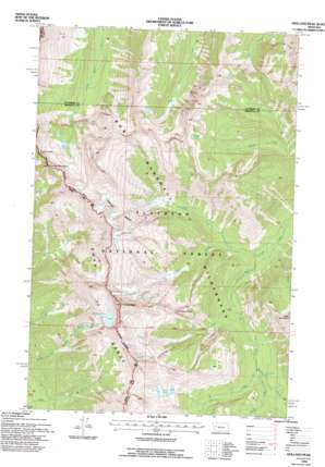
Holland Peak Topo Map Montana
To zoom in, hover over the map of Holland Peak
USGS Topo Quad 47113e5 - 1:24,000 scale
| Topo Map Name: | Holland Peak |
| USGS Topo Quad ID: | 47113e5 |
| Print Size: | ca. 21 1/4" wide x 27" high |
| Southeast Coordinates: | 47.5° N latitude / 113.5° W longitude |
| Map Center Coordinates: | 47.5625° N latitude / 113.5625° W longitude |
| U.S. State: | MT |
| Filename: | o47113e5.jpg |
| Download Map JPG Image: | Holland Peak topo map 1:24,000 scale |
| Map Type: | Topographic |
| Topo Series: | 7.5´ |
| Map Scale: | 1:24,000 |
| Source of Map Images: | United States Geological Survey (USGS) |
| Alternate Map Versions: |
Holland Peak MT 1965, updated 1968 Download PDF Buy paper map Holland Peak MT 1965, updated 1978 Download PDF Buy paper map Holland Peak MT 1994, updated 1996 Download PDF Buy paper map Holland Peak MT 2011 Download PDF Buy paper map Holland Peak MT 2014 Download PDF Buy paper map |
| FStopo: | US Forest Service topo Holland Peak is available: Download FStopo PDF Download FStopo TIF |
1:24,000 Topo Quads surrounding Holland Peak
> Back to 47113e1 at 1:100,000 scale
> Back to 47112a1 at 1:250,000 scale
> Back to U.S. Topo Maps home
Holland Peak topo map: Gazetteer
Holland Peak: Basins
Albino Basin elevation 2310m 7578′Holland Peak: Falls
Big Salmon Falls elevation 1686m 5531′Holland Peak: Gaps
Smith Creek Pass elevation 2416m 7926′Holland Peak: Lakes
Rumble Creek Lake elevation 2406m 7893′Sappho Lake elevation 2266m 7434′
Terrace Lakes elevation 2091m 6860′
Holland Peak: Streams
Albino Creek elevation 1472m 4829′Cataract Creek elevation 1646m 5400′
Dart Creek elevation 1549m 5082′
Gyp Creek elevation 1430m 4691′
Pendant Creek elevation 1773m 5816′
Smoky Creek elevation 1653m 5423′
Tango Creek elevation 1434m 4704′
Holland Peak: Summits
Cooney Mountain elevation 2643m 8671′Holland Peak elevation 2837m 9307′
Tango Point elevation 2334m 7657′
Holland Peak: Trails
Foothills Trail elevation 1515m 4970′Smith Creek Trail elevation 1983m 6505′
Holland Peak digital topo map on disk
Buy this Holland Peak topo map showing relief, roads, GPS coordinates and other geographical features, as a high-resolution digital map file on DVD:


