Marmot Mountain Topo Map Montana
To zoom in, hover over the map of Marmot Mountain
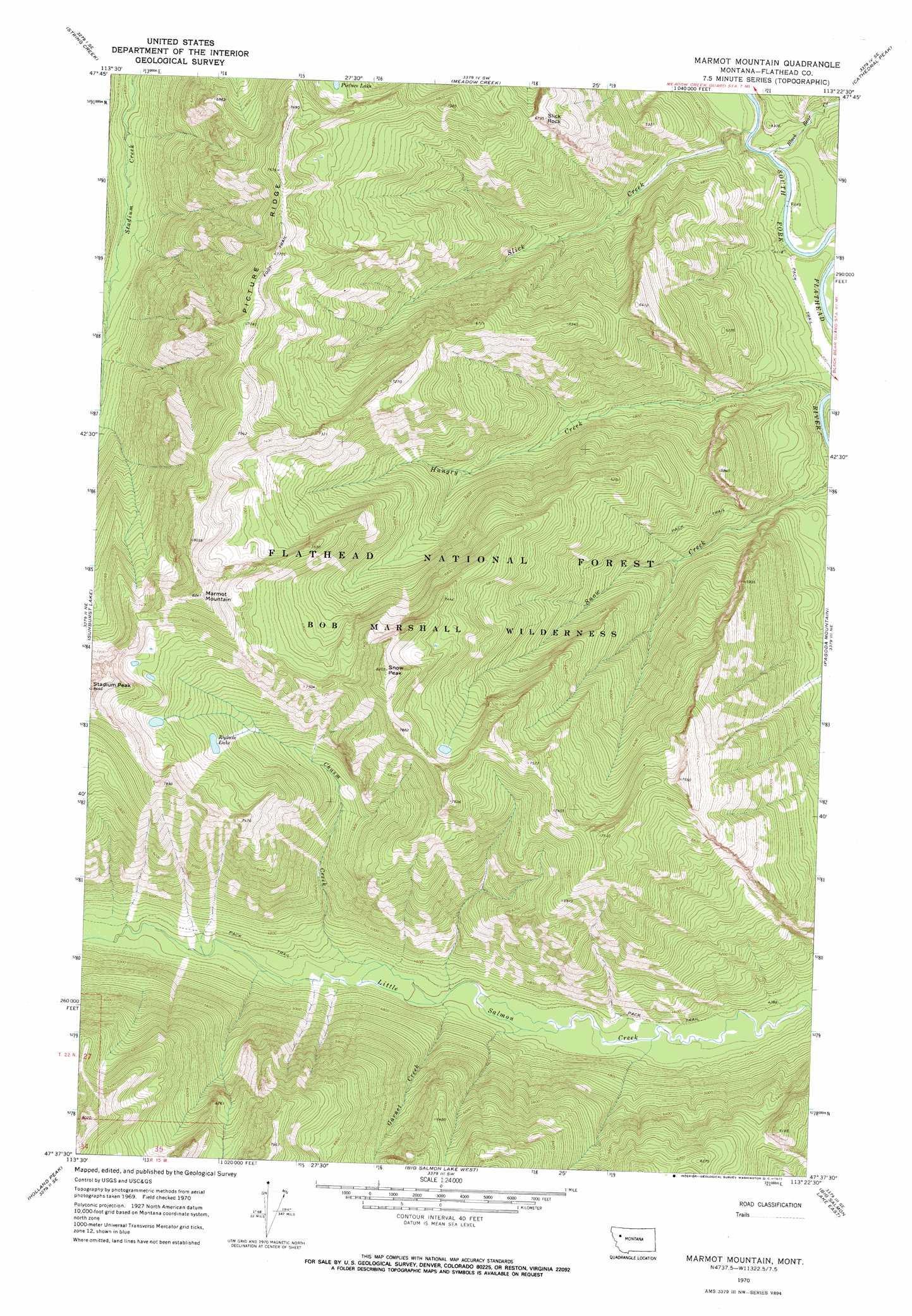
USGS Topo Quad 47113f4 - 1:24,000 scale
| Topo Map Name: | Marmot Mountain |
| USGS Topo Quad ID: | 47113f4 |
| Print Size: | ca. 21 1/4" wide x 27" high |
| Southeast Coordinates: | 47.625° N latitude / 113.375° W longitude |
| Map Center Coordinates: | 47.6875° N latitude / 113.4375° W longitude |
| U.S. State: | MT |
| Filename: | o47113f4.jpg |
| Download Map JPG Image: | Marmot Mountain topo map 1:24,000 scale |
| Map Type: | Topographic |
| Topo Series: | 7.5´ |
| Map Scale: | 1:24,000 |
| Source of Map Images: | United States Geological Survey (USGS) |
| Alternate Map Versions: |
Marmot Mountain MT 1970, updated 1973 Download PDF Buy paper map Marmot Mountain MT 2011 Download PDF Buy paper map Marmot Mountain MT 2014 Download PDF Buy paper map |
| FStopo: | US Forest Service topo Marmot Mountain is available: Download FStopo PDF Download FStopo TIF |
1:24,000 Topo Quads surrounding Marmot Mountain
Connor Creek |
Tin Creek |
Spotted Bear Mountain |
Whitcomb Peak |
Trilobite Peak |
Thunderbolt Mountain |
String Creek |
Meadow Creek |
Cathedral Peak |
Bungalow Mountain |
Swan Peak |
Sunburst Lake |
Marmot Mountain |
Pagoda Mountain |
Amphitheatre Mountain |
Condon |
Holland Peak |
Big Salmon Lake West |
Big Salmon Lake East |
Haystack Mountain |
Cygnet Lake |
Holland Lake |
Shaw Creek |
Una Mountain |
Pilot Peak |
> Back to 47113e1 at 1:100,000 scale
> Back to 47112a1 at 1:250,000 scale
> Back to U.S. Topo Maps home
Marmot Mountain topo map: Gazetteer
Marmot Mountain: Lakes
Picture Lake elevation 2079m 6820′Recluse Lake elevation 2047m 6715′
Marmot Mountain: Streams
Black Bear Creek elevation 1230m 4035′Chasm Creek elevation 1346m 4416′
Garnet Creek elevation 1340m 4396′
Hungry Creek elevation 1247m 4091′
Slick Creek elevation 1227m 4025′
Marmot Mountain: Summits
Marmot Mountain elevation 2511m 8238′Slick Rock elevation 2054m 6738′
Snow Peak elevation 2486m 8156′
Marmot Mountain digital topo map on disk
Buy this Marmot Mountain topo map showing relief, roads, GPS coordinates and other geographical features, as a high-resolution digital map file on DVD: