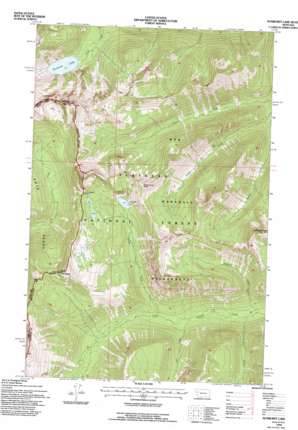
Sunburst Lake Topo Map Montana
To zoom in, hover over the map of Sunburst Lake
USGS Topo Quad 47113f5 - 1:24,000 scale
| Topo Map Name: | Sunburst Lake |
| USGS Topo Quad ID: | 47113f5 |
| Print Size: | ca. 21 1/4" wide x 27" high |
| Southeast Coordinates: | 47.625° N latitude / 113.5° W longitude |
| Map Center Coordinates: | 47.6875° N latitude / 113.5625° W longitude |
| U.S. State: | MT |
| Filename: | o47113f5.jpg |
| Download Map JPG Image: | Sunburst Lake topo map 1:24,000 scale |
| Map Type: | Topographic |
| Topo Series: | 7.5´ |
| Map Scale: | 1:24,000 |
| Source of Map Images: | United States Geological Survey (USGS) |
| Alternate Map Versions: |
Sunburst Lake MT 1965, updated 1968 Download PDF Buy paper map Sunburst Lake MT 1965, updated 1981 Download PDF Buy paper map Sunburst Lake MT 1965, updated 1992 Download PDF Buy paper map Sunburst Lake MT 1994, updated 1996 Download PDF Buy paper map Sunburst Lake MT 2011 Download PDF Buy paper map Sunburst Lake MT 2014 Download PDF Buy paper map |
| FStopo: | US Forest Service topo Sunburst Lake is available: Download FStopo PDF Download FStopo TIF |
1:24,000 Topo Quads surrounding Sunburst Lake
> Back to 47113e1 at 1:100,000 scale
> Back to 47112a1 at 1:250,000 scale
> Back to U.S. Topo Maps home
Sunburst Lake topo map: Gazetteer
Sunburst Lake: Gaps
Lion Creek Pass elevation 2127m 6978′Sunburst Lake: Lakes
Palisade Lake elevation 1886m 6187′Sunburst Lake elevation 1623m 5324′
Sunburst Lake: Streams
Cannon Creek elevation 1499m 4917′Combat Creek elevation 1425m 4675′
Gill Creek elevation 1473m 4832′
Highrock Creek elevation 1415m 4642′
Palisade Creek elevation 1496m 4908′
Trickle Creek elevation 1515m 4970′
Sunburst Lake: Summits
Oreamnos Peak elevation 2420m 7939′Owl Peak elevation 2512m 8241′
Stadium Peak elevation 2561m 8402′
Sunburst Lake: Trails
Lion Creek Trail elevation 1794m 5885′Sunburst Lake digital topo map on disk
Buy this Sunburst Lake topo map showing relief, roads, GPS coordinates and other geographical features, as a high-resolution digital map file on DVD:


