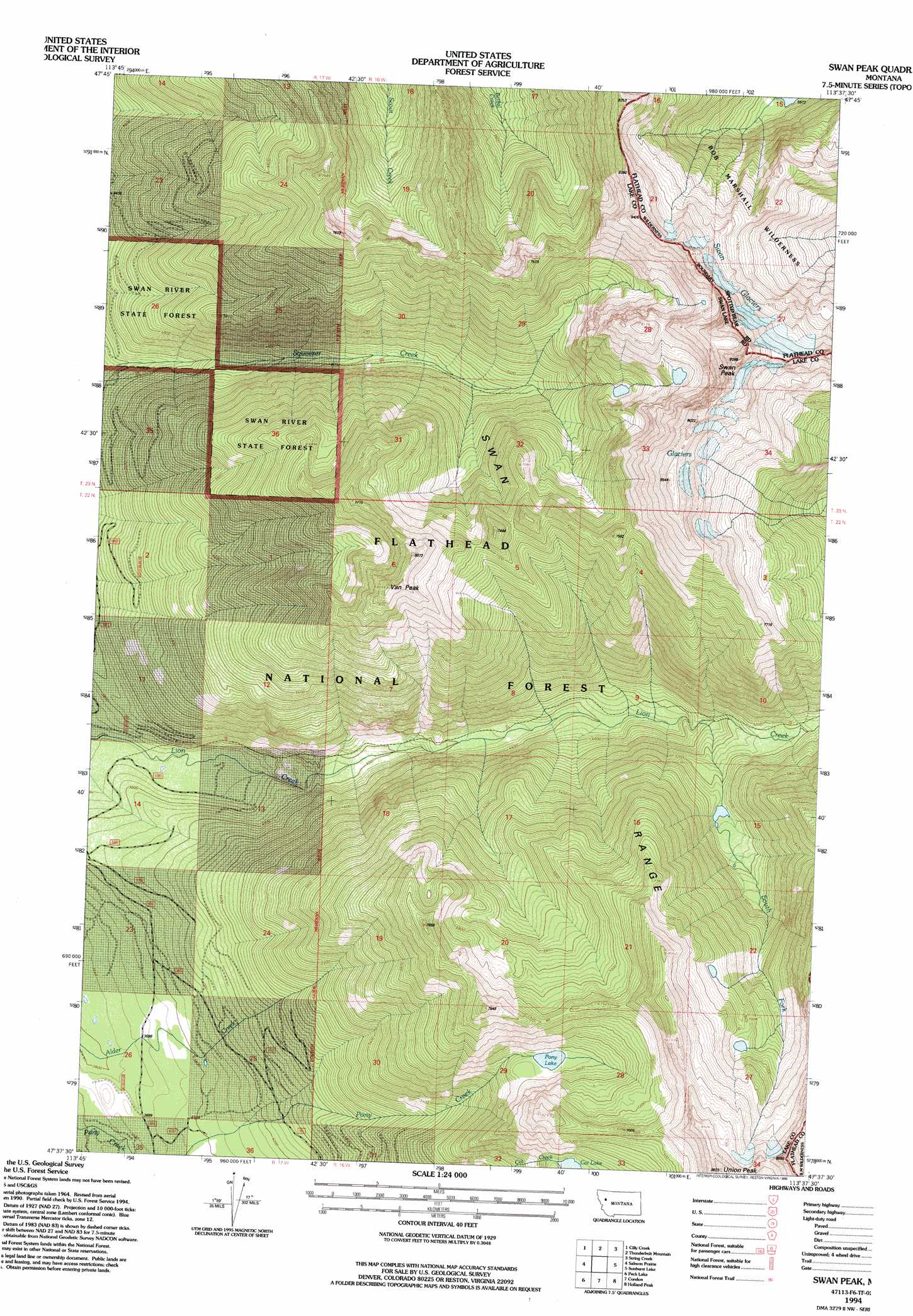
Swan Peak Topo Map Montana
To zoom in, hover over the map of Swan Peak
USGS Topo Quad 47113f6 - 1:24,000 scale
| Topo Map Name: | Swan Peak |
| USGS Topo Quad ID: | 47113f6 |
| Print Size: | ca. 21 1/4" wide x 27" high |
| Southeast Coordinates: | 47.625° N latitude / 113.625° W longitude |
| Map Center Coordinates: | 47.6875° N latitude / 113.6875° W longitude |
| U.S. State: | MT |
| Filename: | o47113f6.jpg |
| Download Map JPG Image: | Swan Peak topo map 1:24,000 scale |
| Map Type: | Topographic |
| Topo Series: | 7.5´ |
| Map Scale: | 1:24,000 |
| Source of Map Images: | United States Geological Survey (USGS) |
| Alternate Map Versions: |
Swan Peak MT 1965, updated 1968 Download PDF Buy paper map Swan Peak MT 1994, updated 1996 Download PDF Buy paper map Swan Peak MT 2011 Download PDF Buy paper map Swan Peak MT 2014 Download PDF Buy paper map |
| FStopo: | US Forest Service topo Swan Peak is available: Download FStopo PDF Download FStopo TIF |
1:24,000 Topo Quads surrounding Swan Peak
Yew Creek |
Swan Lake |
Connor Creek |
Tin Creek |
Spotted Bear Mountain |
Porcupine Creek |
Cilly Creek |
Thunderbolt Mountain |
String Creek |
Meadow Creek |
Cedar Lake |
Salmon Prairie |
Swan Peak |
Sunburst Lake |
Marmot Mountain |
Piper-Crow Pass |
Peck Lake |
Condon |
Holland Peak |
Big Salmon Lake West |
Mount Harding |
Hemlock Lake |
Cygnet Lake |
Holland Lake |
Shaw Creek |
> Back to 47113e1 at 1:100,000 scale
> Back to 47112a1 at 1:250,000 scale
> Back to U.S. Topo Maps home
Swan Peak topo map: Gazetteer
Swan Peak: Glaciers
Swan Glaciers elevation 2448m 8031′Swan Peak: Lakes
Cat Lake elevation 2044m 6706′Pony Lake elevation 1995m 6545′
Swan Peak: Ranges
Swan Range elevation 2251m 7385′Swan Peak: Streams
South Fork Lion Creek elevation 1438m 4717′Swan Peak: Summits
Swan Peak elevation 2826m 9271′Union Peak elevation 2671m 8763′
Van Peak elevation 2454m 8051′
Swan Peak digital topo map on disk
Buy this Swan Peak topo map showing relief, roads, GPS coordinates and other geographical features, as a high-resolution digital map file on DVD: