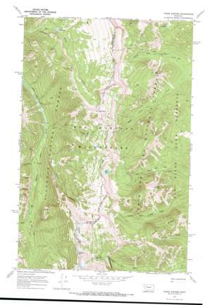
Three Sisters Topo Map Montana
To zoom in, hover over the map of Three Sisters
USGS Topo Quad 47113g1 - 1:24,000 scale
| Topo Map Name: | Three Sisters |
| USGS Topo Quad ID: | 47113g1 |
| Print Size: | ca. 21 1/4" wide x 27" high |
| Southeast Coordinates: | 47.75° N latitude / 113° W longitude |
| Map Center Coordinates: | 47.8125° N latitude / 113.0625° W longitude |
| U.S. State: | MT |
| Filename: | o47113g1.jpg |
| Download Map JPG Image: | Three Sisters topo map 1:24,000 scale |
| Map Type: | Topographic |
| Topo Series: | 7.5´ |
| Map Scale: | 1:24,000 |
| Source of Map Images: | United States Geological Survey (USGS) |
| Alternate Map Versions: |
Three Sisters MT 1970, updated 1973 Download PDF Buy paper map Three Sisters MT 1995, updated 1997 Download PDF Buy paper map Three Sisters MT 2011 Download PDF Buy paper map Three Sisters MT 2014 Download PDF Buy paper map |
| FStopo: | US Forest Service topo Three Sisters is available: Download FStopo PDF Download FStopo TIF |
1:24,000 Topo Quads surrounding Three Sisters
> Back to 47113e1 at 1:100,000 scale
> Back to 47112a1 at 1:250,000 scale
> Back to U.S. Topo Maps home
Three Sisters topo map: Gazetteer
Three Sisters: Lakes
Hart Lake elevation 1741m 5711′Lake Quiet elevation 2155m 7070′
Sock Lake elevation 2281m 7483′
Unnamed Lake elevation 2181m 7155′
Three Sisters: Ridges
Goat Ridge elevation 2221m 7286′Three Sisters: Streams
Christopher Creek elevation 1644m 5393′Goat Creek elevation 1594m 5229′
Hoop Creek elevation 1713m 5620′
North Fork Lick Creek elevation 1769m 5803′
South Fork Lick Creek elevation 1769m 5803′
Three Sisters Creek elevation 1610m 5282′
Three Sisters: Summits
Hahn Peak elevation 2527m 8290′Lick Mountain elevation 2337m 7667′
Lookout Mountain elevation 2487m 8159′
Three Sisters elevation 2711m 8894′
Three Sisters digital topo map on disk
Buy this Three Sisters topo map showing relief, roads, GPS coordinates and other geographical features, as a high-resolution digital map file on DVD:


