Pentagon Mountain Topo Map Montana
To zoom in, hover over the map of Pentagon Mountain
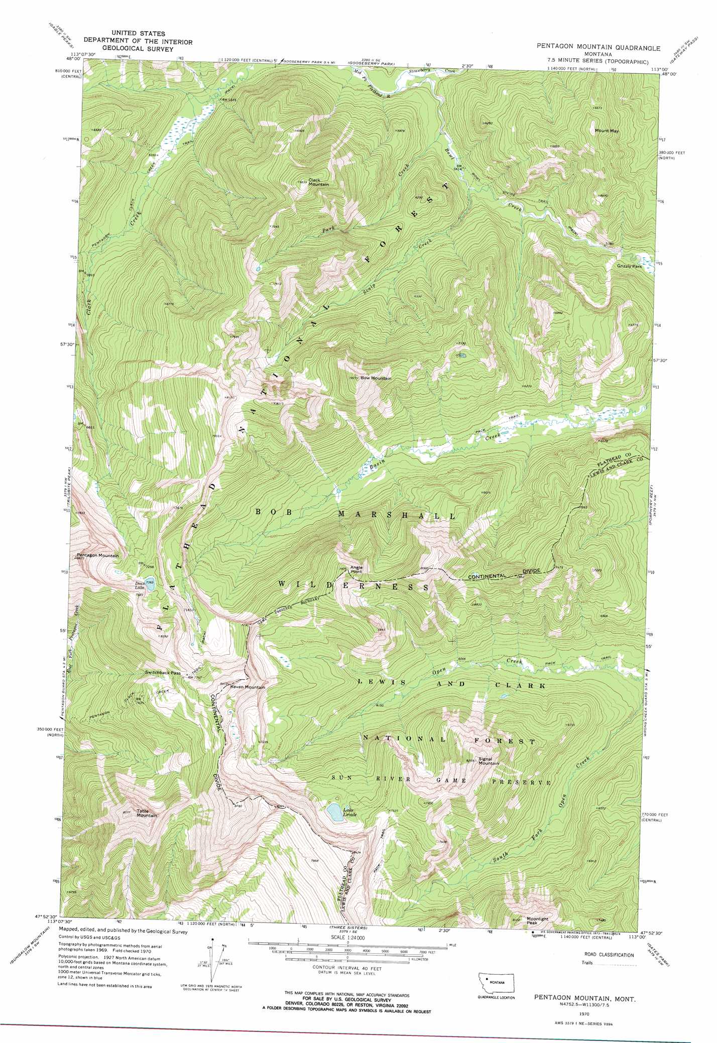
USGS Topo Quad 47113h1 - 1:24,000 scale
| Topo Map Name: | Pentagon Mountain |
| USGS Topo Quad ID: | 47113h1 |
| Print Size: | ca. 21 1/4" wide x 27" high |
| Southeast Coordinates: | 47.875° N latitude / 113° W longitude |
| Map Center Coordinates: | 47.9375° N latitude / 113.0625° W longitude |
| U.S. State: | MT |
| Filename: | o47113h1.jpg |
| Download Map JPG Image: | Pentagon Mountain topo map 1:24,000 scale |
| Map Type: | Topographic |
| Topo Series: | 7.5´ |
| Map Scale: | 1:24,000 |
| Source of Map Images: | United States Geological Survey (USGS) |
| Alternate Map Versions: |
Pentagon Mountain MT 1970, updated 1973 Download PDF Buy paper map Pentagon Mountain MT 1994, updated 1997 Download PDF Buy paper map Pentagon Mountain MT 2011 Download PDF Buy paper map Pentagon Mountain MT 2014 Download PDF Buy paper map |
| FStopo: | US Forest Service topo Pentagon Mountain is available: Download FStopo PDF Download FStopo TIF |
1:24,000 Topo Quads surrounding Pentagon Mountain
Red Plume Mountain |
Crescent Cliff |
Morningstar Mountain |
Swift Reservoir |
Fish Lake |
Capitol Mountain |
Gable Peaks |
Gooseberry Peak |
Gateway Pass |
Walling Reef |
Whitcomb Peak |
Trilobite Peak |
Pentagon Mountain |
Porphyry Reef |
Mount Wright |
Cathedral Peak |
Bungalow Mountain |
Three Sisters |
Gates Park |
Our Lake |
Pagoda Mountain |
Amphitheatre Mountain |
Slategoat Mountain |
Glenn Creek |
Arsenic Peak |
> Back to 47113e1 at 1:100,000 scale
> Back to 47112a1 at 1:250,000 scale
> Back to U.S. Topo Maps home
Pentagon Mountain topo map: Gazetteer
Pentagon Mountain: Flats
Grizzly Park elevation 1750m 5741′Pentagon Mountain: Gaps
Switchback Pass elevation 2378m 7801′Pentagon Mountain: Lakes
Dean Lake elevation 2245m 7365′Lake Levale elevation 2181m 7155′
Pentagon Mountain: Streams
Bowl Creek elevation 1625m 5331′Park Creek elevation 1651m 5416′
Scalp Creek elevation 1663m 5456′
Strawberry Creek elevation 1629m 5344′
Pentagon Mountain: Summits
Angle Point elevation 2424m 7952′Bow Mountain elevation 2383m 7818′
Clack Mountain elevation 2308m 7572′
Kevan Mountain elevation 2537m 8323′
Moonlight Peak elevation 2460m 8070′
Mount May elevation 2126m 6975′
Pentagon Mountain elevation 2698m 8851′
Signal Mountain elevation 2506m 8221′
Table Mountain elevation 2536m 8320′
Pentagon Mountain: Trails
Bowl Divide Trail elevation 1727m 5666′Pentagon Mountain digital topo map on disk
Buy this Pentagon Mountain topo map showing relief, roads, GPS coordinates and other geographical features, as a high-resolution digital map file on DVD: