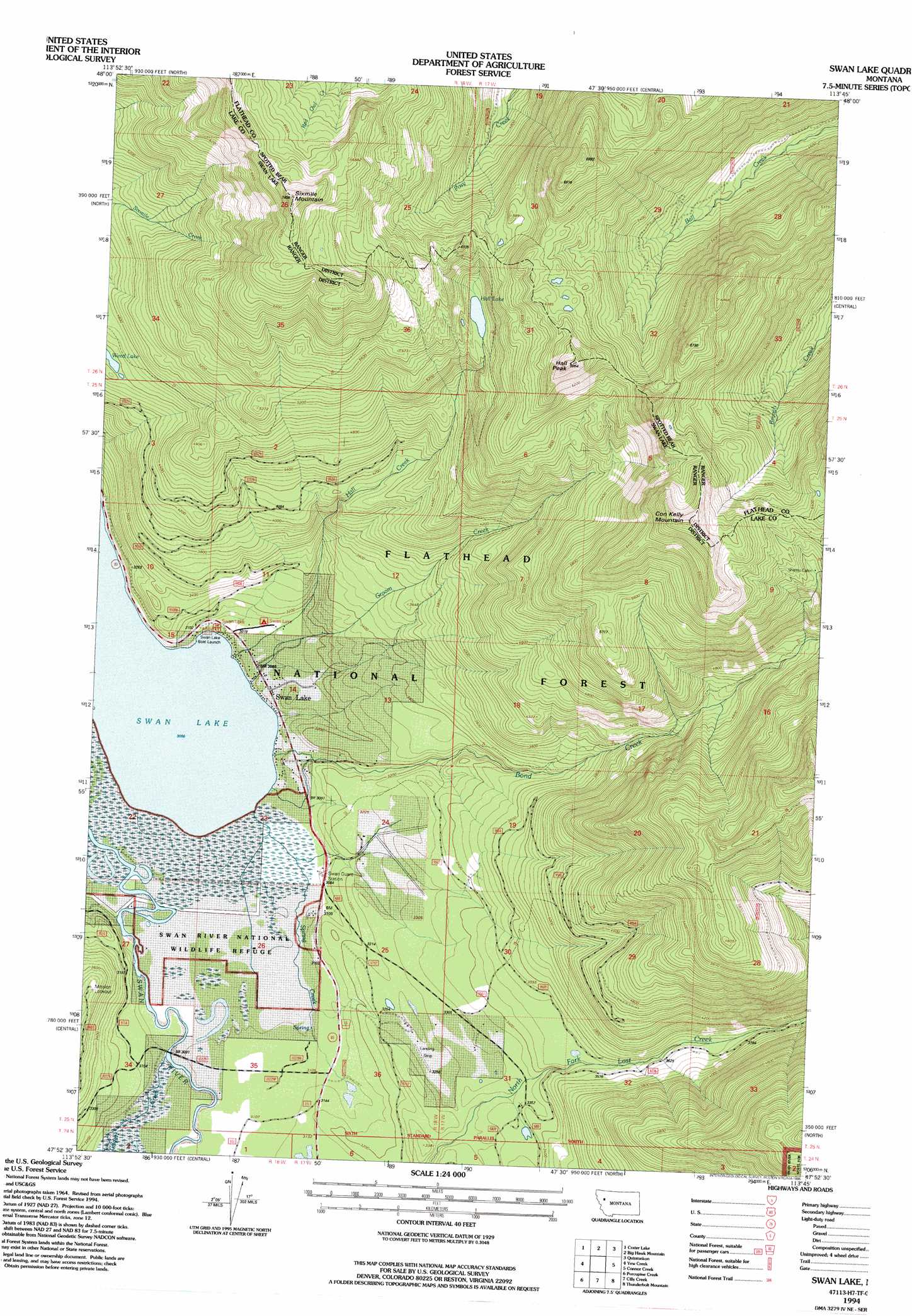
Swan Lake Topo Map Montana
To zoom in, hover over the map of Swan Lake
USGS Topo Quad 47113h7 - 1:24,000 scale
| Topo Map Name: | Swan Lake |
| USGS Topo Quad ID: | 47113h7 |
| Print Size: | ca. 21 1/4" wide x 27" high |
| Southeast Coordinates: | 47.875° N latitude / 113.75° W longitude |
| Map Center Coordinates: | 47.9375° N latitude / 113.8125° W longitude |
| U.S. State: | MT |
| Filename: | o47113h7.jpg |
| Download Map JPG Image: | Swan Lake topo map 1:24,000 scale |
| Map Type: | Topographic |
| Topo Series: | 7.5´ |
| Map Scale: | 1:24,000 |
| Source of Map Images: | United States Geological Survey (USGS) |
| Alternate Map Versions: |
Swan Lake MT 1965, updated 1968 Download PDF Buy paper map Swan Lake MT 1965, updated 1981 Download PDF Buy paper map Swan lake MT 1994, updated 1996 Download PDF Buy paper map Swan Lake MT 2011 Download PDF Buy paper map Swan Lake MT 2014 Download PDF Buy paper map |
| FStopo: | US Forest Service topo Swan Lake is available: Download FStopo PDF Download FStopo TIF |
1:24,000 Topo Quads surrounding Swan Lake
Hash Mountain |
Jewel Basin |
Pioneer Ridge |
Felix Peak |
Nimrod |
Bigfork |
Crater Lake |
Big Hawk Mountain |
Quintonkon |
Circus Peak |
Woods Bay |
Yew Creek |
Swan Lake |
Connor Creek |
Tin Creek |
Bull Island |
Porcupine Creek |
Cilly Creek |
Thunderbolt Mountain |
String Creek |
East Bay |
Cedar Lake |
Salmon Prairie |
Swan Peak |
Sunburst Lake |
> Back to 47113e1 at 1:100,000 scale
> Back to 47112a1 at 1:250,000 scale
> Back to U.S. Topo Maps home
Swan Lake topo map: Gazetteer
Swan Lake: Lakes
Hall Lake elevation 1609m 5278′Weed Lake elevation 1339m 4393′
Swan Lake: Parks
Swan River National Wildlife Refuge elevation 938m 3077′Swan Lake: Populated Places
Swan Lake elevation 946m 3103′Swan Lake: Post Offices
Swan Lake Post Office (historical) elevation 963m 3159′Swan Lake: Streams
Bond Creek elevation 937m 3074′Gildart Creek elevation 939m 3080′
Groom Creek elevation 938m 3077′
Hall Creek elevation 937m 3074′
Spring Creek elevation 936m 3070′
Swan Lake: Summits
Con Kelley Mountain elevation 2153m 7063′Hall Peak elevation 2074m 6804′
Sixmile Mountain elevation 2249m 7378′
Swan Lake: Trails
Wire Trail elevation 1770m 5807′Swan Lake: Wells
25N18W13CDDC01 Well elevation 982m 3221′25N18W14DBB_01 Well elevation 939m 3080′
25N18W35ADDA01 Well elevation 943m 3093′
25N18W35DBCB01 Well elevation 947m 3106′
Swan Lake digital topo map on disk
Buy this Swan Lake topo map showing relief, roads, GPS coordinates and other geographical features, as a high-resolution digital map file on DVD: