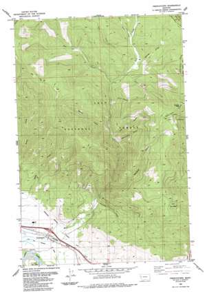
Frenchtown Topo Map Montana
To zoom in, hover over the map of Frenchtown
USGS Topo Quad 47114a2 - 1:24,000 scale
| Topo Map Name: | Frenchtown |
| USGS Topo Quad ID: | 47114a2 |
| Print Size: | ca. 21 1/4" wide x 27" high |
| Southeast Coordinates: | 47° N latitude / 114.125° W longitude |
| Map Center Coordinates: | 47.0625° N latitude / 114.1875° W longitude |
| U.S. State: | MT |
| Filename: | o47114a2.jpg |
| Download Map JPG Image: | Frenchtown topo map 1:24,000 scale |
| Map Type: | Topographic |
| Topo Series: | 7.5´ |
| Map Scale: | 1:24,000 |
| Source of Map Images: | United States Geological Survey (USGS) |
| Alternate Map Versions: |
Frenchtown MT 1984, updated 1984 Download PDF Buy paper map Frenchtown MT 2011 Download PDF Buy paper map Frenchtown MT 2014 Download PDF Buy paper map |
| FStopo: | US Forest Service topo Frenchtown is available: Download FStopo PDF Download FStopo TIF |
1:24,000 Topo Quads surrounding Frenchtown
> Back to 47114a1 at 1:100,000 scale
> Back to 47114a1 at 1:250,000 scale
> Back to U.S. Topo Maps home
Frenchtown topo map: Gazetteer
Frenchtown: Canals
Frenchtown Irrigation District Ditch elevation 937m 3074′Frenchtown: Crossings
Interchange 89 elevation 928m 3044′Frenchtown: Populated Places
Frenchtown elevation 928m 3044′Frenchtown: Post Offices
Frenchtown Post Office elevation 928m 3044′Frenchtown: Streams
Bear Creek elevation 1378m 4520′Burnt Point Creek elevation 1446m 4744′
Edith Creek elevation 936m 3070′
Fern Creek elevation 1438m 4717′
Fir Creek elevation 1413m 4635′
Fournier Creek elevation 971m 3185′
Herzog Creek elevation 1422m 4665′
Spring Creek elevation 1242m 4074′
Frenchtown: Summits
Charity Peak elevation 1992m 6535′Frenchtown: Valleys
Blackcat Gulch elevation 1064m 3490′Blind Gulch elevation 1354m 4442′
Cottonwood Gulch elevation 1211m 3973′
Lion Gulch elevation 1250m 4101′
Frenchtown: Wells
14N20W04ADBD01 Well elevation 1034m 3392′14N21W02AA__01 Well elevation 930m 3051′
15N21W25BBBA01 Well elevation 1072m 3517′
15N21W25CBBC01 Well elevation 1022m 3353′
15N21W25CCBA01 Well elevation 990m 3248′
15N21W27BB__01 Well elevation 936m 3070′
15N21W27CD__01 Well elevation 925m 3034′
15N21W34AD__01 Well elevation 928m 3044′
15N21W34BD__01 Well elevation 923m 3028′
15N21W34BD__02 Well elevation 923m 3028′
15N21W34CB__01 Well elevation 923m 3028′
15N21W34CD__01 Well elevation 923m 3028′
15N21W34DA__01 Well elevation 927m 3041′
15N21W34DA__02 Well elevation 927m 3041′
15N21W34DA__03 Well elevation 927m 3041′
15N21W34DB__01 Well elevation 925m 3034′
15N21W35BD__01 Well elevation 938m 3077′
15N21W35CD__01 Well elevation 929m 3047′
15N21W35CD__02 Well elevation 929m 3047′
17N20W35DBCA01 Well elevation 1584m 5196′
Frenchtown digital topo map on disk
Buy this Frenchtown topo map showing relief, roads, GPS coordinates and other geographical features, as a high-resolution digital map file on DVD:


